#SD2KW, Day 26, Sanderson to Seminole Canyon State Park, 82 miles | Easy 80

Riding Stats

Accommodations

Route Tracker

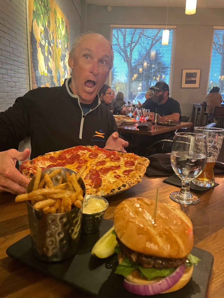
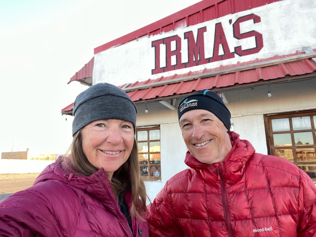
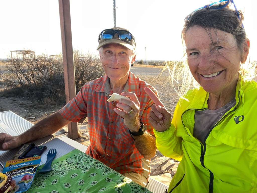
After a day off, you could say today was an easy 80 miler. Happy Valentine’s Day to us and to you!! ♥️ It started off with Tom bringing me coffee in bed. What a treat!

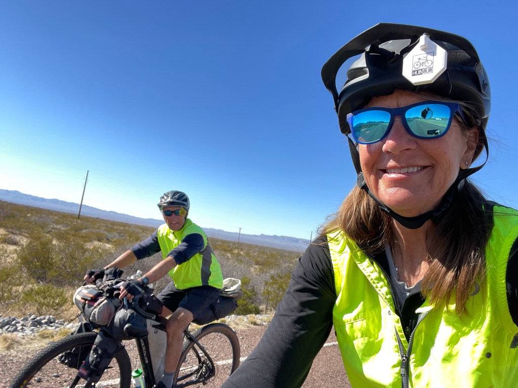
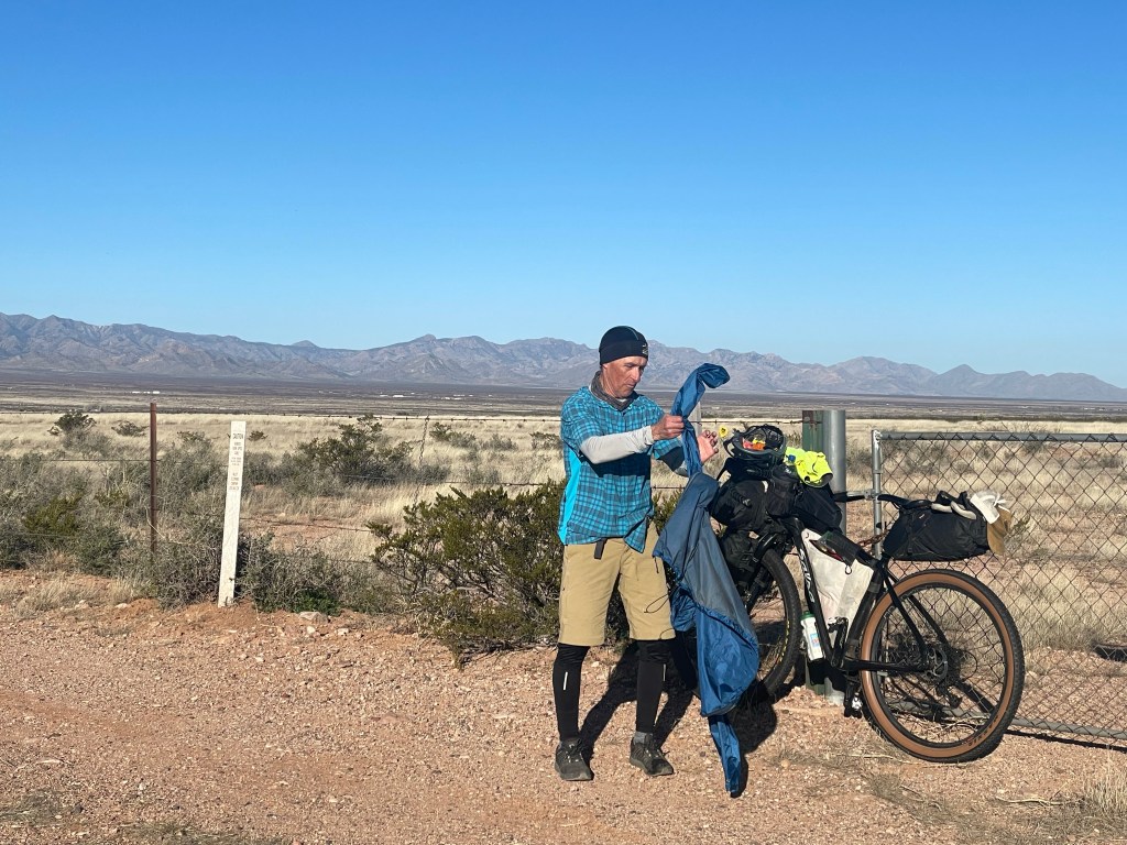
We knew the wind would be in our favor most of the day and although 80 miles is still sitting on a bike saddle for a good amount of time we had some righteous descents as well as favorable wind.

It wasn’t all rainbows and unicorns however. That side wind was obnoxious. When the road veered southeast the side wind about blew us over. I looked ahead at Tom leaning his bike to the right into the strong winds as he peddled hard successfully staying upright. I wanted to get a pic because it looked so funny with his bike at a constant 20 degree angle but I didn’t dare take one hand off my own handlebars to grab my phone for I was riding at the same angle keeping my bike upright.

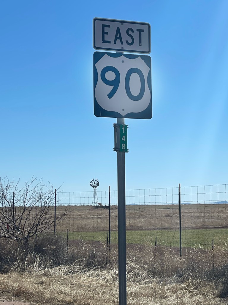
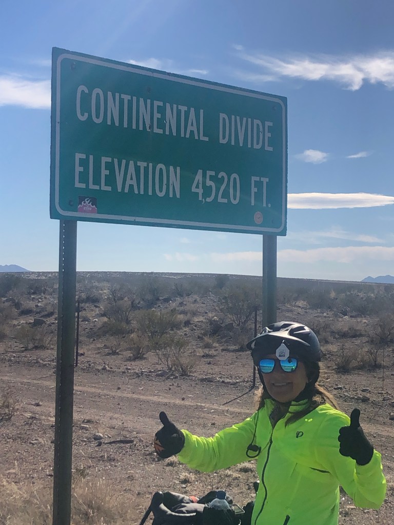
Friends, we live in an absolutely beautiful country. There’s not one of our photos that does the scenery justice. We rolled up and over so many rises in the road today only to be blown away (sometimes literally) 😂 at the view. And the topography is slowing changing giving way as we leave mountains behind and peddle toward the Texas Hill Country.

We crossed the Pecos River and again rode very close to the USA/Mexican border where we observed a big increase in Border Patrol activity.

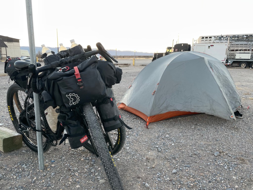
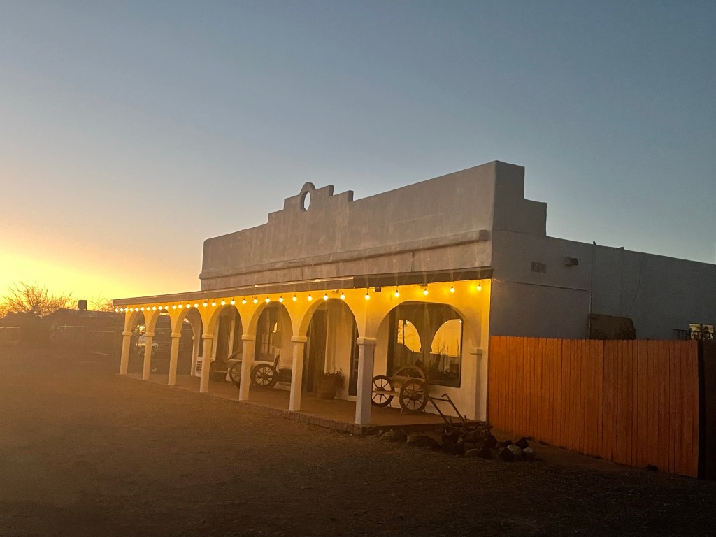
We’ve got a sweet campsite on a rise overlooking a great expanse of land in Seminole Canyon State Park. Again, we’d like to come back. The area is know for petroglyphs and native history with lots of wildflowers in season.

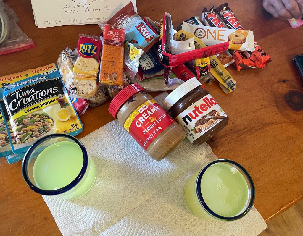
When the wind finally died down we enjoyed a simple Valentine’s Day dinner at our campsite and later watched the sun set.

For the second graders:

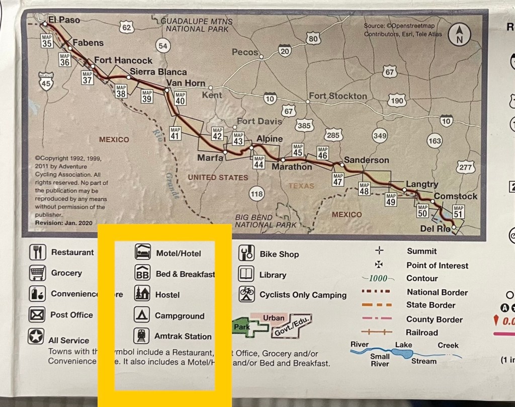
Sophia wants to know how you know where the hotels are located. Sophia that is an important part of bike travel. Great question! Think about how your parents choose places to stay when you go on vacation. They probably do three things: 1) Google or Google Map places to stay. We find hotels and campsites using our phones because we are not carrying a computer.

2) Look at our maps. The Map Legend shows where hotels and campsites are located. See the picture below of one of our map panels for tomorrow. There are lots of campsites but not many hotels.

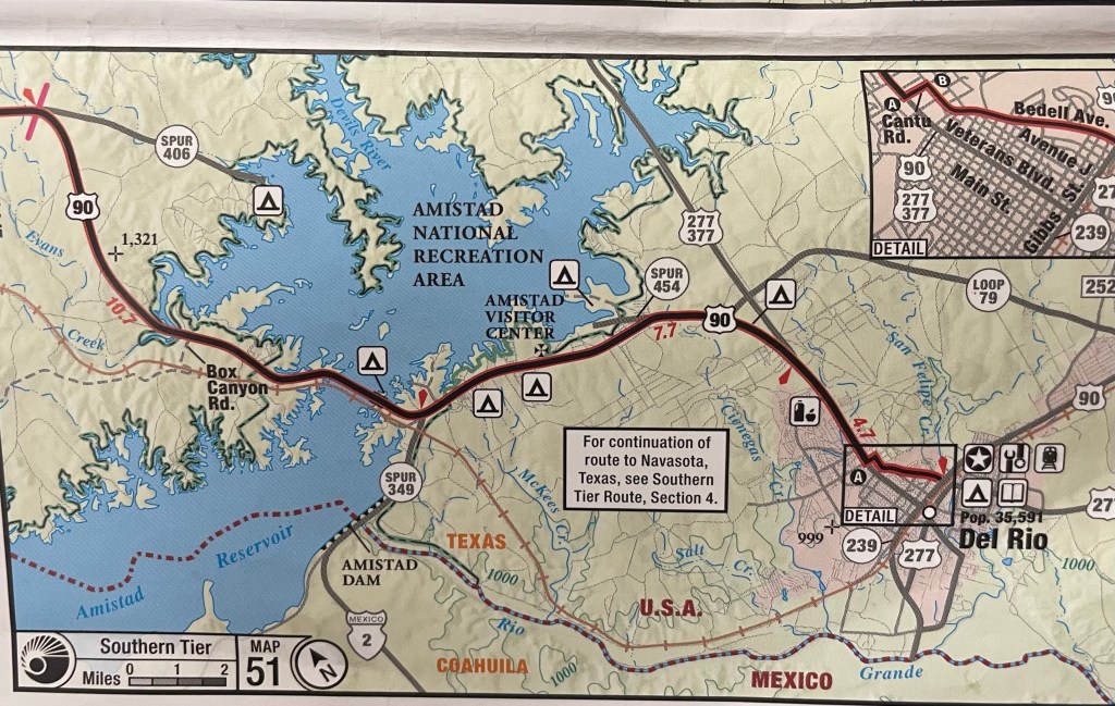
3) We talk to people we meet along the way who have been where we are going. Often they suggest good places to stay. I bet if your parents or friends are going to Florida for Spring Break, they have done the same thing.

Cole we will answer your question tomorrow. 😊

Click on the image below to view more pics and vids:

#SD2KW, Day 25, Marathon to Sanderson, 54 miles | Super Sunday

Riding Stats

Accommodations

Route Tracker

By now you know we have three things on our mind when we bike tour (besides our family at home): food, weather and elevation.

If you’re still riding along with us, you’re either 1) waiting to see our state line dance for Texas, 2) wondering if we can EACH put a medium sized pizza away on our own or, 3), looking for a post when food, weather and/or elevation is NOT mentioned.

Today is not that day for any of the above as Tom scores one of the best tasting blueberry tarts on the Southern Tier.😉

The most memorable site of the day however, was a very large herd of big horn sheep trotting away. They are difficult to see because they blend in well with their surroundings so about the only way to spot them is if they are moving. If you look carefully you may be able to see some of the herd moving to the left in the video below.

Our Super Sunday, although ridden under cloudy skies included a super slide into the small town of Sanderson, TX.

Check out this nice descent. So long 4,000 feet!

Sanderson, TX offers camping in the area and it was above 40 degrees however we checked into the Desert Air Motel to watch the game on TV, and have other amenities within reach – like a flusher. 🚽

Whoops turns out Dish didn’t carry the game but… with the help of our son, we were able to see the game on my iPhone. It’s the little things… literally.

Taking a zero day tomorrow (a rest day), our first one in over three weeks! We don’t actually need one but headwinds are forecasted tomorrow and we have a longish ride. So nope! There’s a wind advisory on Tuesday but wind is blowing in the right direction – at our back. Yay!

For those of you wondering, the big balloon in the desert just before Marfa is a border patrol blimp. With so much activity in the skies these days, the confirmation is comforting, isn’t it?

Click on the link below to view more pics and vids:

#SD2KW, Day 24, Marfa to Marathon, 56 miles | A Tale of Two Rides

Riding Stats

Accommodations

Route Tracker

Today was a tale of two rides (not cities). The morning was idyllic with perfect weather, friendly winds and wide shoulders. After our lunch things changed but let’s not talk about that.😂

Let’s talk about this area and when we can come back with a car and bikes. Tom and I stopped by the Marfa Mystery Lights viewing area. It was daylight of course, but we still wanted to learn what all the hubbub was about.

Turns out the Marfa Mystery Lights are visible on many clear nights between Marfa and Paisano Pass as one looks toward the Chinati Mountains. The lights are reported to move about in various colors, split apart and then meld back together.

Robert Ellison first reported seeing the mysterious lights in 1883 as he was tending cattle and thought the lights a reflection of nearby Apache cook fires. Apache Indians believed the lights to be stars falling to the earth.

Theories on the cause of the Marfa Mystery Lights land on a continuum between science and science fiction. It’d be a lot of fun to come back, check them out and draw our own conclusions.

We took a pic as soon as we got to Marathon, TX and will take another when we get to Marathon, FL in the Florida Keys.

We rolled into Marathon on a sunny, Saturday afternoon and like a lot of travelers that roll through town, we were thirsty. Sooo…

After scouting the town for Bar B Q, we headed back a half mile to The Marathon Motel and RV Park. It was one of the coolest places we’ve camped due to the community feeling and space. I linked to the history of the property above. It’s interesting. A guy and his daughter drove through one spring break and he goes out for a run. On his way back he noticed a “For Sale” sign in the window and ends up buying the property. The rest is “history”.

The property’s proximity to the small town of Marathon is also a plus. At night, people get their telescopes out to view the stars. Wouldn’t you know it, last night was our first cloudy night. So again… we want to come back!

So grateful to be living our best lives!

Click on the image below to view more pics and vids:

#SD2KW, Day 23, Van Horn to Marfa, 75 miles | Chilly Willy

Riding Stats

Accommodations

Route Tracker

The word for today is CHILLY! When we started riding the temp was 29 but wind chills were 19 degrees. Burrrr… I started riding with four layers on top and three on the bottom.

Within five miles my back tire felt spongy and I could tell there was more effort required to pedal the bike forward. We pulled over and discovered the tire was very low and tire sealant sprayed all over my seat bag. However it looked like the sealant did its job and sealed the puncture so all good! Tom just added air and we were on our way.

About 35 miles into our ride we came across the infamous Prada “store” – out in the middle of nowhere. Read more about it here. We stopped only briefly to snap pics and cycled on to Valentine.

Riding out of Valentine Tom saw what looked to be another spy balloon. I kid you not. It wasn’t until 10-12 miles later we found out what it was but we had a lot of fun guessing what it COULD be as we were riding along. Check out the vid for an up-close look.

We hoped to camp out in Marfa as there is a hip camping spot and Marfa is known as a Dark Sky area which is perfect for stargazing but again, with temps in the teens it was too cold for our equipment.

Life is seldom what we expect but IS what we make of it. As it turns out the hot shower felt pretty darn good after a long day of cycling in the cold. We walked a little under a mile to town and reminisced about the day over a tasty meal and bevvies in a warm restaurant.

We’ve been hovering around 4,000 feet of elevation for the past few weeks and will climb back up to 5,000 feet today when we ride up and over Paisano Pass.

And for about the next 250 miles, Highway 90 will be our new BFF as we cycle her all the way to Bracketville, TX. In its hey day US 90 (before I-10), went all the way from Van Horn, Texas to Jacksonville, Florida. Although grateful for interstates, the reroutes have taken their toll on small towns. It’s like peddling through history riding through them along US 90.

For the second graders:

Joey wants to know if you worry riding your bike when the trucks and cars go so fast? Thank you for your question Joey. Yes we do worry a little bit. Before our day of riding begins we hold hands, turn to the sun and pray that God keep the drivers around us alert, that he keeps our bikes working mechanically sound, we pray for mental and physical strength and very importantly, we pray for the well being of our family, friends and neighbors at home. So prayers are important to us! Also we have lots of practice riding in traffic and never assume the drivers see us. In other words we get out of their way when we can.

Abby wants to know what you do when you get a flat tire. We cry. No just kidding Abby. 😁 We don’t cry. In fact today we almost had a flat but the tire fixed itself with sealant and Mr. Gardner pumped the tire back up. He carries a miniature pump to fix flat tires. He also has extra inner tubes he can put in the tire if the sealant doesn’t work. Mr. Gardner is the best!

Off to Marathon, Texas today and dreaming of the day we reach the town of Marathon in the Florida Keys. ☀️💦🌴

Click on the image below to view more pics and vids:

#SD2KW, Day 22, Esperanza to Van Horn, 53 miles | I-10 Oreo Cookie

Riding Stats

Accommodations

Route Tracker

It was an Oreo cookie type day with Interstate 10 for two miles at the beginning of the ride, 11 at the end and “good stuff” in the middle.

But first breakfast burritos and coffee were in order because adulting can be hard. And adulting in the cold and cycling even harder. We were the first customers at the truck stop when they opened at 6am and didn’t leave until 9am since we had a shorter mileage day and it was cold. I mean why leave warmth, wifi, food and free flowing coffee?

Once on our way we noticed something sketchy was going on with our Garmin devices; both of them were all jammed up and having difficulty acquiring satellites so we resorted to using our paper maps to get started. Oh the horror! 😱 Tom blamed accidental Border Patrol surveillance and I blamed it on an undetected Chinese spy balloon. 😅

However soon enough we were eastbound with a short stint on I-10 and then a glorious two lane frontage road with very little traffic and wait for it… a tail wind. The good stuff. Traffic was so sparse we even got to ride side by side most of the day.

We felt a little closer to home today because we’re on Central Time now and getting closer to Eastern Time.

Weather calls for 22 degrees overnight and sustained 20mph winds so no camping but Tom did snag this cute cabin for the night and it was right on route.

The other half of our breakfast burritos, a bagel, beef stick and cheese for dinner, a chocolate covered Payday for dessert with a bottle of red wine to share while playing Gin. Tom’s up 3 games to my 1. Darn it!

So grateful for our little cabin. The wind is howling, and I mean howling outside.

Click on the image below to view more pics and vids:

#SD2KW, Day 21, El Paso to Esperanza, 82 miles | 1,000 and Some Change

Riding Stats

Accommodations

Route Tracker

We’ve been on the road for three weeks now and have gone a little over 1,000 miles! Yay!

Our first full day in The Lone Star State started with getting out of El Paso. It took us over three hours but we were safe and got a good look at many parts of the city. It’s worth coming back to!

Beyond the city we began cycling through several pecan orchards, many of whom were topping trees and burning orchard debris. Talk about getting “smoked”! 😂

We tentatively targeted Ft. Hancock (with a motel but no hot food or coffee) as today’s destination or six miles beyond the tiny town of Esperanza (offers free tenting to cyclists and is a truck stop off I-10 with food and coffee). With favorable winds, we pushed the extra 25 or so miles on to the Traveling Tiger Truck Stop after Esperanza.

Early evening cycling is just about our fave time to ride. Not only does the end-of-day light cast spectacular shadows on the landscape it seems particularly peaceful.

As mentioned, we headed for the truck stop, knowing it was going to be a cold night of camping but knew hot food was available.

Friends, let me tell ya, we are just a block from I-10 (and about 2-3 miles from the border). Truckers drive all night long! The trucks didn’t stop. Lucky for us – were it not for them, how would our country stay so well supplied? Right? The ground was a little rocky but we stayed toasty warm even with temps in the low 30’s.

Last night we were in a Fairfield Inn by Marriott and tonight we rest in a tent at a truck stop sleeping in the clothes we rode over 80 miles in. It’s feast or famine on the journey. And if this doesn’t grow our comfort zone, I don’t know what will. 😊

Have a beautiful Thursday!

Click on the image below to view more pics and vids:

#SD2KW, Day 20, Columbus to El Paso, 71 miles | Trail Angel

Riding Stats

Accommodations

Route Tracker

Remember yesterday when I related the 40 degree temperature swings in the desert? Not so today. It never got over 55 degrees. Not complaining though. It was cloudy but the sun peeked out a few times.☀️

Well it’s kind of a buzz kill but we have no idea when we entered Texas. Having focused on staying safe in El Paso traffic and finding our way to the hotel, we missed the state line, soooo, friends, we have some work to do.

Most bike travelers look for hot coffee and bandwidth in the morning, not to mention bathroom facilities. We were good to go on the bathroom but really needed hot coffee and to do some weather and route checking on the Internet. However, Columbus is small and doesn’t open early. As we walked around the small town we peeked in Irma’s cafe thinking how lucky we would be if they were open for breakfast.

Sure enough Irma was making her shopping list for her restaurant, which is closed on Tuesday. However she insisted on making us toast and a carafe of hot coffee. After chatting it up with Irma we ambled down to the restaurant we visited the night before. Standing outside their building, we were able to connect to their wifi and get our online tasks finished. Luck, resourceful and blessings like Irma don’t go unnoticed or unappreciated.

Friends, Texas is a big state – so big it takes up three of the Southern Tier map collection of seven. It will be about 1,000 miles until we reach Louisiana. We are as of today, back on the official Southern Tier route.

We cycled east almost all day on NM-9. We started on that two lane road all the way back in Rodeo (when it started at the border of New Mexico) and cycled the heck out of it through Hachita, Animas all the way to El Paso.

NM-9 skirts the wall that separates the border between Mexico and the United States. At times NM-9 steered us quite close to the wall and we noticed an increase in Border Patrol policing the dirt road between NM-9 and the border. The landscape is also peppered with surveillance equipment to help Border Patrol in their efforts to secure our southern border.

We noticed an increase in discarded clothing and shoes and as we got closer to El Paso many, many full water bottles and a couple backpacks by the side of the road.

A week or so ago (before NM-9), a face peeked up and over a ditch, looked at us, and then quickly hid. Our guess is he didn’t hear the quiet bicycles approaching. Before we realized what we’d seen we were well past him. We have no idea what his story is, but just something to ponder and pray about.

Whether it’s the homeless communities we saw in San Diego, Phoenix and Tucson or our southern neighbors entering our country through the back door, I have no answers to these complex issues, only questions. I’m grateful for our Border Patrol who are doing their best to neutralize the border traffic, yet know there are neighbors in need just to the south.

Let’s just say all of our neighbors in need have been in my prayers. Every. Single. Day – That the under resourced have access to nutritious food, clean water, shelter, clothing, health care, education, transportation and employment.

My trail boss is waiting. Time to giddy up!

Click on the image below to view more pics and vids:

#SD2KW, Day 19, Rodeo to Columbus, 94 miles | Old Haunts

Riding Stats

Accommodations

Route Tracker

Have you ever been to a place that you just knew you would return to? Maybe there was unfinished business or it was just that amazing?

On the other hand have you ever been to a place and known you wouldn’t be back because it was so remote or there was no reason?

Such was the case with Hachita, NM. Back in August 2021 we spent our last night on the Great Divide Ride sleeping in the Community Center in Hachita, NM (‘bout the middle of nowhere). Never in my wildest dreams did I think we would ever return.

But here we were today!

The plan was to ride to Hachita and stay however we arrived at 12:30pm and with the wind at our backs we sailed right through to Columbus chalking our longest ride yet on the Southern Tier at 94 miles and crossing the Continental Divide early this morning.

The temperature swings here in the Chihuahan desert can be as much as 40 degrees daily. In the mornings, it’s lower 30’s and by late afternoon in the comfortable 70’s so we frequently find ourselves taking layers off, putting sunscreen and chapstick on, and watering down.

Not only are we traveling a birding trail (by coincidence) it’s also a hub for stargazers due to clear nights, low population densities, high elevations and dry climate. We passed this sign this morning and thought… what if… It might someday be designated as an International Dark Sky Park.

Hitting the Lone Star state tomorrow but for tonight, good night from room #1 at the Hacienda.

Click on the image below to view more pics and vids:

#SD2KW, Day 18, Douglas to Rodeo, 52 miles | 50 x 80

Riding Stats

Accommodations

Route Tracker

We rode over 50 miles on Historic Route 80. It was almost like riding on the Monon rail trail for a morning bike ride except… we had and a sweet (and I mean sweet) tail wind all afternoon into New Mexico.

Our reintroduction to cycling in New Mexico began in the midst of a high speed law enforcement chase. One “bad guy” going over 100 mph I think and three police officers in pursuit, with berries, cherries and sirens. No need to wave my little left arm up like I always do to let traffic know I see them. They were on a mission.

Keeping with tradition, we have choreographed a new state line jig for y’all. It’s our Mexican Hat (or for us, Helmet) Dance. Funny thing was, we did it right at the pull off by the state line sign while law enforcement continued the chase.

Today was just one of those idyllic days to ride. Clear sky, high desert, little traffic, shoulders and nice pavement. We don’t take it for granted.

We are staying in a little place just over the border, in a town called Rodeo (pronounced like the swanky street in California). Without C Stores or restaurants around we pooled our food together and this is what we have for lunch (and dinner). 🤣 And it tastes pretty darn good.

The birds in the trees (I think Cassin’s sparrows) chirped a victory song for us as we ended our ride at the Mountain Valley Lodge. Tomorrow more tail winds are predicted. Will they blow us into Texas?

Click on the link below to view more pics and vids:

#SD2KW, Day 17, Bisbee to Douglas, 30 miles | Easy Peasy Ride

Riding Stats

Accommodations

Route Tracker

Before leaving Bisbee we couldn’t resist taking one more stroll around town and taking a few more pics, especially since today was a short ride and mostly downhill. The hardest part of the day was out cycling the loose dogs in Douglas. #woof

After leaving Bisbee we passed an enormous mining operation, Lavender Pit of the Copper Queen Mine and on to Lowell where several vintage and antique cars lined the streets.

Once out in the country it was downhill to Douglas. Douglas is a border city and our hotel is two miles away from Mexico.

For the first time it was warm enough for short sleeves on our ride however it’s still in the low 30’s at night so no tenting.

Tomorrow we hit a new state line. Hello New Mexico! Currently accepting applications for dance choreographers for our traditional state line dance routines. 💃

Click on image below to view more pics and vids: