Pretty sure we woke up with ashes on our tent fly from the wildfires. Last night was the coldest night yet in the low 40’s but we were absolutely warm and comfty in our sleeping quilts and puffy coats, although I’m pretty sure I heard a gunshot (just one) at 4:20 am.😳
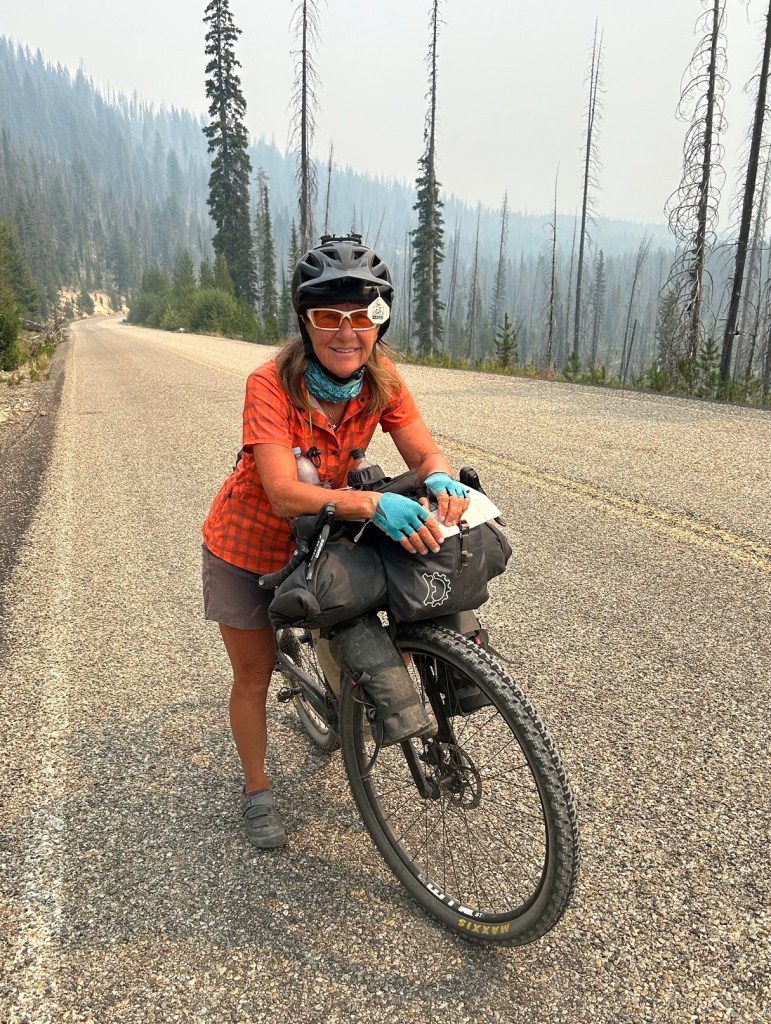
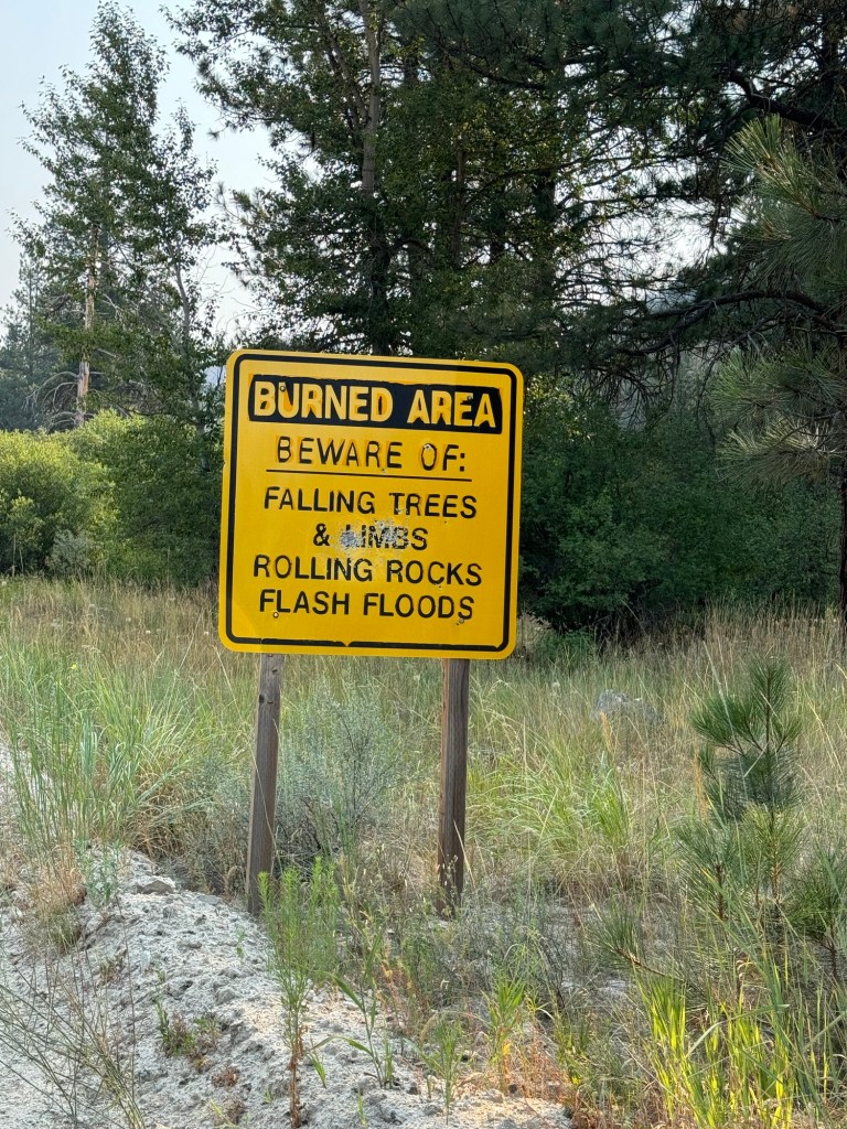
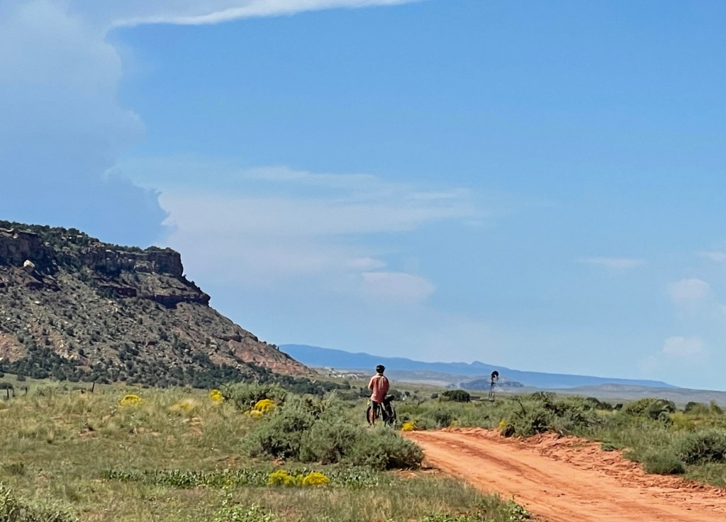
Our destination today was past Warm Lake where there is an active wildfire blazing and growing nearby.
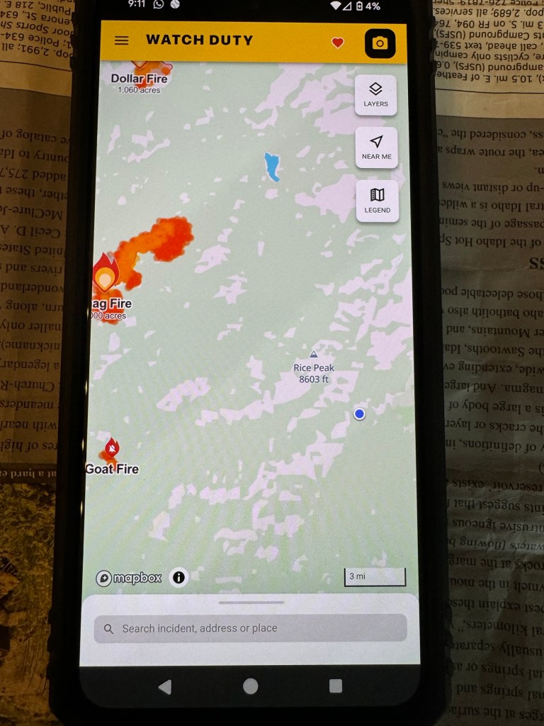
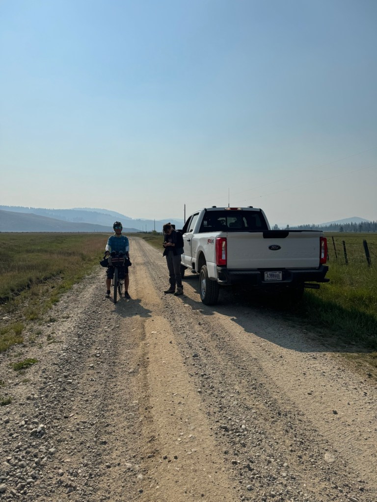
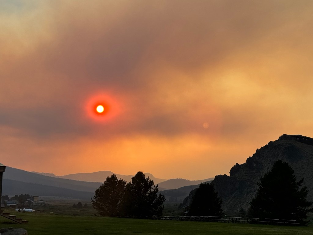
We stopped in Deadwood Outfitters for a cup of coffee and a wildfire update. Wrangler Sean showed us the Watch Duty app (same one as the Forest Ranger mentioned yesterday for fire updates). Apparently the Snag fire grew from 4,000 to 7,000 acres overnight and Warm Lake, the next town down the road was on Evac 1 Alert, meaning get your things ready to evacuate.
We wi-fi called the Valley County Sheriff Office from the Outfitter at Sean’s suggestion to ensure our route wasn’t closed and we were good to go.
Though smoky we continued our climb up and over Warm Lake Summit and stopped in the “Lodge” (and I use that term loosely) 😂 where we ran into Nick and Al whom we have been leapfrogging. They are riding the north Idaho Hot Springs loop and will cut back east on the Lowman Pass to return to Stanley.
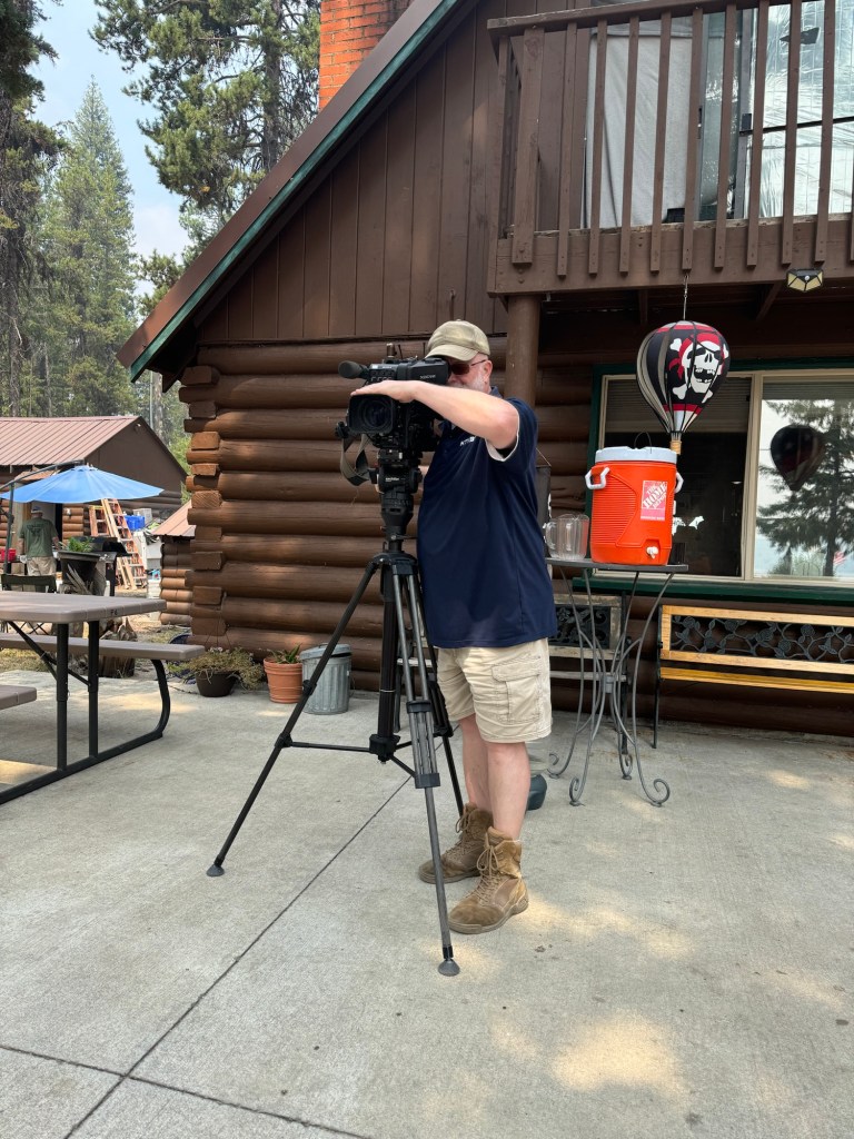
A news crew came to take video and report on the Snag fire and lake area near the lodge where we stopped for burgers.
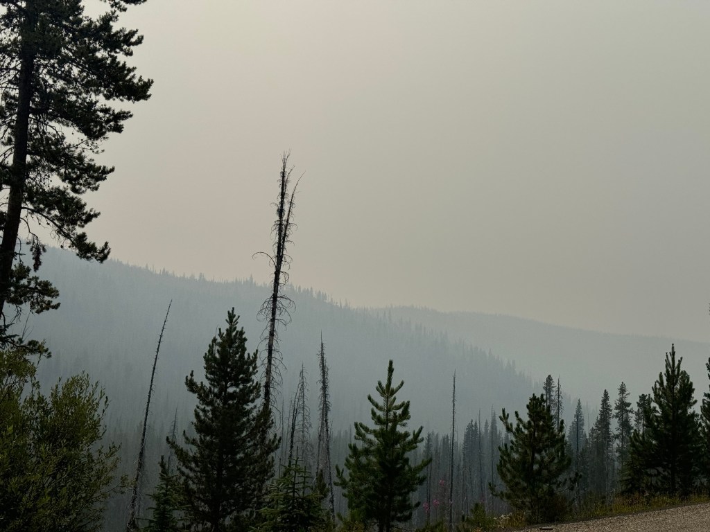
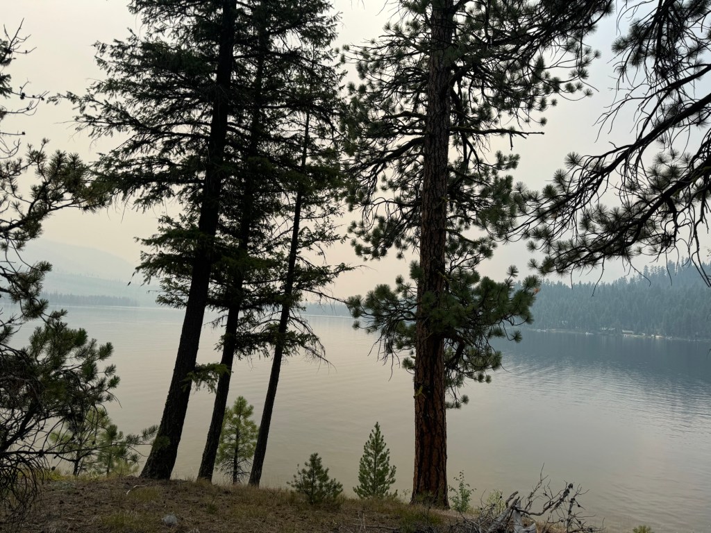
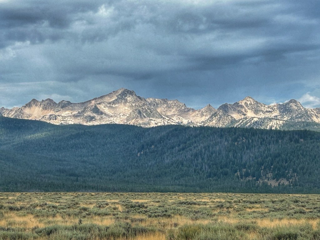
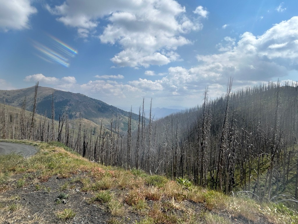
Smoke was getting thicker. 😢
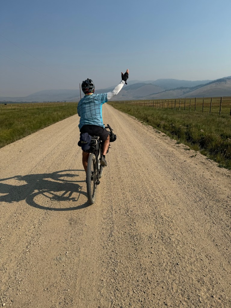
As we left Warm River and cycled north the smoke diminished.
However of all things we ran into wait for it…. a chip and seal crew. Too funny not to capture on video, I included a few clips in the video at the bottom of the post. Ya just never know what you’ll run into on a bike tour.
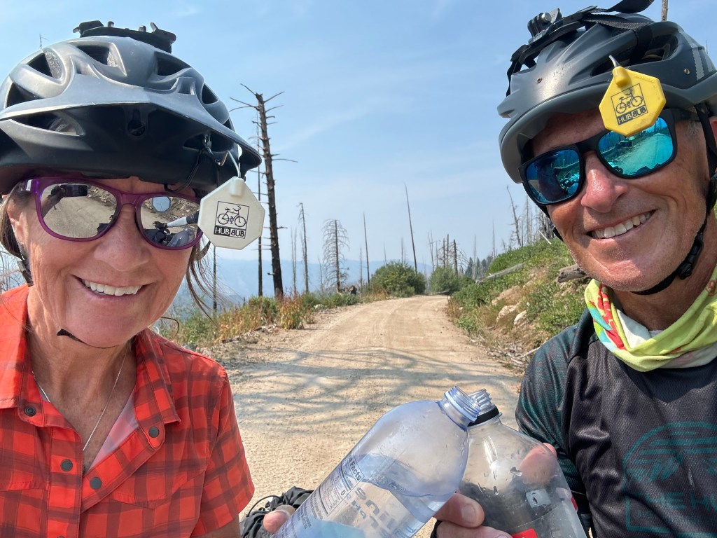
Made it to Buckhorn Campground which sets us up nicely for spending my birthday in McCall!
Click on the link below to view more pics and vids:
Today, finally, I think I got my “air” back and got acclimated to higher elevation and boy did it feel good to feel zippy again!
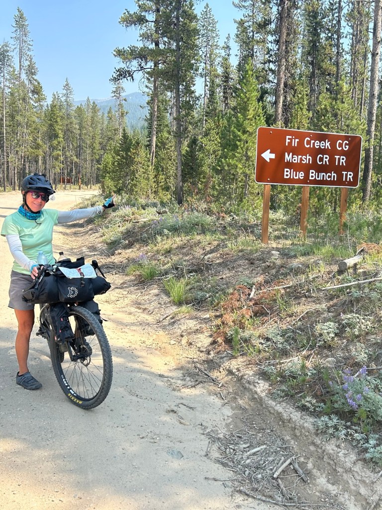
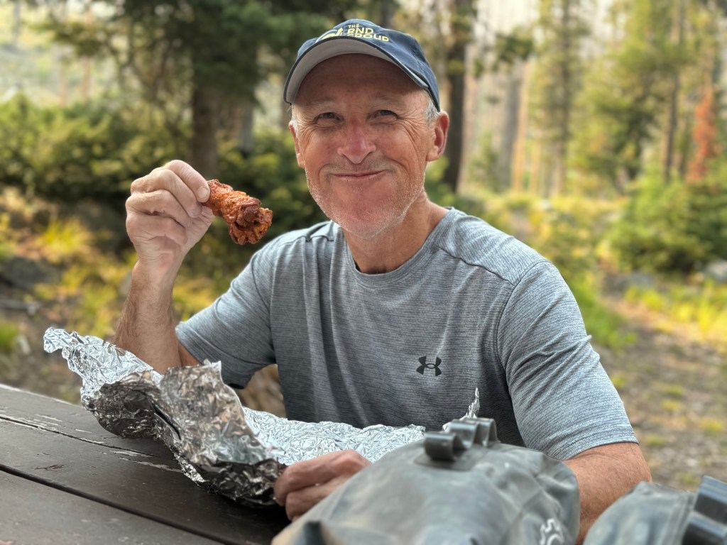
We left Stanley unfortunately without leftover pizza in our bags but instead, leftover Buff Chick Wings which aren’t a bad sub, and had Fir Creek Campground as a tentative stopping place for the day.
Since we hit Fir Creek early about 3pm we decided to push on to Deer Flat Campground.
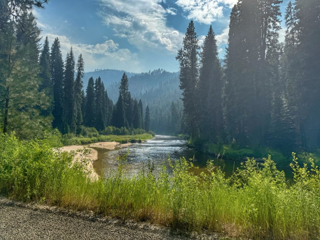
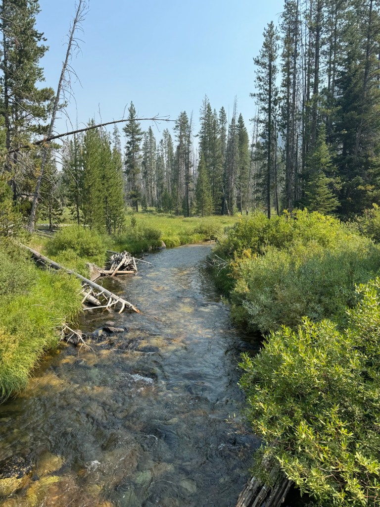
Again, the scenery dazzles us. Over most every rise and around every corner we stop to admire it.
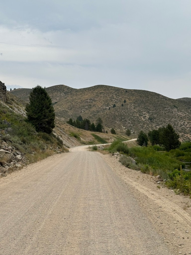
However, the road surface on the climbs and descents between Stanley and McCall (our next town) is horrendous with a lot of washboarding, deep sand with a few ratchet rocks and ruts to maneuver around. This makes for much slower going on a bike. We crawl up climbs and have to slowly descend down the other side being careful to keep the bikes upright.
About 15 miles in we stopped to chat with National Forest Service (NSF) Ranger Kayla, hoping we could get an update on wildfires as smoke is still visible.
She didn’t have any answers for us on that question but was eager to answer others we had, you know since we are “Googleless” out here. Plus, she’s from Seymour, Indiana and you know midwesterners… we like to help and chat it up.
She’s on Range Duty and part of her job is to ensure fencing and other conditions are ready for open grazing.
She said the area we are in is known as the Stanley Basin and water is abundant. When I mentioned we haven’t seen as much wildlife as we expected, not only here in the Boise National Forest but also in the Sawtooth, she said that animals seem to migrate away when the seasonal people come. In the off season more deer, pronghorn, elk and even wolverine can be seen. There is even a lone wolf that likes to patrol the area.
In the winter, snow is deep and easily covers the fence line and the area is easily accessible by snowmobile. Visualizing winter, it must be a wonderland.
We did see more pronghorn, some deer, pairs of sand hill cranes and Kayla wasn’t wrong about water in the Stanley Basin.
One of these days I’m going to make a list of all the things I would need to learn if I ever solo bike packed. Not only does Tom do his share of “camp chores” he keeps the bikes field serviced, takes the lead on navigation and so many other things that I don’t take for granted. Plus he carries the leftovers on his bike.
Looking forward to more jaw dropping scenery… ratchet road surface… well maybe not so much.😂
Click on the image below to view more pics and vids:
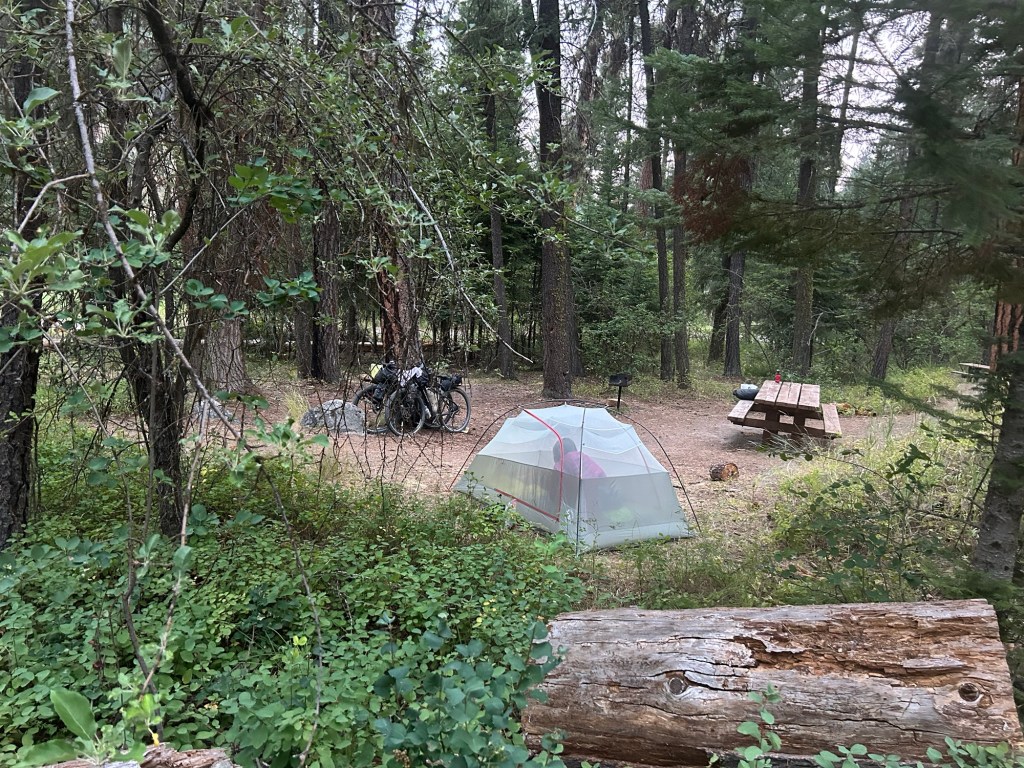
Ya just can’t beat waking up in a tent on a clear morning in the mountains.
We’re headed to Stanley today for, from what we’ve heard, pizza worth peddling for.
One of the best parts of bike tours is meeting fellow riders on the road, chatting it up with locals and also hearing from people we may never even have met who have read our blog.
Cycling really does bring people together. We have no idea who they are going to vote for, where they sit in a pew on Sunday (or if they sit at all) or what their fave pizza toppings are. We share a common thread of curiosity and a love and respect for each other and the outdoors.
Such was the case when we met Rhonda, John and Mark at the top of a climb. We could have chatted with them all day and it was they who suggested pizza in Stanley. True to their word, it was amazing. We got their contact info too and will take our bear sprays, extra fuel and bug juice when we get back to Boise.
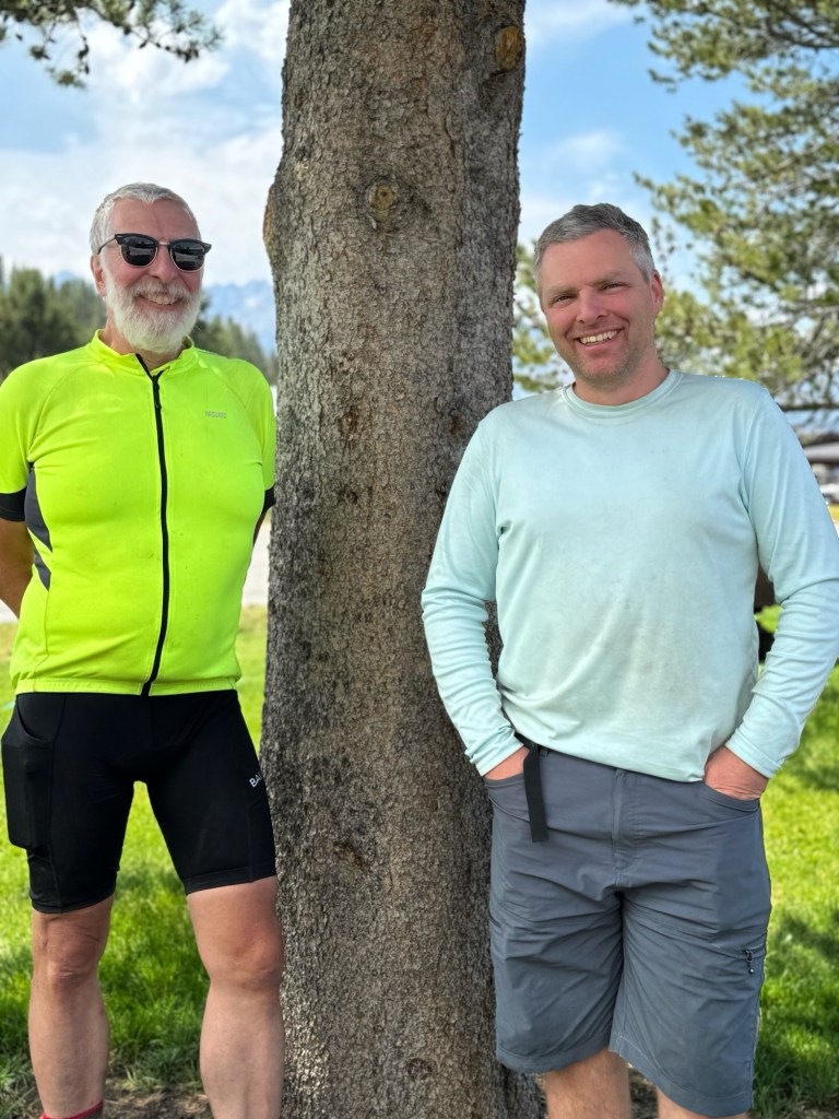
We said goodbye to Karl and Brian today in Stanley. They finished their bike tour a day early and weren’t going to use their hotel room so they let us use it! So long friends… until next time.
And not only do the comments on social media and the blog encourage us, hearing from new people that have route suggestions, questions or are inspired in some way, touch us in a special way.
We are SO very grateful for ALL of this, even the tough parts, because we know we are lucky to live the gift of life.
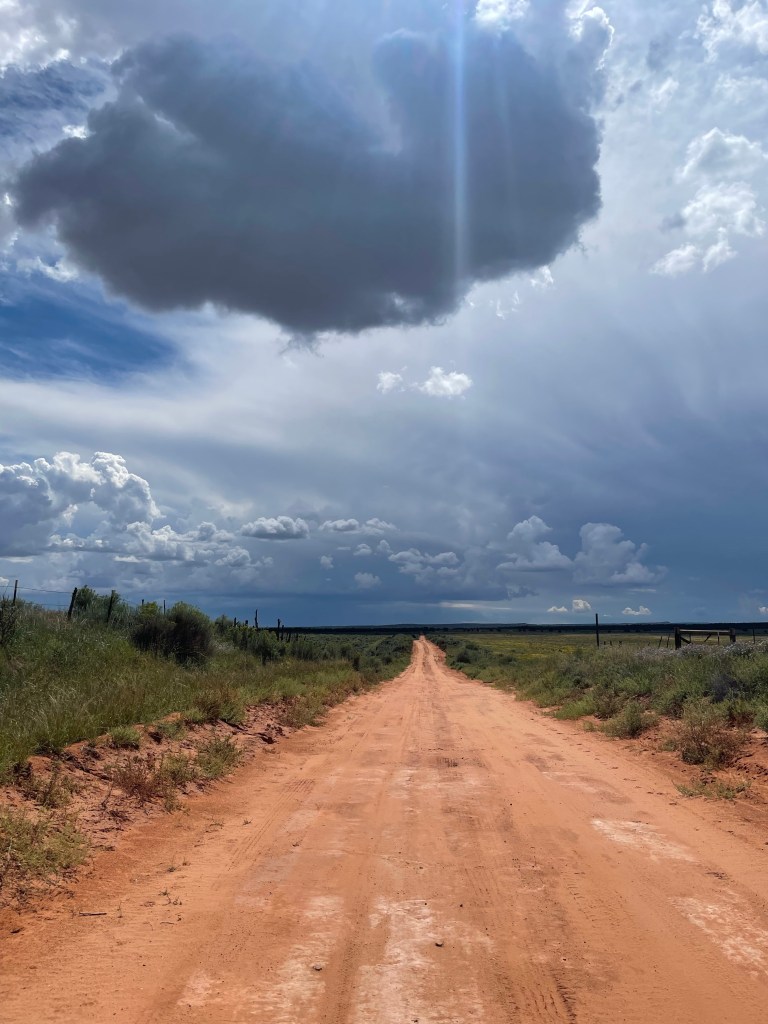
Wildfire smoke continues to move with the wind and there are several fires burning up here in Idaho. Yesterday the wind blew in smoke to Stanley. When we rolled in, it was clear and by the time we finished hot wings and a salad for dinner the mountains were obscured by smoke.
Next “city” stop is McCall and about three days away. Stay away smoke!
Click on the image below to view more pics and vids:
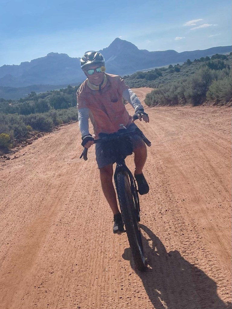
Our route out of Ketchum took us north as we will ride into Stanley on Tuesday.
Harriman Trail, a very well maintained double track with spectacular views of the Boulder Mountains on the right took us to Galena Lodge and on the way we met four cyclists brand new to bikepacking having just completed their first outing.
All agreed next time they will pack even less and figure out how to make their bike saddles play nice.
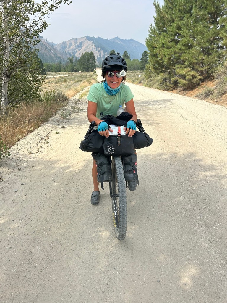
The tentative plan that Tom put together weeks ago for the Idaho Hot Springs ride (he’s an excellent planner) had us riding up and over Galena Summit and camping at Smiley Creek which was about the halfway point to Stanley, Idaho.
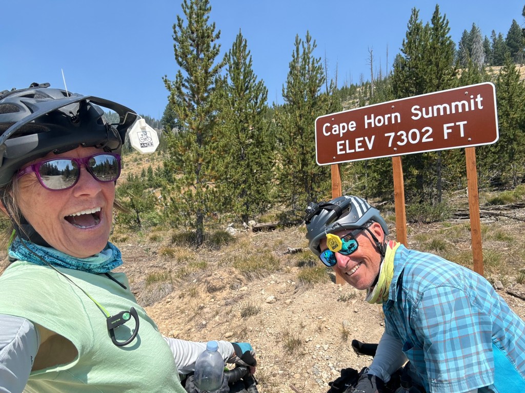
Galena summit is an 11 mile climb, however the grade is more gradual than Steel and Dollarhide Mountains. Still, we’d get up over 8,700 feet at the summit and the last four miles were going to be steep.
After a quick stop at Galena Lodge which is actually not much more than a restaurant and bike shop that serves hand dipped ice cream cones, we continued cycling up to the Galena summit.
So glad to have stopped for ice cream and water. We met 15 year old Edyn who just finished riding the Tour Divide this year in 1️⃣9️⃣ days which is so fast, especially with all the snow.
Today’s twist didn’t involve losing a sandal, meeting a snake or an unexpected eight mile (for me) Hike-A-Bike, but four miles of uphill rocky single track along a steep ridge.
Whew! Don’t look over the edge, keep my focus just ahead of me on the trail and pedal punch over the big rock clusters. When water features or bridges appear, get off the bike and walk them.
We sure didn’t expect singletrack on Galena’s Old Toll Road but here we were. I thought the Toll Roads were for road improvements. Someone’s not doing their job.😂
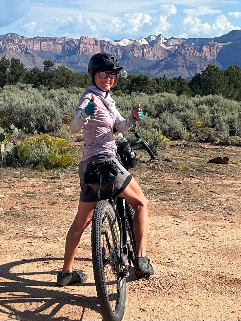
At the top of Galena we saw weather coming in quickly so we decided to take State Highway 75 down to Smiley Creek. The paved two lane highway with good line of site allowed for one of our most memorable descents as we could let it loose peddling downhill.
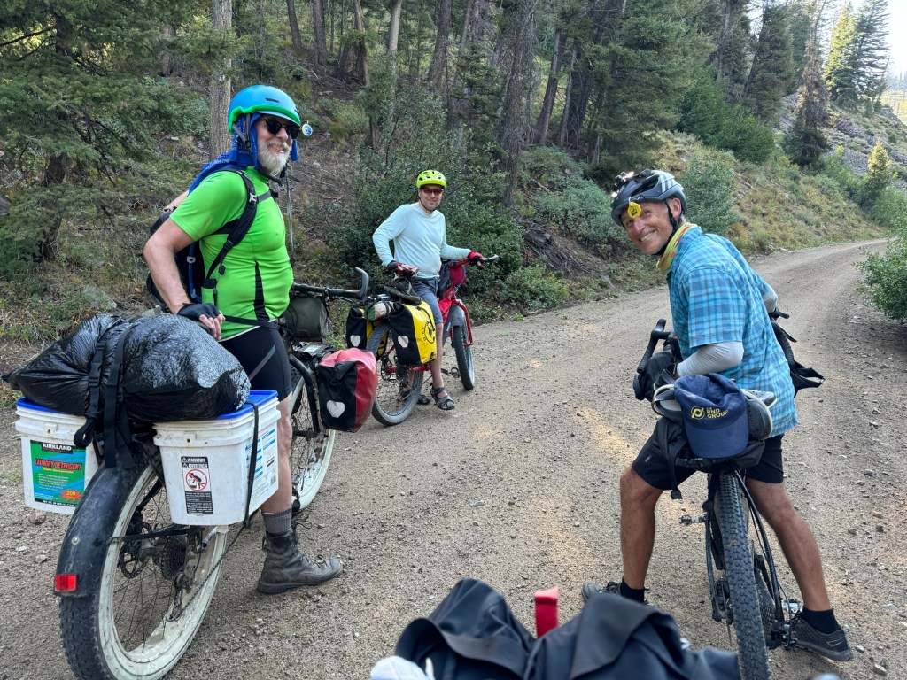
Drops began to fall as we came off the mountain but we were able to skirt around the storm and rolled into Smiley Creek where Brian and Karl (friends we met on Dollarhide Mountain) came out with smiles of their own to say hello.
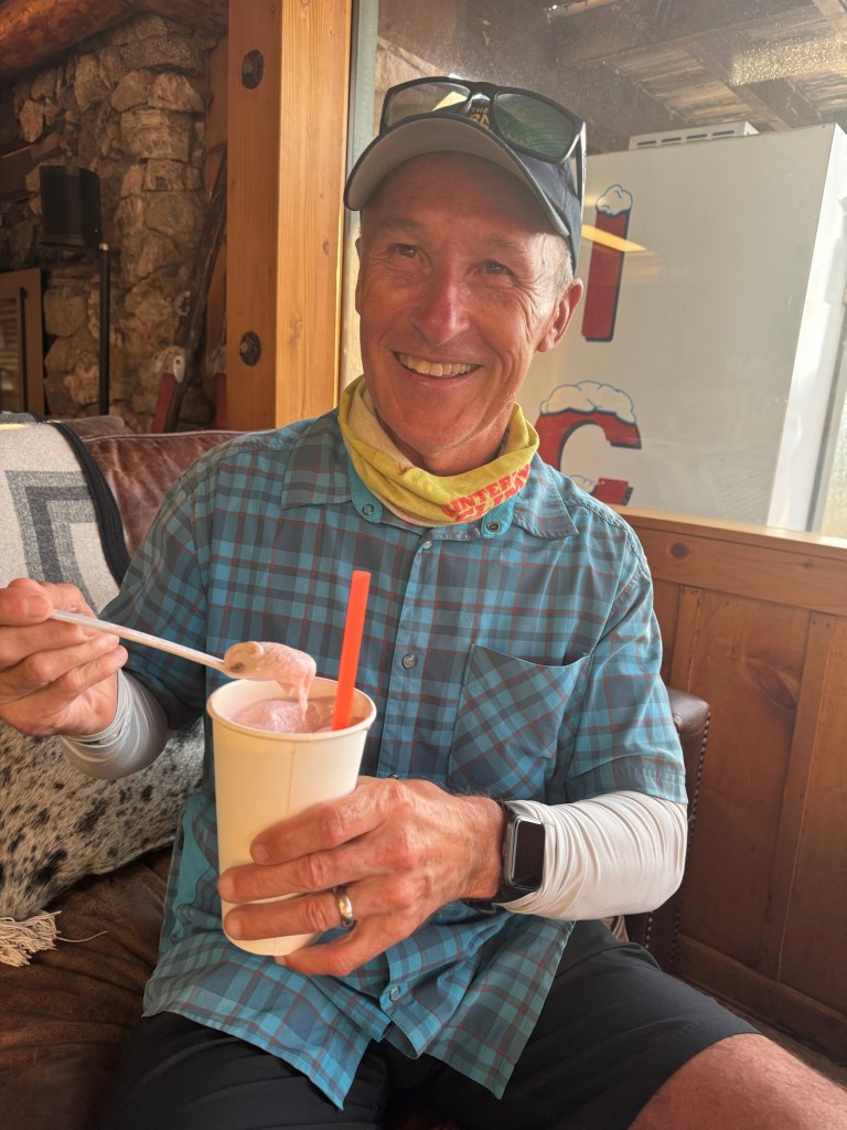
Food tastes best to us when we’ve earned it and tonight was no different. The four of us, Brian, Karl, Tom and I ate dinner together and swapped bike stories after which Tom celebrated the day with a Huckleberry milkshake.
Click on the image below to view more pics and vids:
Another 8+ mile climb is the main course on the menu today with two appetizer one mile warm up climbs first.
Dollarhide Mountain is the same distance as two days ago up Steel Mountain but has one less percentage of climb. #whoopwhoop
We were a little smarter this time in that we planned the ride for early morning and took more water. Plus there was an early morning surprise rain shower that cleared the air (forcing us to quickly put our rain fly on at 5:30 am) , lowered the temps and settled the dust. We hoped all this set us up for better results.
After breakfast as we were packing up two bikepackers peddled past our campsite.
Brian and Karl, who we would meet later in the morning, got an early start as well.
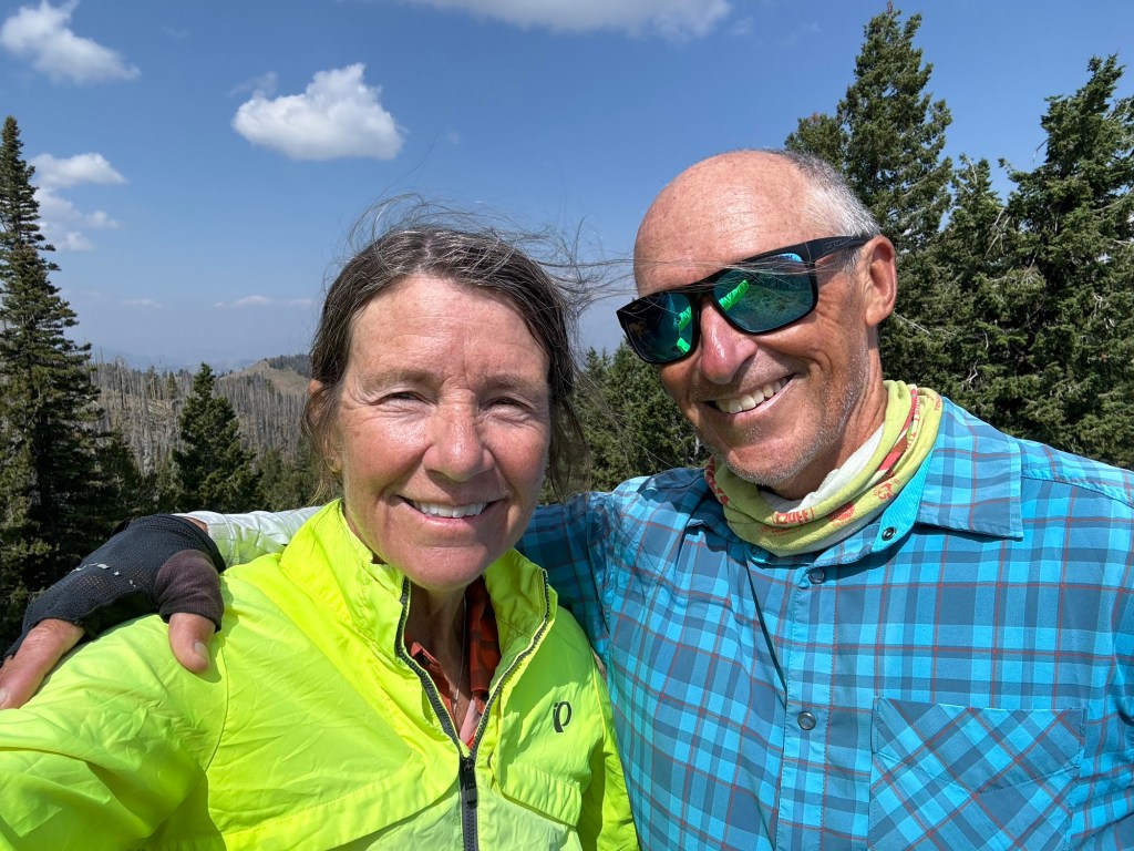
As Tom reached the summit before I, he had the chance to talk to a local who recommended two places in Ketchum we shouldn’t miss. Always listen to the locals.
Dollarhide Mountaintop
The ride down Dollarhide Mountain on dirt was as swift as it was picturesque as layers of mountain ranges came into view in the distance and colonnades of purple wildflowers waved to us as we flew by. Fast and spectacular!
We had a hotel stay in Ketchum to look forward to and that meant a hot shower and city food so yea we were motivated to get to Ketchum.
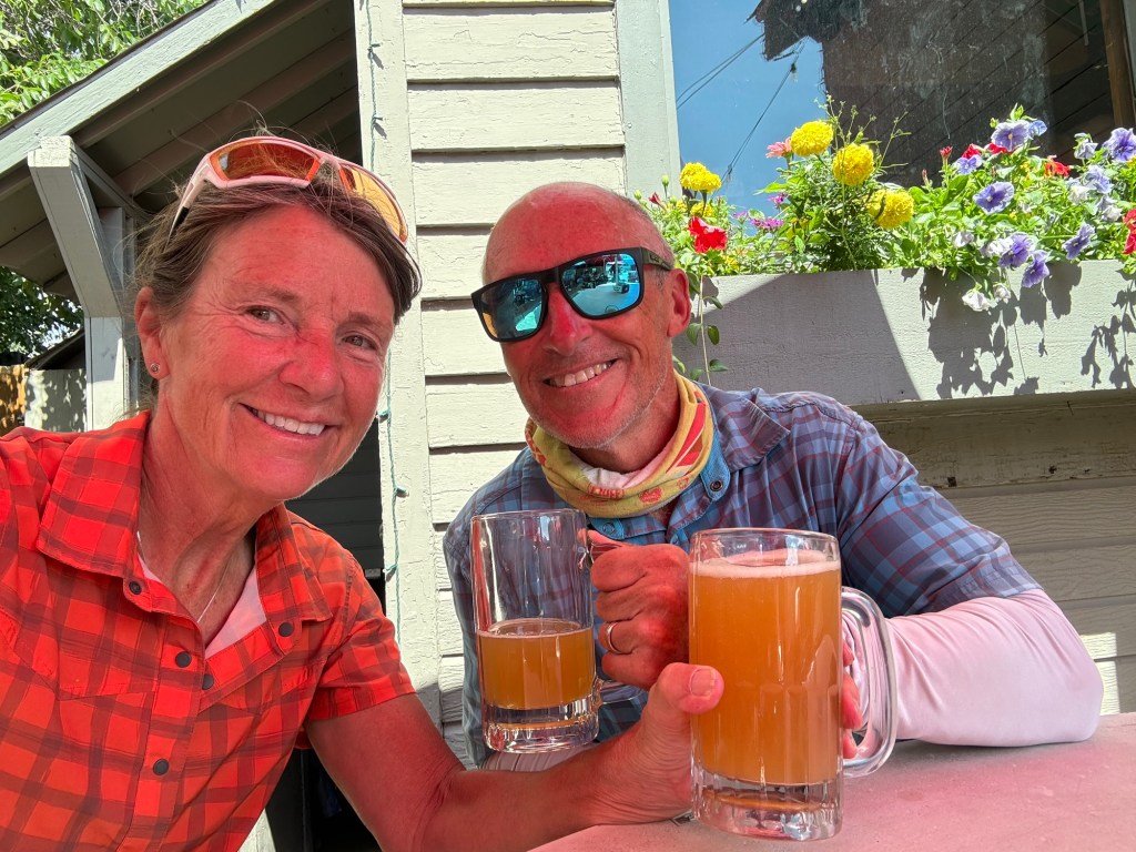
Grumpy’s for lunch and Sawtooth Brewery for dinner. Neither disappointed and either does beautiful Idaho.
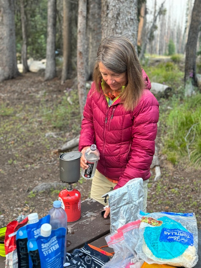
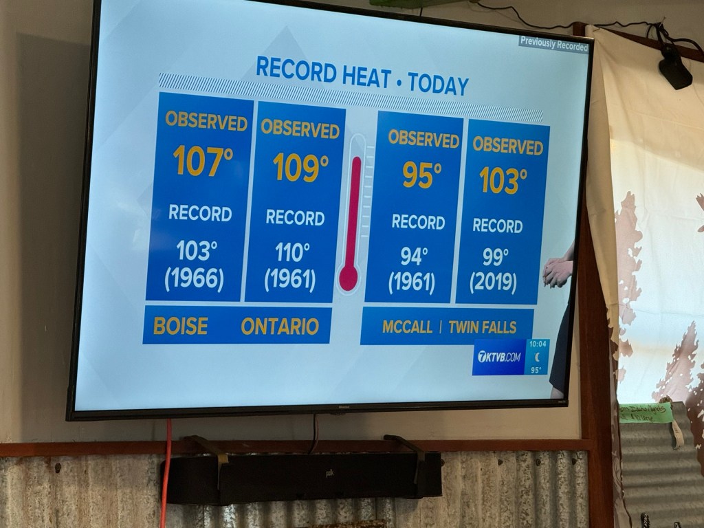
We slept in until 7:30 am since we are planning a recovery ride of a just little over 40 miles and we have another big climb tomorrow. The gentleman who made us burgers last night at the Cafe promised us fresh coffee and breakfast burritos. So after “Pack and Pray” (well friends, our usual 100 pushups and 4 minute planks every morning are out the window on this tour), we went for some breaky and wifi to check on wildfire updates and weather.
We haven’t had any cell service or wifi since we left and that can be problematic. No internet. At all. No way to check weather, wildfire activity, check in on family, play Wordle or Connections, identify flowers or answer any one of about a hundred questions I have throughout the day, including “is that bear scat?” So when we can get connected we have a lot of catch up, including weather forecast. Nothing’s changed. It’s still hot out.
Back to the breakfast burritos. Eric, the cook, shared with us that he and his wife got married in the exact same spot we camped last night by the creek. It’s just that special.
He also let me try out his fly pistol. Eric’s pistol has a Co2 cartridge and some other supplies to go with. Aim, fire and the fly is obliterated. Once I got my finger on the actual trigger it was all good. Apparently I need to go to the firing range and learn now to find the trigger. Got ‘em! Another fly that won’t land on someone’s breakfast burrito.
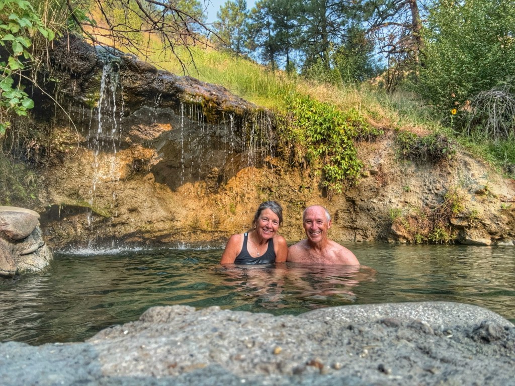
Burritos were 💯 so back to the gravel roads for an easy spin through the mountains and hopefully a soak in Worsick hot spring later in the day near our planned camp spot.
I said it was a recovery day and it was in more ways than one. About 10 miles in, I reached back to make sure my Chaco sandals were still rock-strapped to my seat bag and one was gone! Not. Good. At. All.
I quickly turned around wondering how far back I’d have to go. I knew it probably popped off as I was bombing down a hill over chunk rocks and bumpy washboard. Sure enough, 1.1 miles back my lone sandal was recovered. Whew! A recovery day in more ways than one.
The plan was to lay up as close to the start of the eight mile climb up Dollarhide Mountain as possible. Worswick Hot Spring appeared to be the perfect destination, except we got there about 4pm, the sun was out and it was blazing hot.
Lunch stop at Smokey Bar Store
Nope! Not a day for hot springs. We then proceeded to cycle by Smokey Bar Creek but the water certainly wasn’t flowing Iike the Middle Fork of the Boise. When we finally found what might be a suitable spot somewhat close to water, there were so many cow pies left from open range cattle, the flies formed a welcoming party we REALLY didn’t want to join.
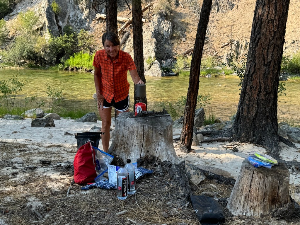
Without many choices left, (and without Eric’s fly pistol) we decided to pitch our tent and went strait to the water to rinse off and filter water. What does Tom see? A snake in the water. Really?
After throwing a rock in the water to encourage Mr. Snake to move along downstream, that snake stuck his head out of the water and looked right at Tom as if to say “Hey I was here before you”.
When I went back later to see if the coast was clear so we could cool off in the water, some sort of giant water mammal was swimming to shore toward our tent, maybe a muskrat, a beaver, a river otter? I have no idea because I have no cell service and I can’t check Google to find out. 😂
So instead of sitting in the hot spring, or a dip in cool creek water we took a two mile walk down the dusty road just to get away from the flies, the snake and muskrat thingy.
Ya just never know what you’ll find and recover on a bike tour. No matter what, there will be a story to tell and I guarantee it will get better every time you tell it.
Thanks for following along friends, family and neighbors.
Click on the image below to view more pics and vids:
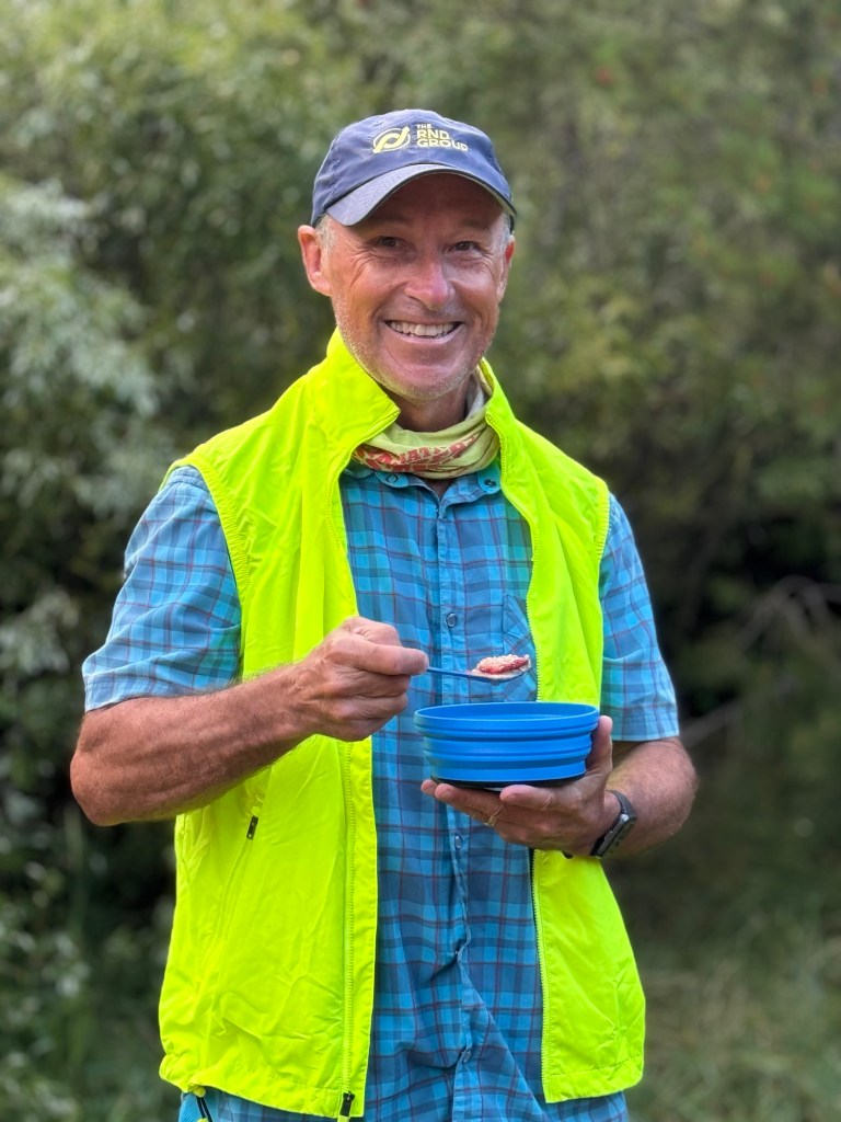
Day two started out with two coffees each and oatmeal with freeze dried strawberries.
Within two miles we hit our first hot spring: Loftus. We keep shorts handy at the top of our bags so we can quickly slip out of bike shorts and into quick dry shorts to wear in the spring. The hot water on a cool morning felt soooo good!
The scenery riding on Willow Creek Road along the middle fork of the Boise River continues to awe us although we’re beginning to see remnants of past forest fires.
The route had us turn right on Pfifer Creek Road for an eight mile climb and that’s when the party ended.
We rode Pfifer Creek Road up and over Steel Mountain Summit (elevation 7,150 feet) and it was about the biggest butt kicker of a climb we’ve experienced due to heat (upper 90’s and little shade), grade (8% average but also areas of 14%) and road surface (rocky, rutted and deep sand).
Tom didn’t have as much trouble as I but in addition to the heat and climb, my legs and lungs just weren’t getting the oxygen they needed to work. Maybe I’m not adjusted to altitude?
However, the Trinity Mountains were to the south and the Boise Mountains to the north so there was always something to look at while I hobbled up to the top.
Honestly I’ll bet I walked almost the entire eight miles pushing a 50 lb loaded bike up the mountain in the sun. Tom came back TWICE to help me push my bike up because about all I could do was take 25 steps, stop and rest and then 25 more. Sometimes only 10 steps. It was a pitiful experience.
I kept thinking about my friend Bonnie, my nephew Vince and my friends and neighbors undergoing treatment for cancer (all of whom I’ve been praying for) who would give anything to be out doing what they love to do and here I was squandering what I love to do. It was definitely a buzz kill for me.
About a mile from the top Tom found a waterfall with fresh cold water. We filtered four liters and continued peddling to the summit. After clinking plastic water bottles for cheers once we got to the top we immediately began the steep descent back down the other side.
Riding down Steel Mountain I spotted a black bear running up the hill to my right. Both times I’ve seen bears on back country rides I’ve heard them first. They are so noisy in the woods tromping on everything in their path. They certainly could take a few lessons on stealth in the woods from white tailed deer. On second thought. Maybe it’s better if they don’t. 👀
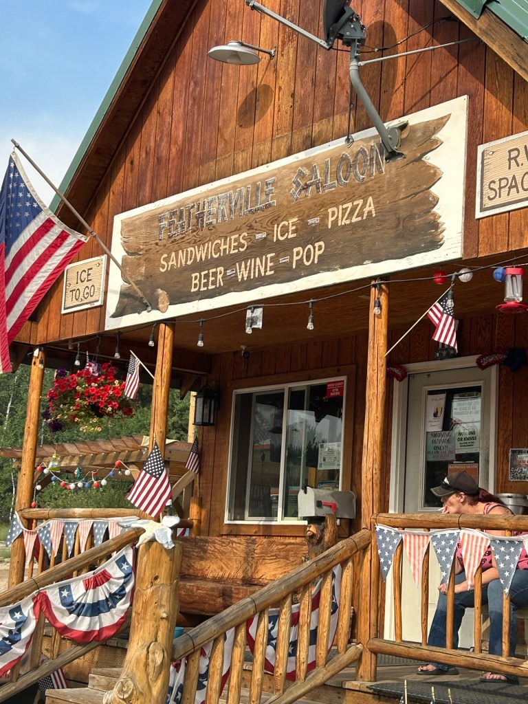
We made a right on Rocky Bar Road into Featherville onto the first stretch of pavement we’ve seen since we started.
It appears to be a rally point for ATVers and locals with a motel, saloon and cafe. We took in burgers and a beer but passed on the motel and instead chose a nice spot by the creek suggested by Pat, one of the locals.
Click on the image below to view more pics and vids:
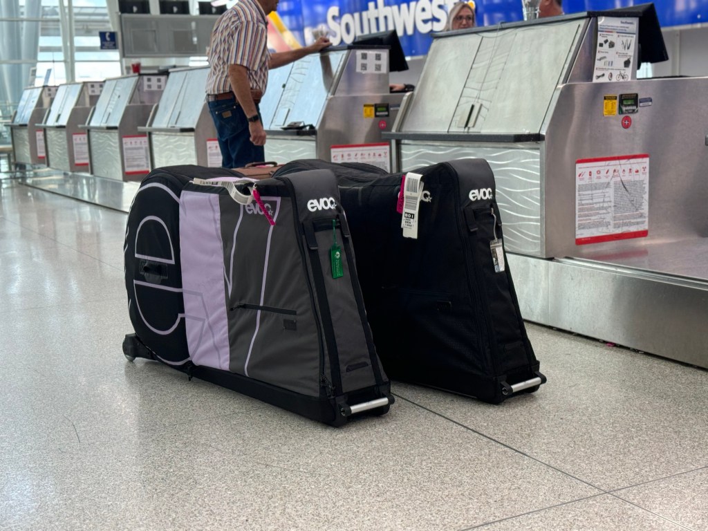
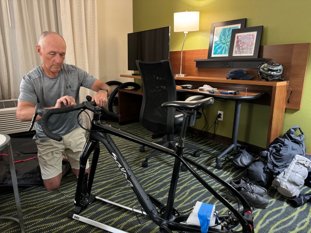
We started cycling from our hotel which was adjacent to the Boise airport – very convenient. The 32 mile Boise Spur begins at the airport and connects riders to the beginning of the Idaho Hot Spring (IHS) route.
Our hotel will store our bike boxes until we get back when we will again check them as baggage when we fly back to Indy. This is the first time we’ve used bike boxes and a trial run for future tours.
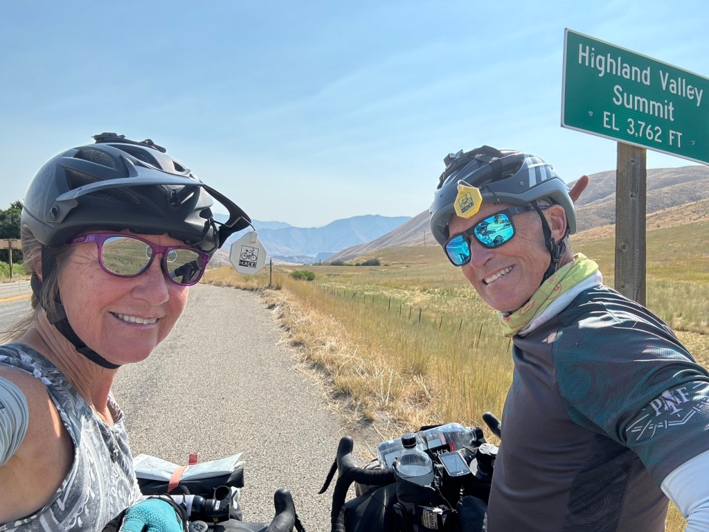
We kicked off the ride with a “well hello legs” four mile climb. It was on pavement and gradual so no biggie. At the top of the Highland Valley Summit there’s a little store and the tag line is “it’s all downhill from here.” Made me laugh.😂
We followed along Lucky Peak Reservoir and were treated to stunning views.
At 23 miles the route becomes dirt and the Boise Spur ends at the junction of Middle Fork Road and Cottonwood Canyon where we began following the Middle Fork of the Boise River.
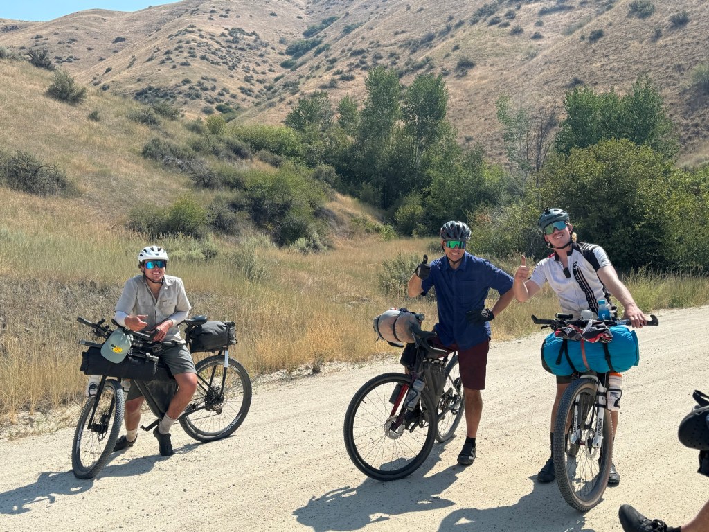
As we were wrapping up the Boise Spur we met Andrew, Scott and Daniel who were just finishing the IHS loop and shared some helpful route intel. They looked worn, weathered and happy.
Middle Fork Road turned out to be a very exposed (little shade), washboardy and sandy road which made for very slow going. Plus apparently Boise is experiencing its third hottest summer on record. It’s a dry heat but whew it’s hot!
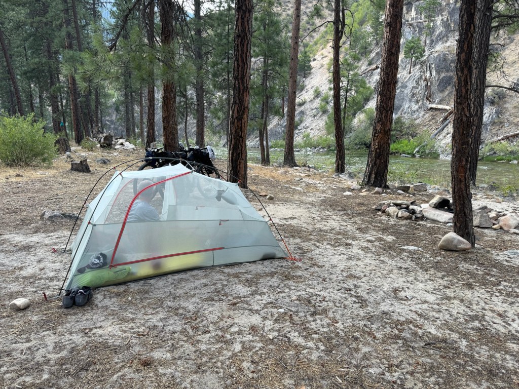
Around the 50 mile mark we started looking for a campsite. We’re on public land so we can “stop and plop” just about anywhere and camp (with some restrictions).
On our first night we were looking for shade, water access for cooking, filtering, maybe a quick dip and lastly, a tree to hang food to keep away from the bears. Mission accomplished.
We were sound asleep before dark and it was a no tent fly night. There’s nothing like running river water, cool mountain air and a good day of cycling to get peaceful sleep.
Click on the image below to view more pics and vids:
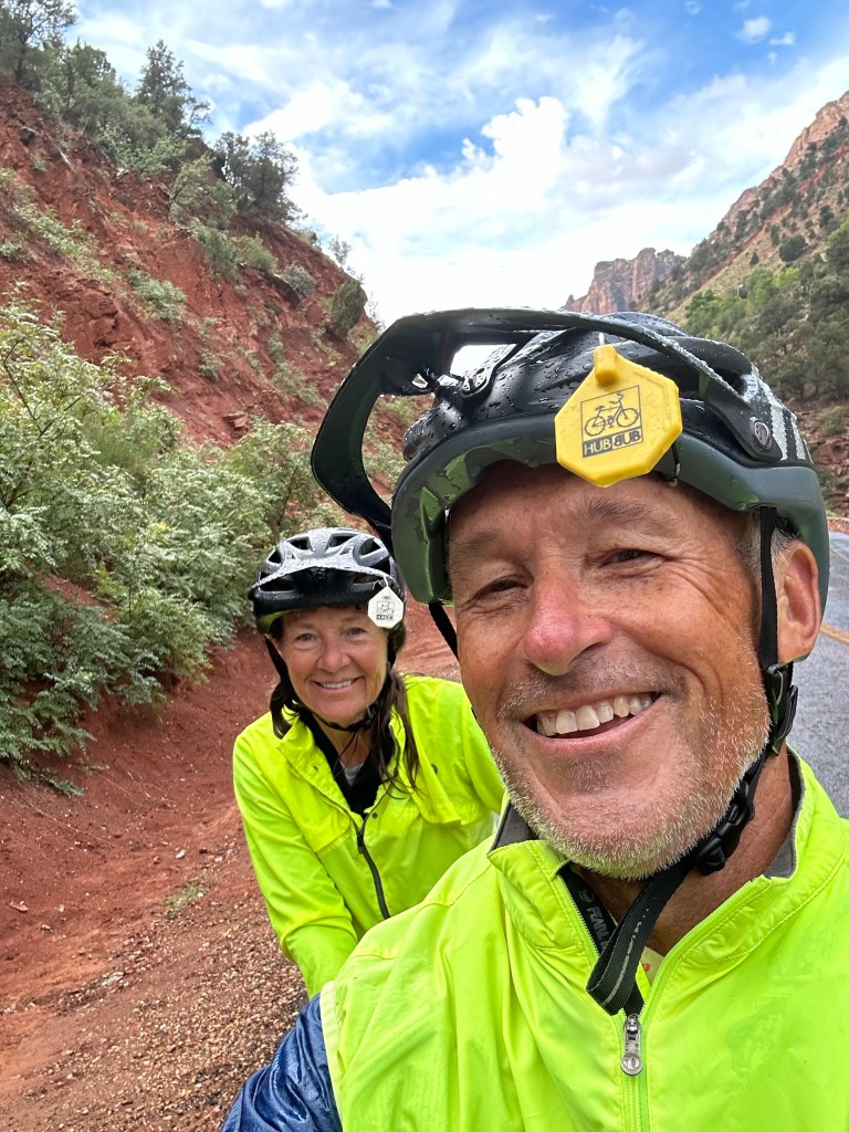
Just a 30 mile gravel ride today that started about an hour outside of the national park on and around Gooseberry Mesa.
We found the route on the Gravel Bike Race website that hosts an annual gravel race, downloaded the gpx file and just went with it. There was some technical riding on one end with open canyon country on the other and both were 🤙🏻
Ya never know what you’re going to get. The directions said turn left on Main Street but Main Street was nothing but a dirt road. 🤣
The ride did NOT disappoint and we had a little bit of everything as far as road surface; gravel, baby head rocks, small boulders, ruts, deep sand, lots of washboard and mucho cattle guards. As usual the afternoon thunderboomers kept us at the ready.
There were views of Zion National Park and Kolob Canyon and the second half took us through cowboy country and some of the best canyon scenery at 12 mph.
We rode south towards the Arizona border and then made our way back to the car.
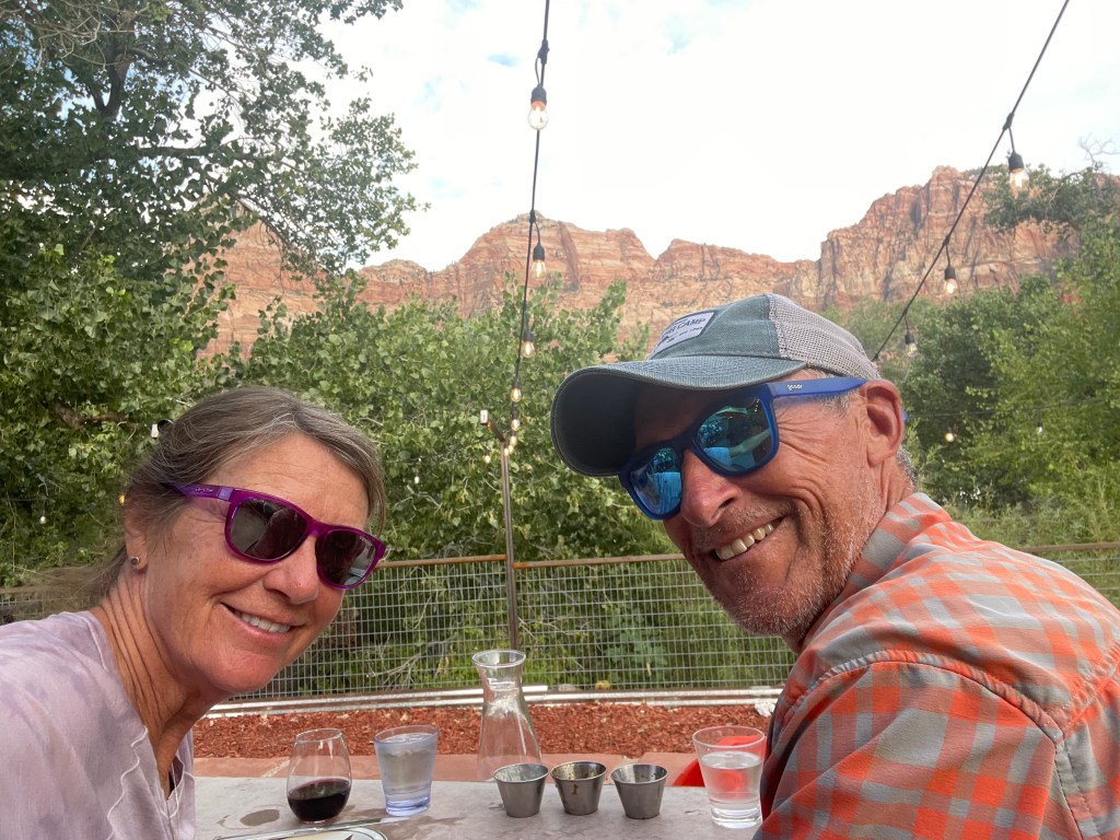
For dinner it was back to Zion Canyon Brewery because I mean why end a good thing? The food has been tasty, service 💯 and we sit right by the Virgin River each night recapping our day, planning for the next and estimating how old the ancient Cottonwood trees are along the river.
We got a 20% “locals discount” since we’re basically regulars now this being our third night in a row.🫣
Tomorrow we head to Nevada for our 49th state with a bike cruise through Valley of Fire State Park and our first proper showers in a week!
Click on the image below to view more pics and vids:
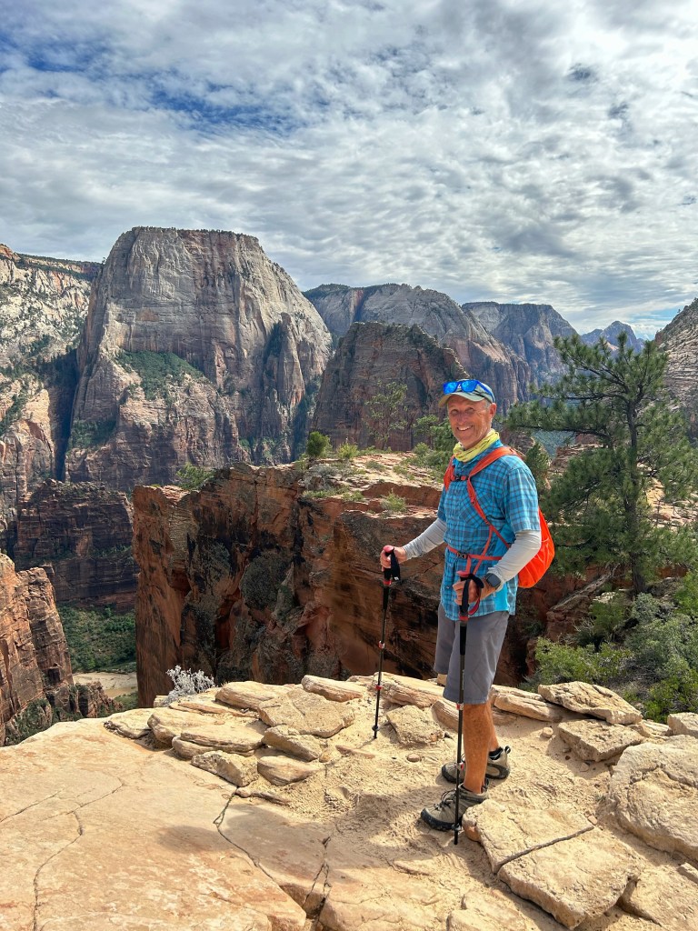
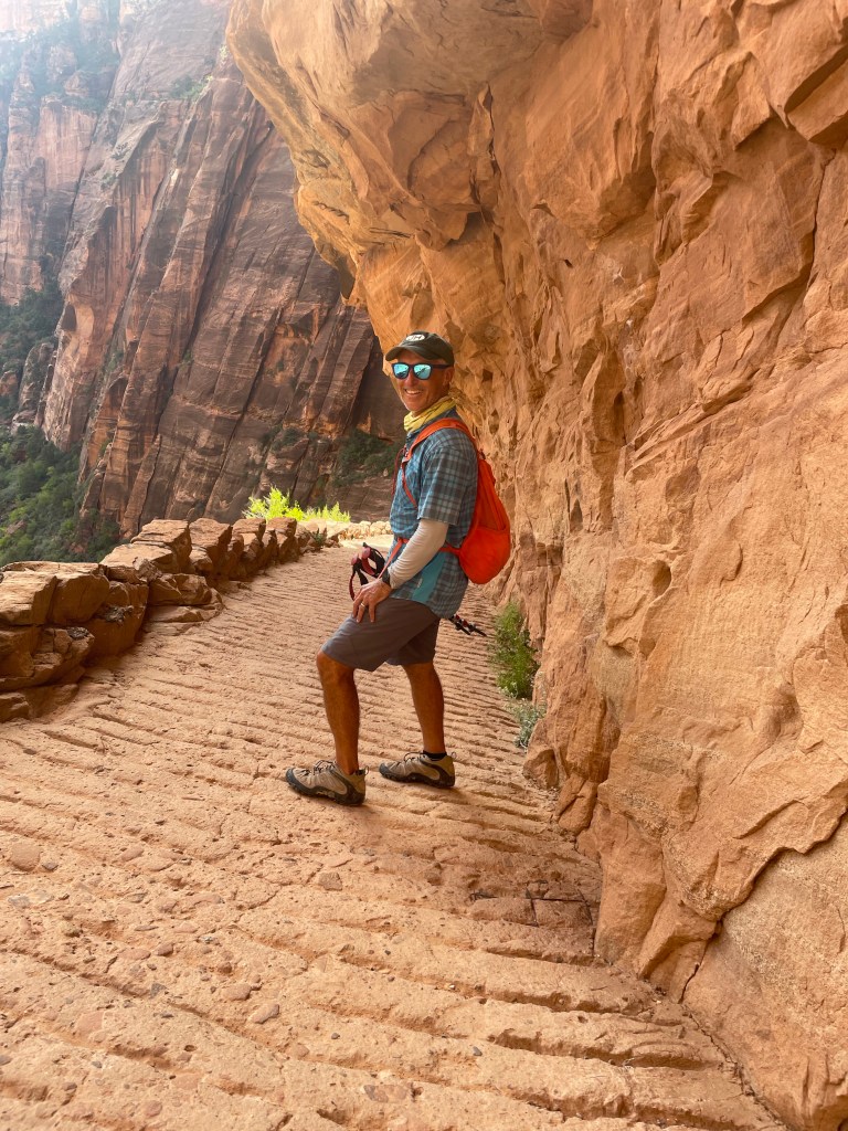
The title of this blog post Hike AND Bike is not to be confused with HAB (Hike A Bike) which we have experienced on Fleecer Ridge, Lava Mountain, et al on the Great Divide.
We started the day out in the rain but ended it in the sunshine and put in a 40 mile bike ride and a little under 6 miles of hiking.
Soon after the rain the skies gave way to sun and we were on our way to hike. Having our bikes with us means we don’t have to ride the shuttle. We just cycle to the trail head.
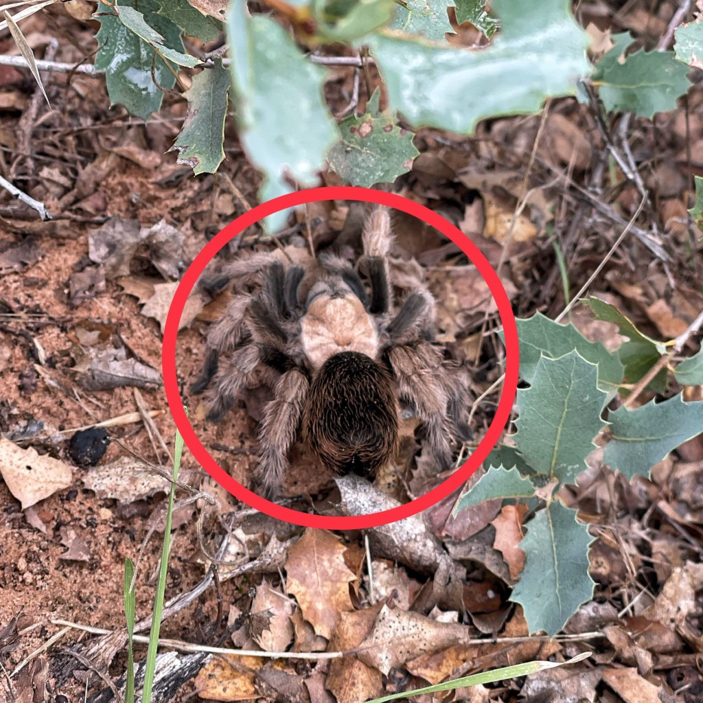
And meet Tina the tarantula. She’d just crossed the trail before us. About the size of my fist and cuddly as a golden doodle we decided to leave her be but not before snapping her pic.
The day ended at our fave place, the Zion Canyon Brewery for cheers and beers and deciding what the next day might bring.
Click on the image below to view more pics and vids: