There are so many stories to share about this full day: finishing the climb to the Mangapurua Trig, the sketchy decent, making it to the jet boat at Mangapurua Landing and the just-in-time arrival of Sarah and Amelia to the Landing but the one I give the most space in my mind to is the Western Vally Settlers and their story.
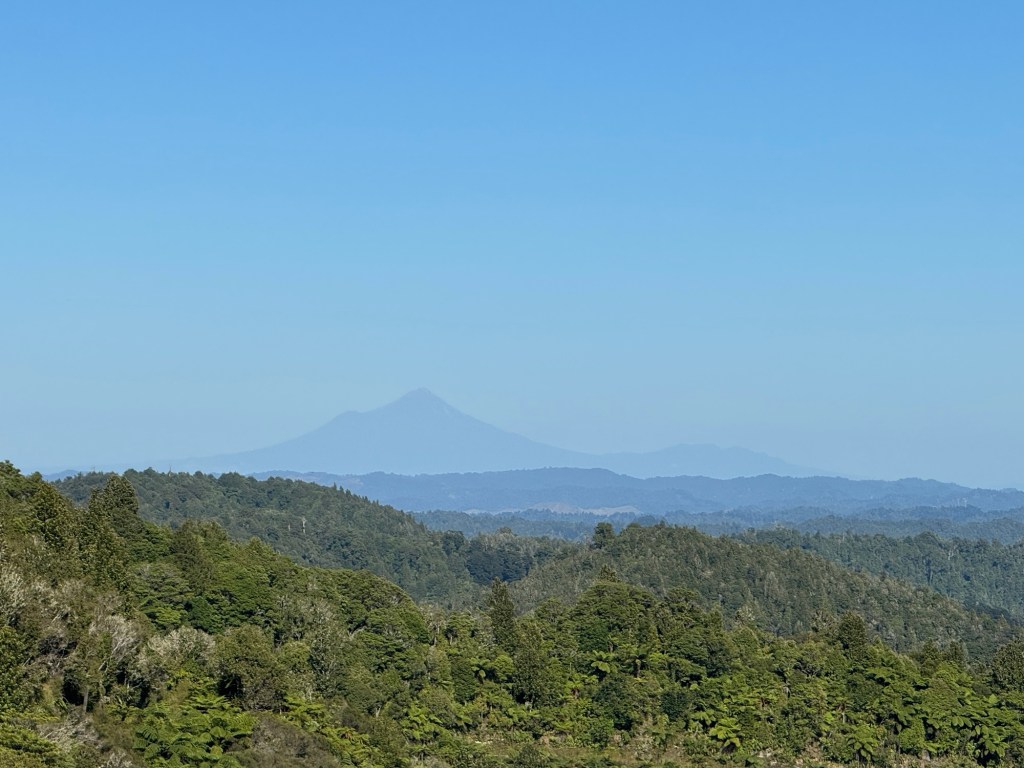
Not gonna lie… the view from the Mangapurua Trig was spectacular (and if you don’t know what a “trig” is look it up, ‘cause I had to.🤣 The teacher in me wants you to remember.)😊
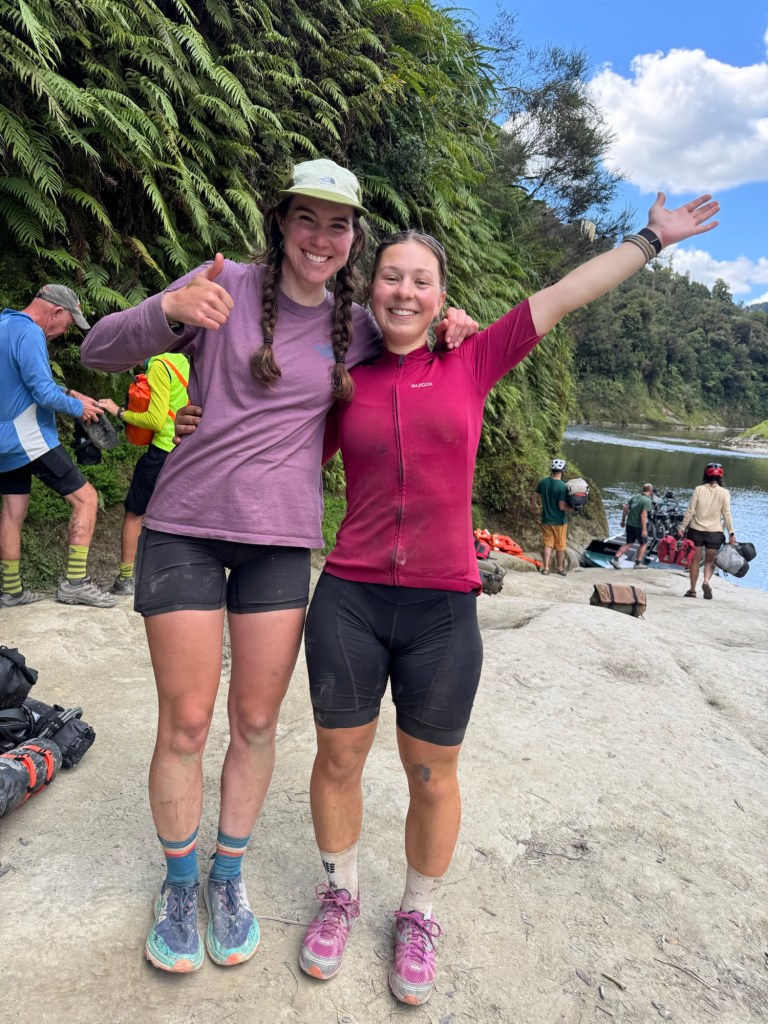
Looks like the descent would be an enjoyable ride downhill. Nope! It was a bit of a sloppy mud mess in places and we were in a hurry to get to the landing. Both of us went down once.
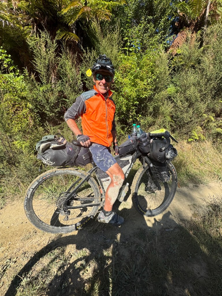
We managed to get to the landing to meet the jet boat with an hour to spare.
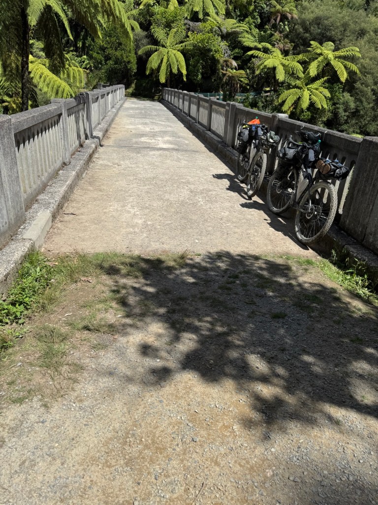
However, we’d been in contact with our friends Sarah and Amelia and knew they were trying to make the same boat we were but they started way back in Whakahoro (near the Blue Duck where we ate lunch yesterday) and had the entire climb to make before 3:30pm. There were six very narrow bridges they had to take their panniers off their bikes in order to pass, the mud, the dismount areas. Plus who doesn’t want to stop to take pics? But with 20 minutes to spare, these two rolled in to cheers at the Landing.
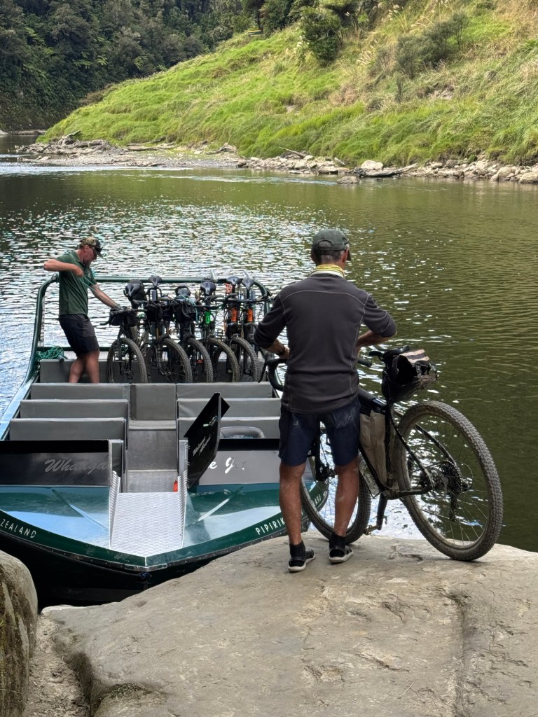
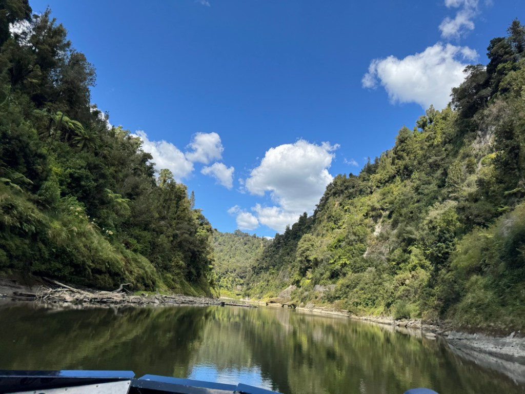
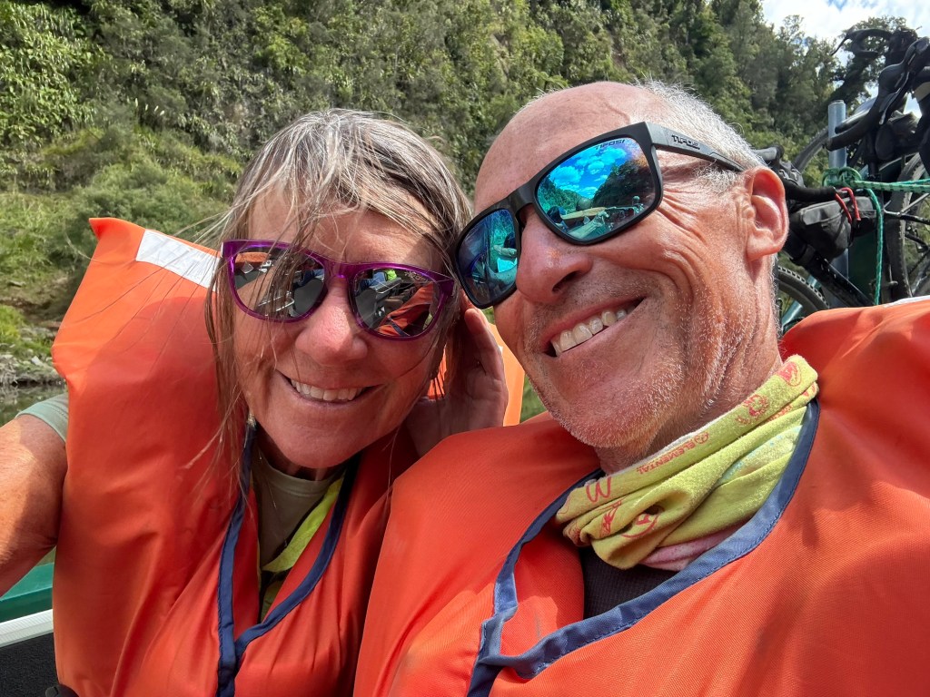
The jet boat ride itself was, well… unforgettable. Captain Ken basically maneuvered his boat up to the landing, which was nothing more than a big ole rock, and loaded our bikes on the back. He asked if anyone had ever ridden on a jet boat (Tom and I were a “no”) and then he began to advise us of the safety protocols on board and let us know “don’t worry; I’ve got this. Well he sure did!
He gunned the throttle so hard the bow of the boat went straight up in the air and I was sure the bikes on the back of the boat were at the bottom of the Whanganui River.
The views were spectacular, the ride, thrilling and the river history Ken shared was fascinating. The Whanganui River has been a water roadway for centuries and he pointed out evidence of this when pausing the trip downstream.
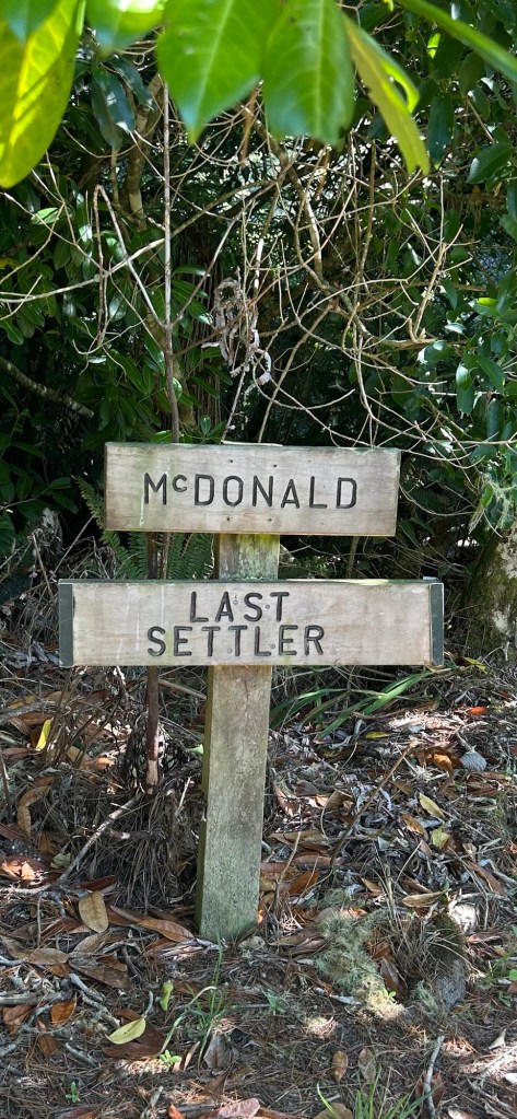
Lest we forget, however, the people who used this river to eke out a life with their families and friends in the Western Mangapurua Valley.
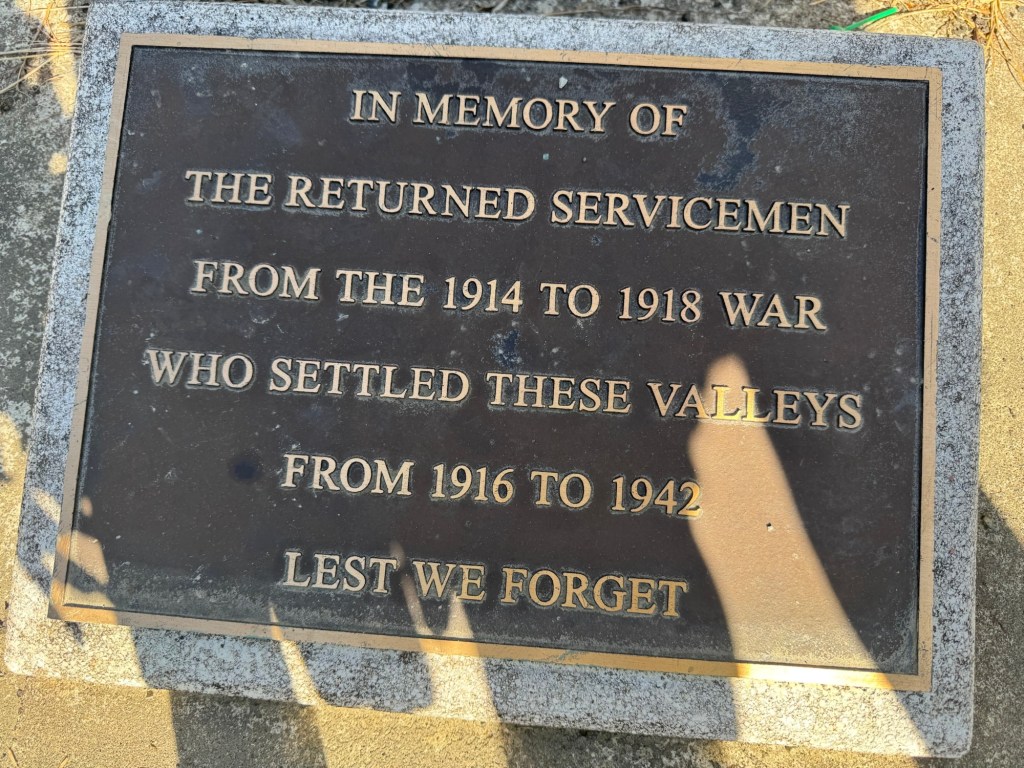
Post WWI, the New Zealand government granted returning servicemen large tracts of land to be settled. Many chose to do so on the promise a bridge would be built to improve access to roads and the Whanganui River as this area was remote and largely inaccessible.
The government did indeed build a bridge – and a rather sturdy one that would accommodate needed supplies to the early settlers.
The bridge, now named Bridge to Nowhere, never served its purpose, since settlers eventually abandoned their dreams and left the valley due to forces of nature.
As I rode through the valley seeing only chimneys that remained, old signposts of plots and evidence of clearing in the midst of thick forests, I was thinking of those who lived here, died here, were born here. What might their live have been like putting all they had into making their homestead work. And at what point did they decide they couldn’t anymore after all they had invested? Many still suffered shell shock (now called PTSD) from WWI and when the left, they left everything behind and pretty much penniless.
Lots to think about as we peddled up the hills and through the valleys of abandoned dreams.
Ok long post – but the video is pretty cool today. Click on the image below to view.

That may sum up one of the constant and nagging questions in my mind from exploring old western ghost towns. Just what was life like for them, how did the do all the necessities of life, and most burning question – why? Love your writing style and photos.
LikeLiked by 1 person
Just incredible what the human spirit can withstand. Thanks for taking an interest. 😊
LikeLike
Welcome to “the danger zone”. Glad you both survived it. Loved seeing the servicemen photos and reading about the Bridge to Nowhere (more used now than when it was built). Thanks for the tour!
LikeLiked by 1 person