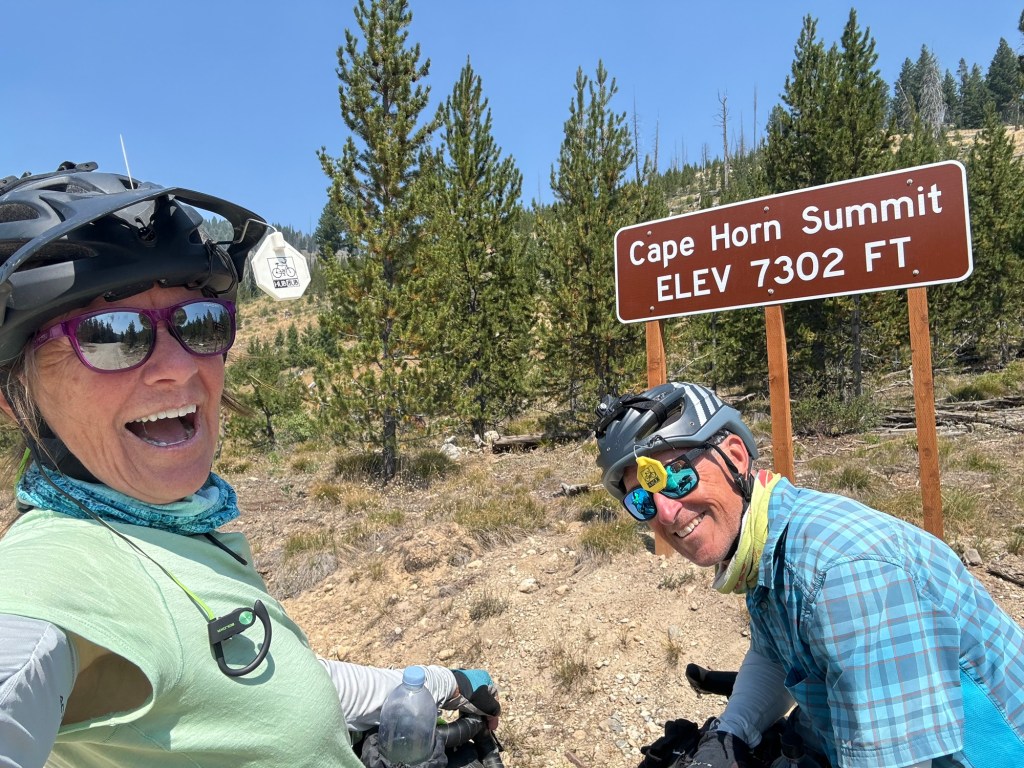
Today, finally, I think I got my “air” back and got acclimated to higher elevation and boy did it feel good to feel zippy again!
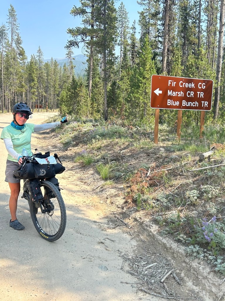
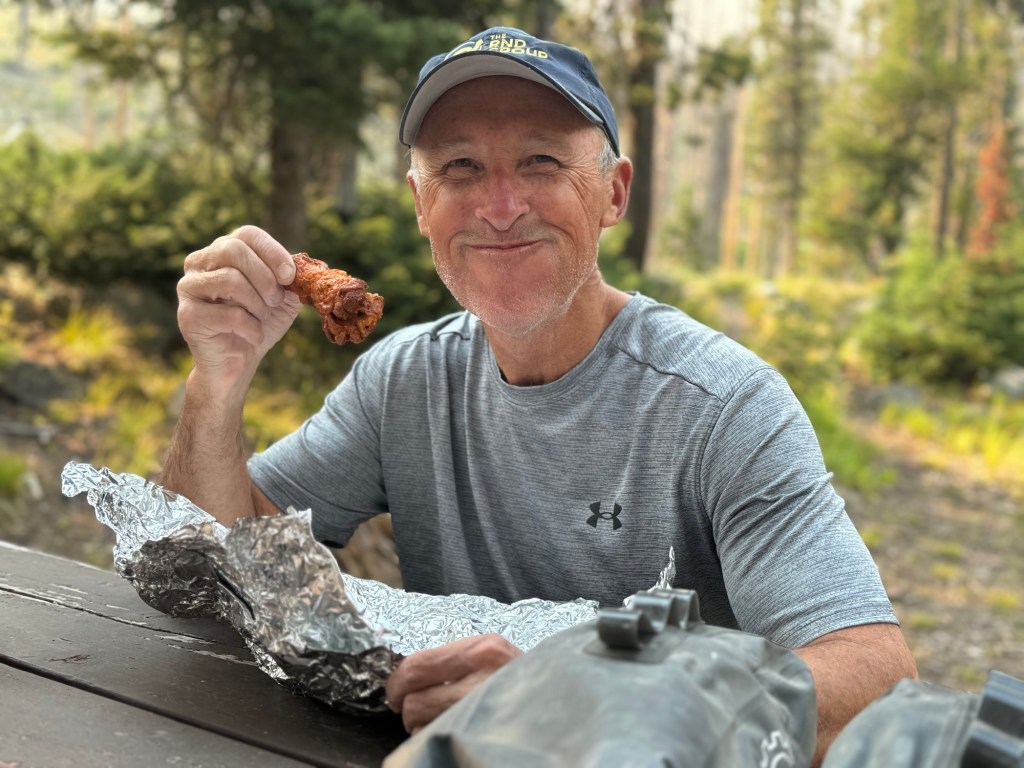
We left Stanley unfortunately without leftover pizza in our bags but instead, leftover Buff Chick Wings which aren’t a bad sub, and had Fir Creek Campground as a tentative stopping place for the day.
Since we hit Fir Creek early about 3pm we decided to push on to Deer Flat Campground.
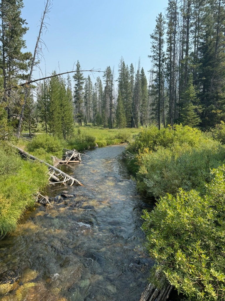
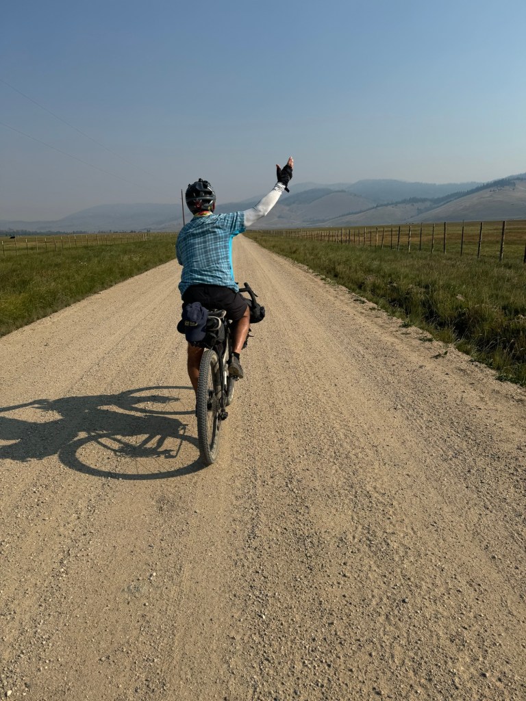
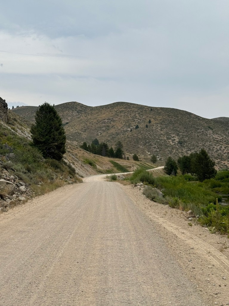
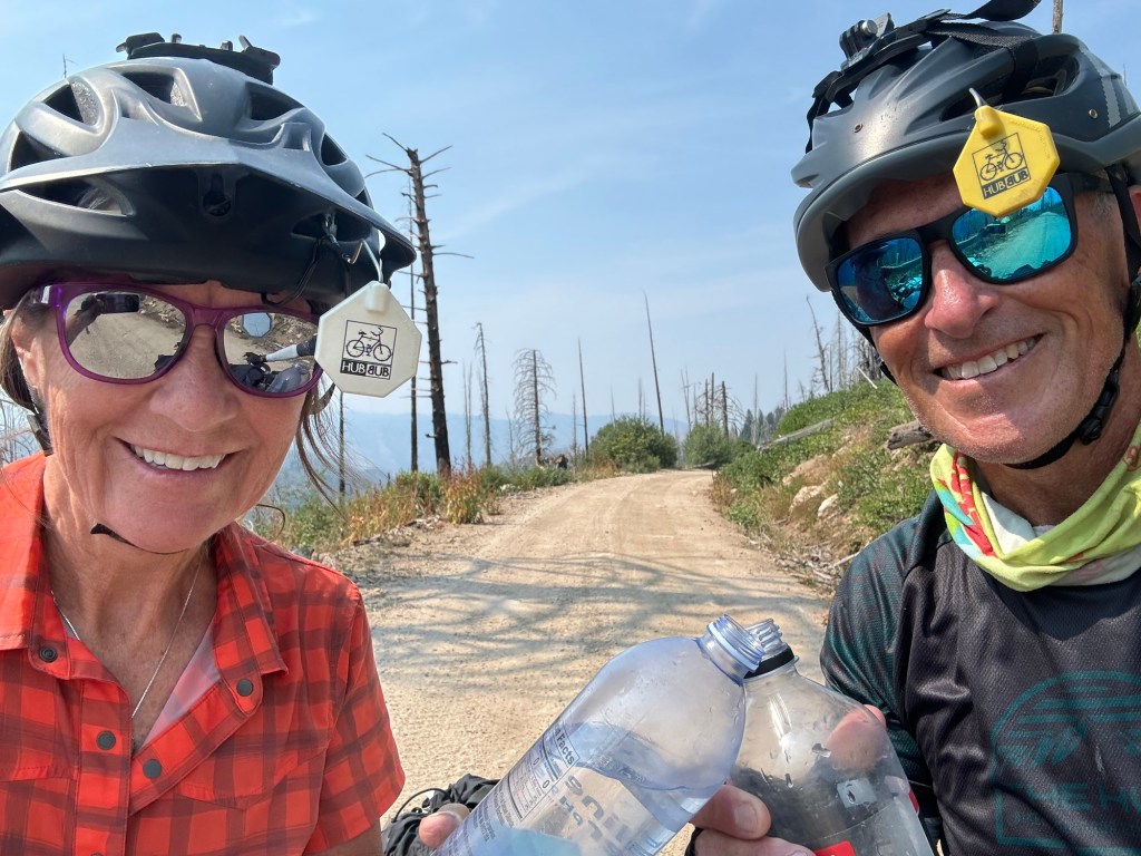
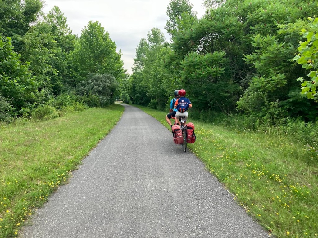
Again, the scenery dazzles us. Over most every rise and around every corner we stop to admire it.
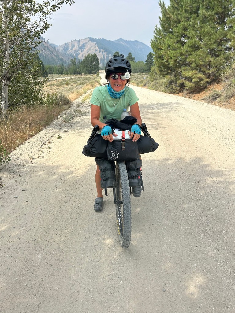
However, the road surface on the climbs and descents between Stanley and McCall (our next town) is horrendous with a lot of washboarding, deep sand with a few ratchet rocks and ruts to maneuver around. This makes for much slower going on a bike. We crawl up climbs and have to slowly descend down the other side being careful to keep the bikes upright.
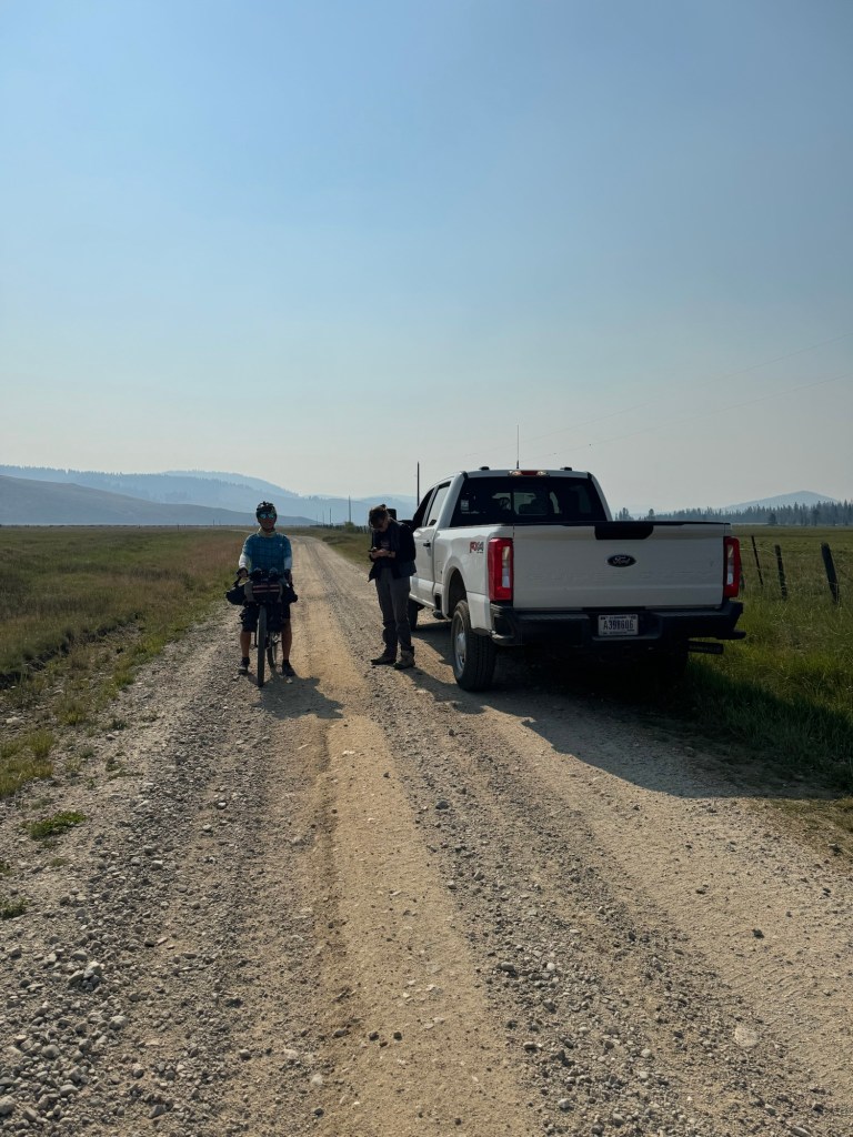
About 15 miles in we stopped to chat with National Forest Service (NSF) Ranger Kayla, hoping we could get an update on wildfires as smoke is still visible.
She didn’t have any answers for us on that question but was eager to answer others we had, you know since we are “Googleless” out here. Plus, she’s from Seymour, Indiana and you know midwesterners… we like to help and chat it up.
She’s on Range Duty and part of her job is to ensure fencing and other conditions are ready for open grazing.
She said the area we are in is known as the Stanley Basin and water is abundant. When I mentioned we haven’t seen as much wildlife as we expected, not only here in the Boise National Forest but also in the Sawtooth, she said that animals seem to migrate away when the seasonal people come. In the off season more deer, pronghorn, elk and even wolverine can be seen. There is even a lone wolf that likes to patrol the area.
In the winter, snow is deep and easily covers the fence line and the area is easily accessible by snowmobile. Visualizing winter, it must be a wonderland.
We did see more pronghorn, some deer, pairs of sand hill cranes and Kayla wasn’t wrong about water in the Stanley Basin.
One of these days I’m going to make a list of all the things I would need to learn if I ever solo bike packed. Not only does Tom do his share of “camp chores” he keeps the bikes field serviced, takes the lead on navigation and so many other things that I don’t take for granted. Plus he carries the leftovers on his bike.
Looking forward to more jaw dropping scenery… ratchet road surface… well maybe not so much.😂
Click on the image below to view more pics and vids:
Ya just can’t beat waking up in a tent on a clear morning in the mountains.
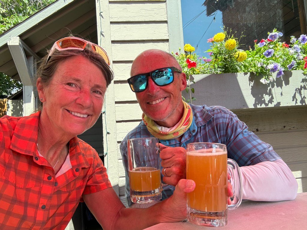
We’re headed to Stanley today for, from what we’ve heard, pizza worth peddling for.
One of the best parts of bike tours is meeting fellow riders on the road, chatting it up with locals and also hearing from people we may never even have met who have read our blog.
Cycling really does bring people together. We have no idea who they are going to vote for, where they sit in a pew on Sunday (or if they sit at all) or what their fave pizza toppings are. We share a common thread of curiosity and a love and respect for each other and the outdoors.
Such was the case when we met Rhonda, John and Mark at the top of a climb. We could have chatted with them all day and it was they who suggested pizza in Stanley. True to their word, it was amazing. We got their contact info too and will take our bear sprays, extra fuel and bug juice when we get back to Boise.
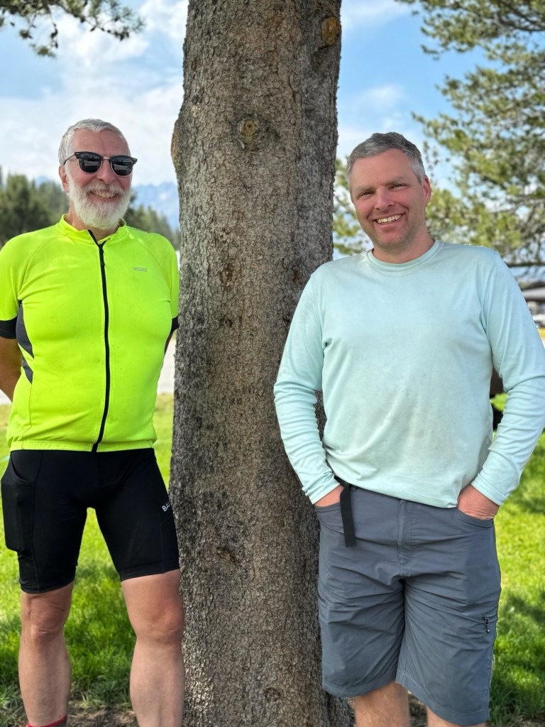
We said goodbye to Karl and Brian today in Stanley. They finished their bike tour a day early and weren’t going to use their hotel room so they let us use it! So long friends… until next time.
And not only do the comments on social media and the blog encourage us, hearing from new people that have route suggestions, questions or are inspired in some way, touch us in a special way.
We are SO very grateful for ALL of this, even the tough parts, because we know we are lucky to live the gift of life.
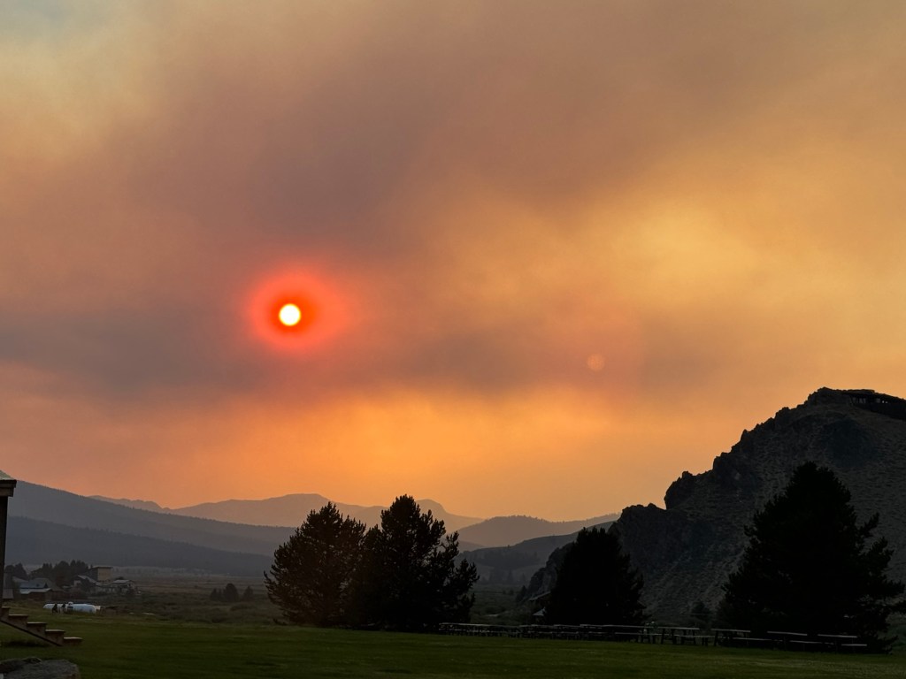
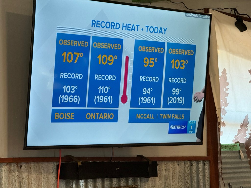
Wildfire smoke continues to move with the wind and there are several fires burning up here in Idaho. Yesterday the wind blew in smoke to Stanley. When we rolled in, it was clear and by the time we finished hot wings and a salad for dinner the mountains were obscured by smoke.
Next “city” stop is McCall and about three days away. Stay away smoke!
Click on the image below to view more pics and vids:
Our route out of Ketchum took us north as we will ride into Stanley on Tuesday.
Harriman Trail, a very well maintained double track with spectacular views of the Boulder Mountains on the right took us to Galena Lodge and on the way we met four cyclists brand new to bikepacking having just completed their first outing.
All agreed next time they will pack even less and figure out how to make their bike saddles play nice.
The tentative plan that Tom put together weeks ago for the Idaho Hot Springs ride (he’s an excellent planner) had us riding up and over Galena Summit and camping at Smiley Creek which was about the halfway point to Stanley, Idaho.
Galena summit is an 11 mile climb, however the grade is more gradual than Steel and Dollarhide Mountains. Still, we’d get up over 8,700 feet at the summit and the last four miles were going to be steep.
After a quick stop at Galena Lodge which is actually not much more than a restaurant and bike shop that serves hand dipped ice cream cones, we continued cycling up to the Galena summit.
So glad to have stopped for ice cream and water. We met 15 year old Edyn who just finished riding the Tour Divide this year in 1️⃣9️⃣ days which is so fast, especially with all the snow.
Today’s twist didn’t involve losing a sandal, meeting a snake or an unexpected eight mile (for me) Hike-A-Bike, but four miles of uphill rocky single track along a steep ridge.
Whew! Don’t look over the edge, keep my focus just ahead of me on the trail and pedal punch over the big rock clusters. When water features or bridges appear, get off the bike and walk them.
We sure didn’t expect singletrack on Galena’s Old Toll Road but here we were. I thought the Toll Roads were for road improvements. Someone’s not doing their job.😂
At the top of Galena we saw weather coming in quickly so we decided to take State Highway 75 down to Smiley Creek. The paved two lane highway with good line of site allowed for one of our most memorable descents as we could let it loose peddling downhill.
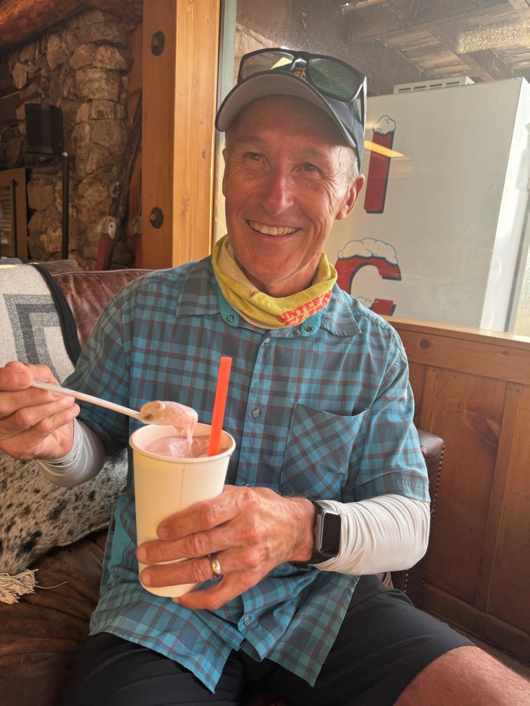
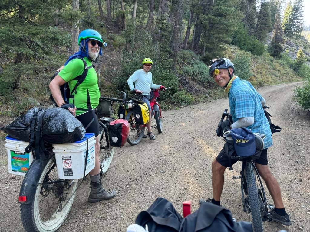
Drops began to fall as we came off the mountain but we were able to skirt around the storm and rolled into Smiley Creek where Brian and Karl (friends we met on Dollarhide Mountain) came out with smiles of their own to say hello.
Food tastes best to us when we’ve earned it and tonight was no different. The four of us, Brian, Karl, Tom and I ate dinner together and swapped bike stories after which Tom celebrated the day with a Huckleberry milkshake.
Click on the image below to view more pics and vids:
Another 8+ mile climb is the main course on the menu today with two appetizer one mile warm up climbs first.
Dollarhide Mountain is the same distance as two days ago up Steel Mountain but has one less percentage of climb. #whoopwhoop
We were a little smarter this time in that we planned the ride for early morning and took more water. Plus there was an early morning surprise rain shower that cleared the air (forcing us to quickly put our rain fly on at 5:30 am) , lowered the temps and settled the dust. We hoped all this set us up for better results.
After breakfast as we were packing up two bikepackers peddled past our campsite.
Brian and Karl, who we would meet later in the morning, got an early start as well.
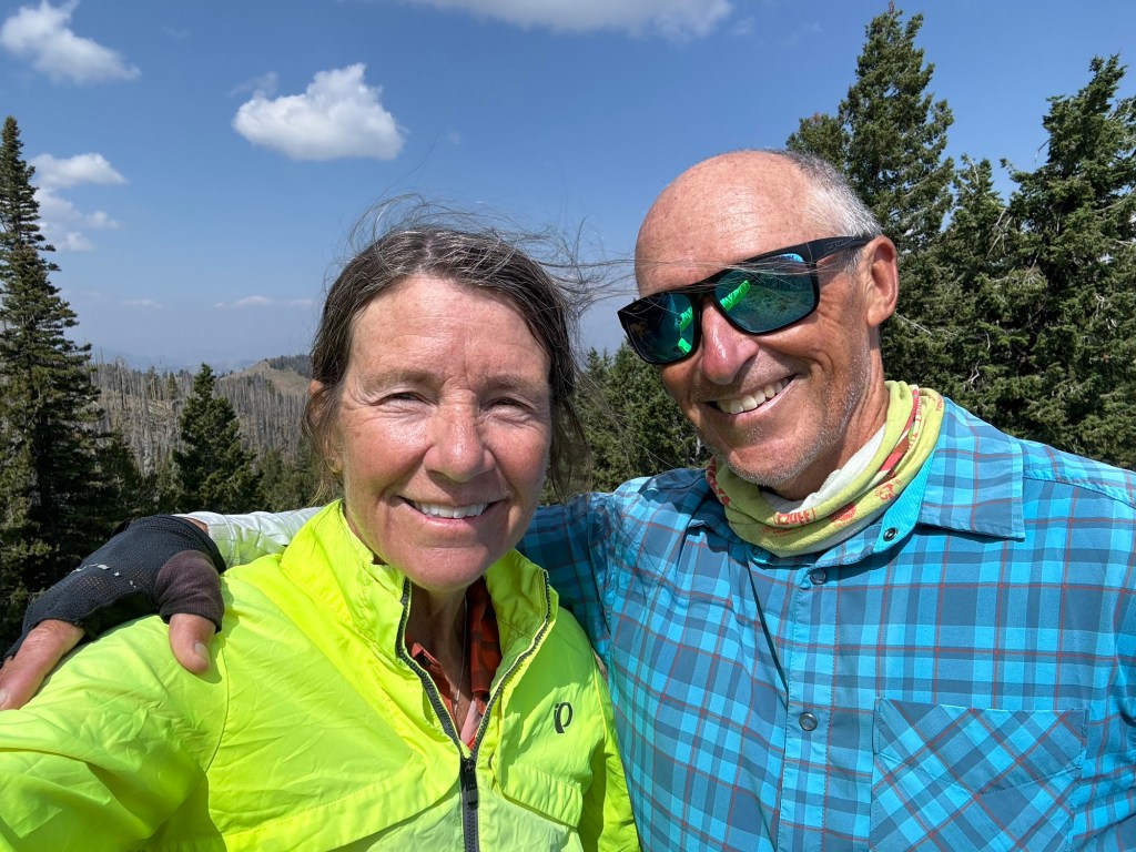
As Tom reached the summit before I, he had the chance to talk to a local who recommended two places in Ketchum we shouldn’t miss. Always listen to the locals.
Dollarhide Mountaintop
The ride down Dollarhide Mountain on dirt was as swift as it was picturesque as layers of mountain ranges came into view in the distance and colonnades of purple wildflowers waved to us as we flew by. Fast and spectacular!
We had a hotel stay in Ketchum to look forward to and that meant a hot shower and city food so yea we were motivated to get to Ketchum.
Grumpy’s for lunch and Sawtooth Brewery for dinner. Neither disappointed and either does beautiful Idaho.
We slept in until 7:30 am since we are planning a recovery ride of a just little over 40 miles and we have another big climb tomorrow. The gentleman who made us burgers last night at the Cafe promised us fresh coffee and breakfast burritos. So after “Pack and Pray” (well friends, our usual 100 pushups and 4 minute planks every morning are out the window on this tour), we went for some breaky and wifi to check on wildfire updates and weather.
We haven’t had any cell service or wifi since we left and that can be problematic. No internet. At all. No way to check weather, wildfire activity, check in on family, play Wordle or Connections, identify flowers or answer any one of about a hundred questions I have throughout the day, including “is that bear scat?” So when we can get connected we have a lot of catch up, including weather forecast. Nothing’s changed. It’s still hot out.
Back to the breakfast burritos. Eric, the cook, shared with us that he and his wife got married in the exact same spot we camped last night by the creek. It’s just that special.
He also let me try out his fly pistol. Eric’s pistol has a Co2 cartridge and some other supplies to go with. Aim, fire and the fly is obliterated. Once I got my finger on the actual trigger it was all good. Apparently I need to go to the firing range and learn now to find the trigger. Got ‘em! Another fly that won’t land on someone’s breakfast burrito.
Burritos were 💯 so back to the gravel roads for an easy spin through the mountains and hopefully a soak in Worsick hot spring later in the day near our planned camp spot.
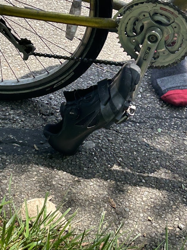
I said it was a recovery day and it was in more ways than one. About 10 miles in, I reached back to make sure my Chaco sandals were still rock-strapped to my seat bag and one was gone! Not. Good. At. All.
I quickly turned around wondering how far back I’d have to go. I knew it probably popped off as I was bombing down a hill over chunk rocks and bumpy washboard. Sure enough, 1.1 miles back my lone sandal was recovered. Whew! A recovery day in more ways than one.
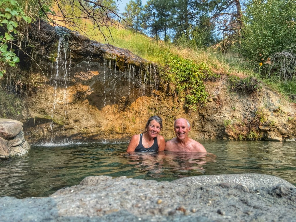
The plan was to lay up as close to the start of the eight mile climb up Dollarhide Mountain as possible. Worswick Hot Spring appeared to be the perfect destination, except we got there about 4pm, the sun was out and it was blazing hot.
Lunch stop at Smokey Bar Store
Nope! Not a day for hot springs. We then proceeded to cycle by Smokey Bar Creek but the water certainly wasn’t flowing Iike the Middle Fork of the Boise. When we finally found what might be a suitable spot somewhat close to water, there were so many cow pies left from open range cattle, the flies formed a welcoming party we REALLY didn’t want to join.
Without many choices left, (and without Eric’s fly pistol) we decided to pitch our tent and went strait to the water to rinse off and filter water. What does Tom see? A snake in the water. Really?
After throwing a rock in the water to encourage Mr. Snake to move along downstream, that snake stuck his head out of the water and looked right at Tom as if to say “Hey I was here before you”.
When I went back later to see if the coast was clear so we could cool off in the water, some sort of giant water mammal was swimming to shore toward our tent, maybe a muskrat, a beaver, a river otter? I have no idea because I have no cell service and I can’t check Google to find out. 😂
So instead of sitting in the hot spring, or a dip in cool creek water we took a two mile walk down the dusty road just to get away from the flies, the snake and muskrat thingy.
Ya just never know what you’ll find and recover on a bike tour. No matter what, there will be a story to tell and I guarantee it will get better every time you tell it.
Thanks for following along friends, family and neighbors.
Click on the image below to view more pics and vids:
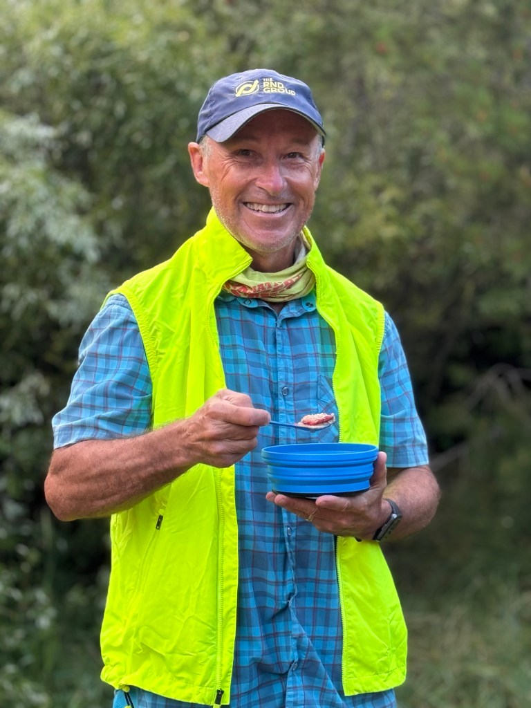
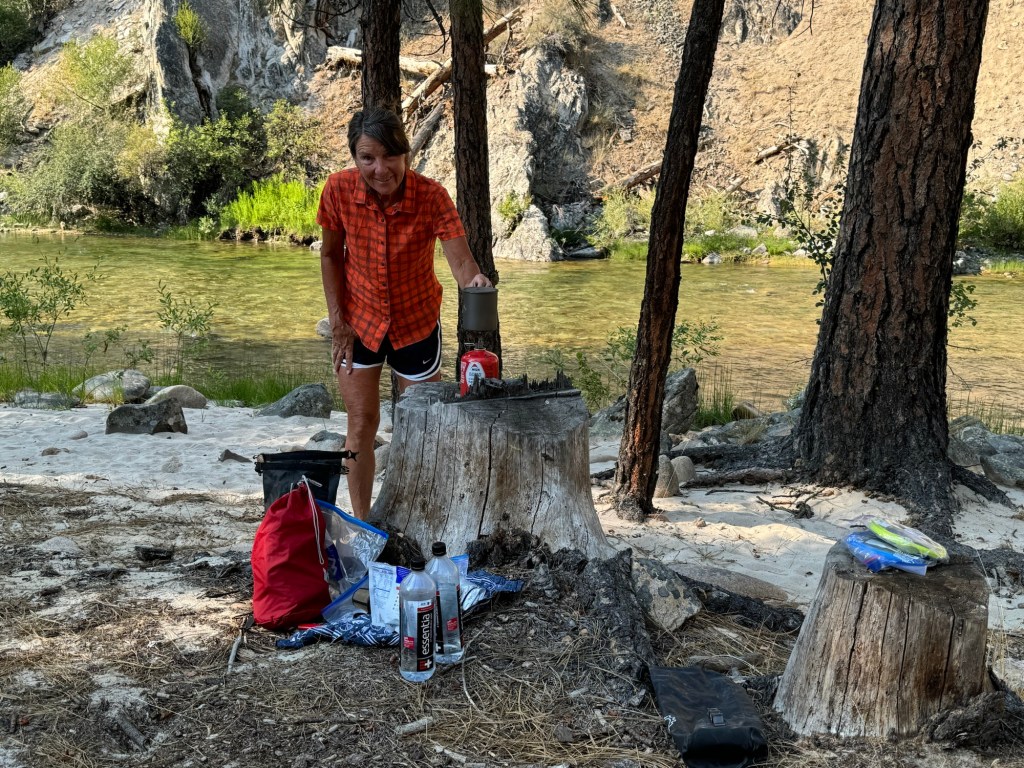
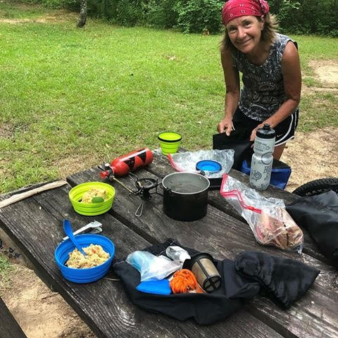
Day two started out with two coffees each and oatmeal with freeze dried strawberries.
Within two miles we hit our first hot spring: Loftus. We keep shorts handy at the top of our bags so we can quickly slip out of bike shorts and into quick dry shorts to wear in the spring. The hot water on a cool morning felt soooo good!
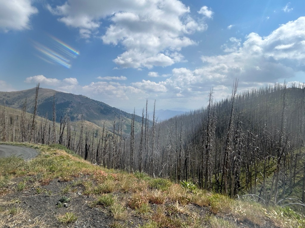
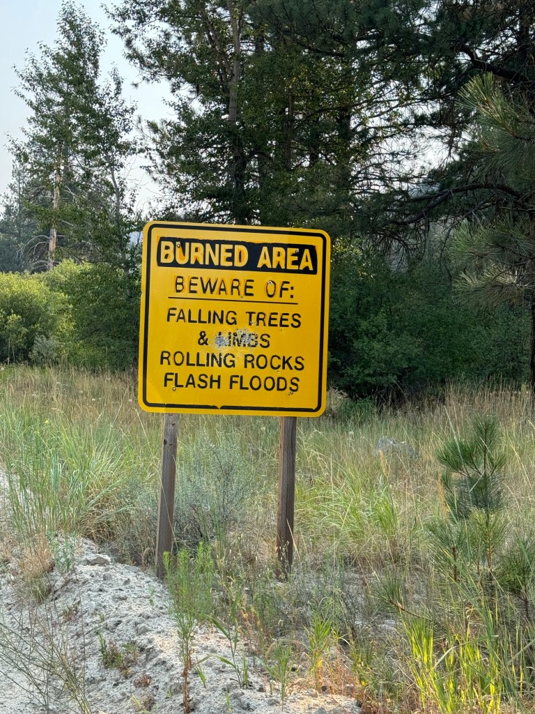
The scenery riding on Willow Creek Road along the middle fork of the Boise River continues to awe us although we’re beginning to see remnants of past forest fires.
The route had us turn right on Pfifer Creek Road for an eight mile climb and that’s when the party ended.
We rode Pfifer Creek Road up and over Steel Mountain Summit (elevation 7,150 feet) and it was about the biggest butt kicker of a climb we’ve experienced due to heat (upper 90’s and little shade), grade (8% average but also areas of 14%) and road surface (rocky, rutted and deep sand).
Tom didn’t have as much trouble as I but in addition to the heat and climb, my legs and lungs just weren’t getting the oxygen they needed to work. Maybe I’m not adjusted to altitude?
However, the Trinity Mountains were to the south and the Boise Mountains to the north so there was always something to look at while I hobbled up to the top.
Honestly I’ll bet I walked almost the entire eight miles pushing a 50 lb loaded bike up the mountain in the sun. Tom came back TWICE to help me push my bike up because about all I could do was take 25 steps, stop and rest and then 25 more. Sometimes only 10 steps. It was a pitiful experience.
I kept thinking about my friend Bonnie, my nephew Vince and my friends and neighbors undergoing treatment for cancer (all of whom I’ve been praying for) who would give anything to be out doing what they love to do and here I was squandering what I love to do. It was definitely a buzz kill for me.
About a mile from the top Tom found a waterfall with fresh cold water. We filtered four liters and continued peddling to the summit. After clinking plastic water bottles for cheers once we got to the top we immediately began the steep descent back down the other side.
Riding down Steel Mountain I spotted a black bear running up the hill to my right. Both times I’ve seen bears on back country rides I’ve heard them first. They are so noisy in the woods tromping on everything in their path. They certainly could take a few lessons on stealth in the woods from white tailed deer. On second thought. Maybe it’s better if they don’t. 👀
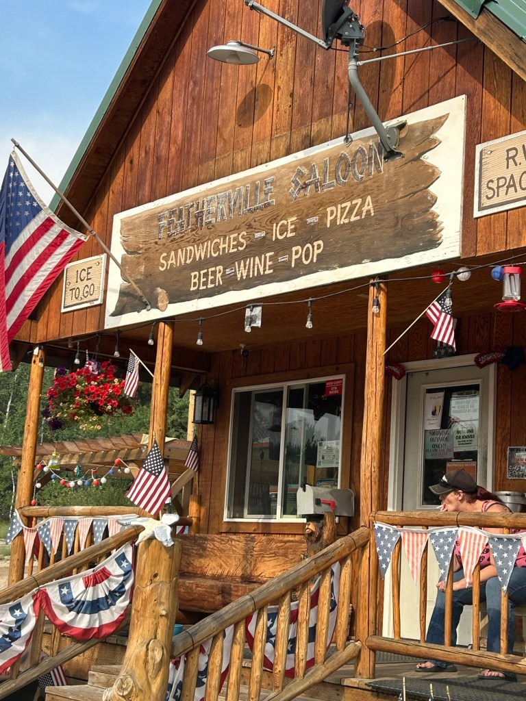
We made a right on Rocky Bar Road into Featherville onto the first stretch of pavement we’ve seen since we started.
It appears to be a rally point for ATVers and locals with a motel, saloon and cafe. We took in burgers and a beer but passed on the motel and instead chose a nice spot by the creek suggested by Pat, one of the locals.
Click on the image below to view more pics and vids:
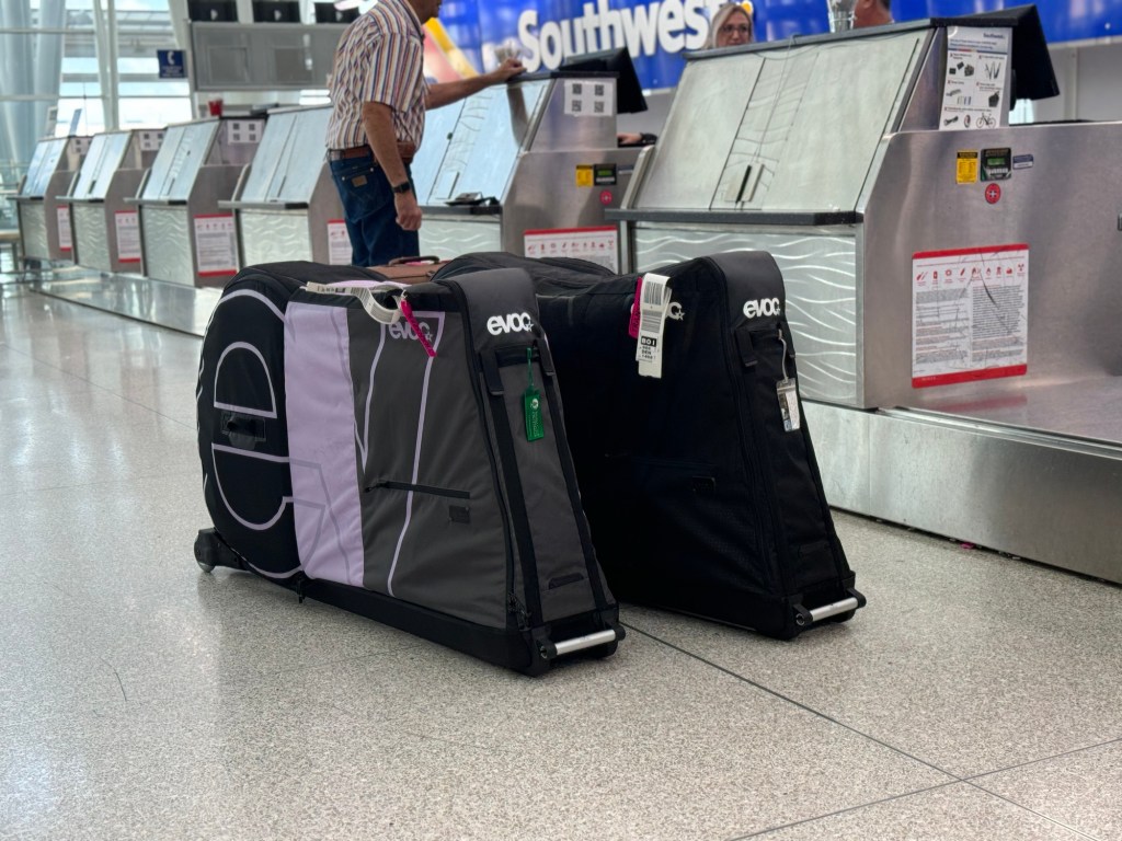
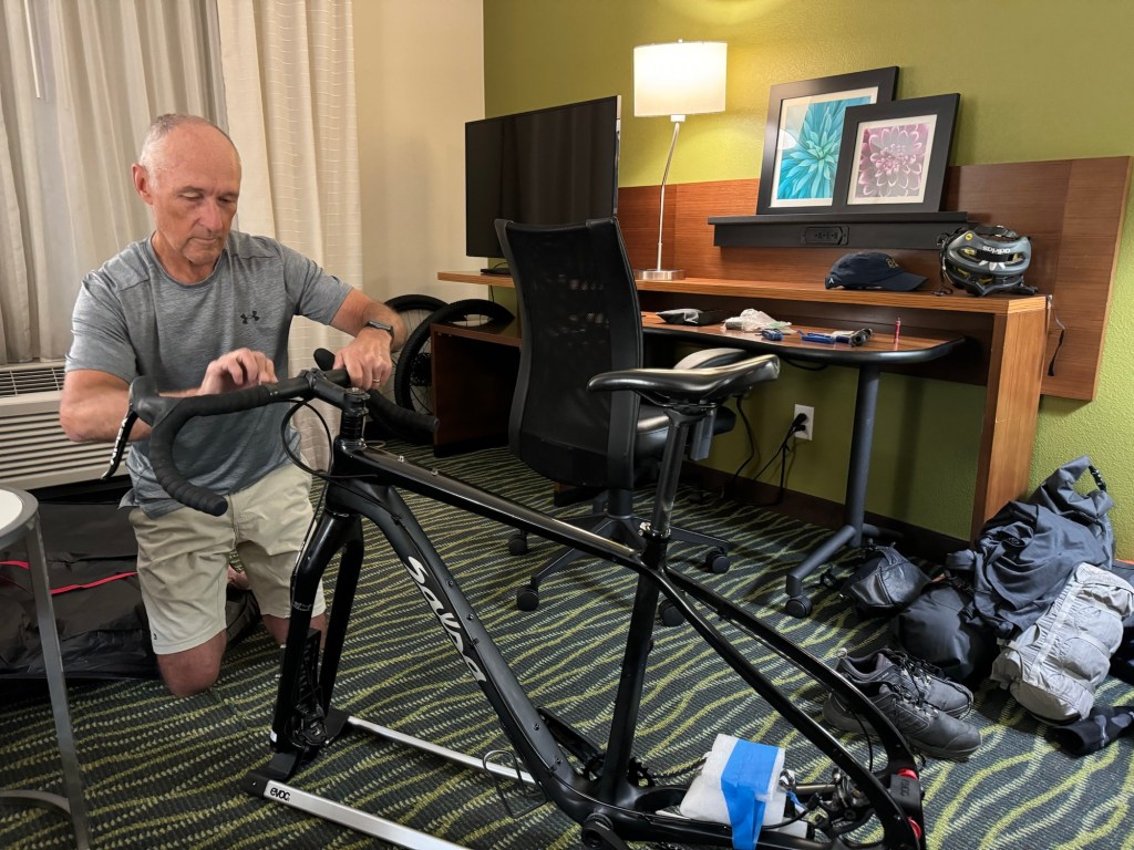
We started cycling from our hotel which was adjacent to the Boise airport – very convenient. The 32 mile Boise Spur begins at the airport and connects riders to the beginning of the Idaho Hot Spring (IHS) route.
Our hotel will store our bike boxes until we get back when we will again check them as baggage when we fly back to Indy. This is the first time we’ve used bike boxes and a trial run for future tours.
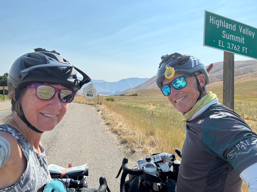
We kicked off the ride with a “well hello legs” four mile climb. It was on pavement and gradual so no biggie. At the top of the Highland Valley Summit there’s a little store and the tag line is “it’s all downhill from here.” Made me laugh.😂
We followed along Lucky Peak Reservoir and were treated to stunning views.
At 23 miles the route becomes dirt and the Boise Spur ends at the junction of Middle Fork Road and Cottonwood Canyon where we began following the Middle Fork of the Boise River.
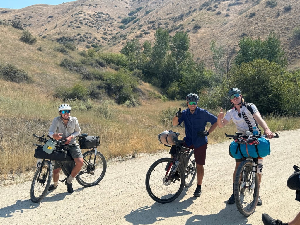
As we were wrapping up the Boise Spur we met Andrew, Scott and Daniel who were just finishing the IHS loop and shared some helpful route intel. They looked worn, weathered and happy.
Middle Fork Road turned out to be a very exposed (little shade), washboardy and sandy road which made for very slow going. Plus apparently Boise is experiencing its third hottest summer on record. It’s a dry heat but whew it’s hot!
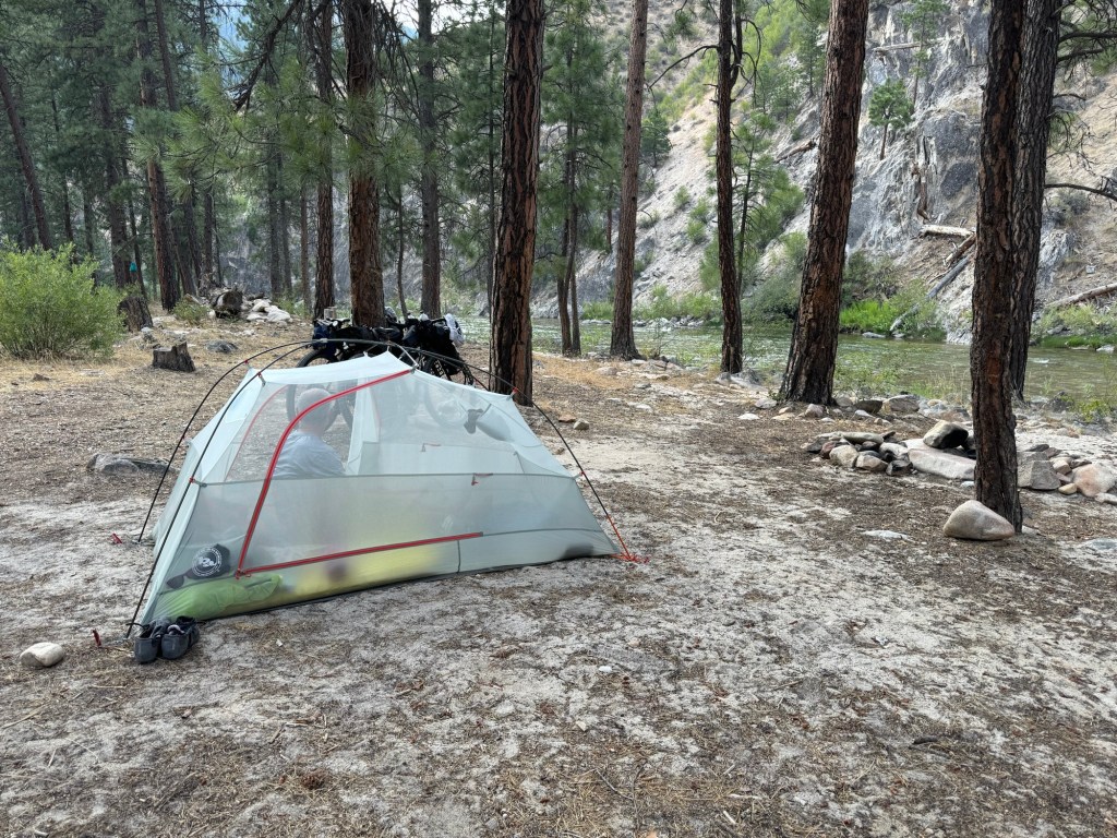
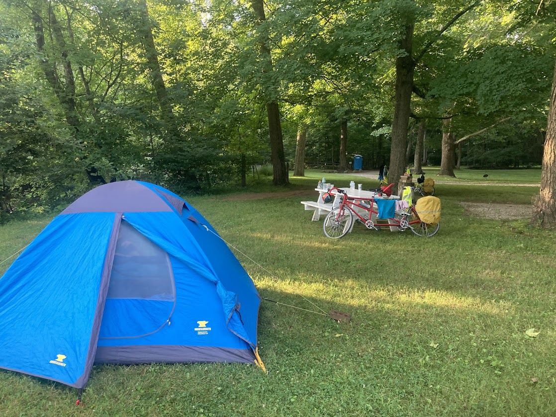
Around the 50 mile mark we started looking for a campsite. We’re on public land so we can “stop and plop” just about anywhere and camp (with some restrictions).
On our first night we were looking for shade, water access for cooking, filtering, maybe a quick dip and lastly, a tree to hang food to keep away from the bears. Mission accomplished.
We were sound asleep before dark and it was a no tent fly night. There’s nothing like running river water, cool mountain air and a good day of cycling to get peaceful sleep.
Click on the image below to view more pics and vids:
Even before Bikecentenniel (now Adventure Cycling) completed the TransAmerica bike route, plans were already underway to create the iconic Northern Tier Route which happened to be the route we chose for our first cross country bike tour.
Adventure Cycling’s Maggie Slepian reached out to us and others to help celebrate its 40th birthday.
Our take on the NT route and how it compares to the Great Divide and Southern Tier can be found in the article below
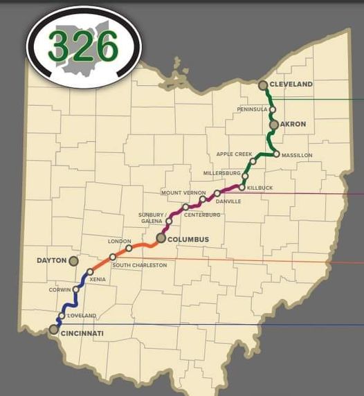
We call it the EtOH ride (more on why later), however most cyclists call it the OTET, or the Ohio to Erie Trail.
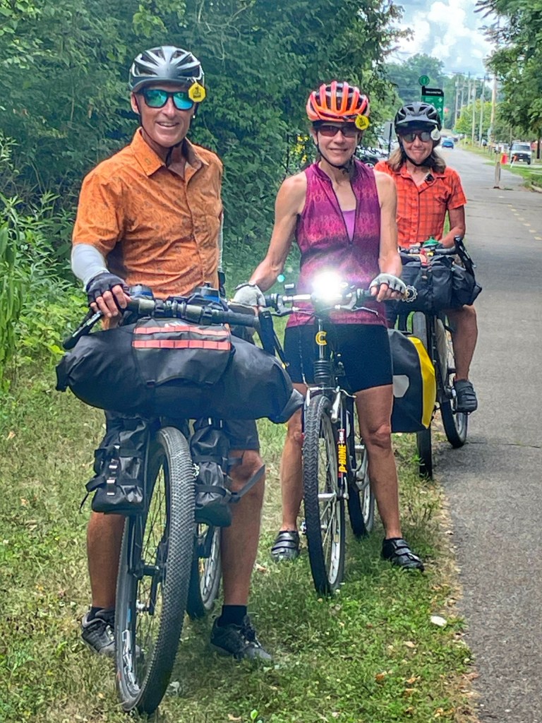
As is the case with any tour, ya just never know what a week or so of riding will bring you: fickle weather, new friends, new learnings, flat tires and other mechanical issues, etc. We knew one thing. Our good buds Dan and Christie were joining us for their first self supported, multi-day bike tour. What we didn’t know is what a gem the OTET is.
Although we haven’t tackled all of the rail trails the US has to offer, we’ve spent considerable time peddling on the C & O, GAP, Cowboy Trail, Mickelson Trail, Katy Trail, Flint Hills Trail, Prairie Spirit Trail, Tony Knowles Coastal Trail, the Swamp Rabbit Trail and our very own B & O, Cardinal Greenway and Monon Trails. Thinking back, why hadn’t we looked at the OTET?
The 326 mile trail is relatively flat with some easy rollers and knits together some of Ohio’s finest scenery and micro cultures (and microbreweries). Easy to navigate using digital maps, it’s peppered with small towns and includes four major cities. It’s rarely busy and when fellow trail users are encountered, they appear friendly, helpful and curious.
Although we chose inside stays on this tour, there are ample places to camp. The OTET website has just about everything you need to set you up for success including digital maps for north and southbound tours, suggested trip itineraries, updated info on trail detours, places to stay and side trips (and there are many). Just add determination, quads and a bike to make it happen.
‘Nuff said about the OTET. Put it on your bucket bike ride list. :) Now back to Dan and Christie’s first self supported bike tour.
Noobies
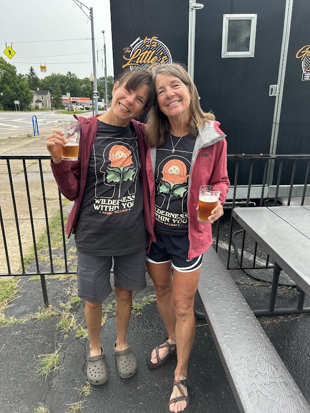
I’m not sure when Dan, Christie, Tom and I came up with the idea of riding the OTET but we all agreed we wanted to cycle it together. Having met as volunteers with Back on My Feet years ago, we’ve been “shenanigating” with them ever since.
Regarding the physical fitness preparation for the ride, both regularly exercise so they had a solid foundation. Prior to the ride, they gradually scaled up their long rides with weight in their rear panniers and completed two longish (50+ mile) rides.
Dan and Tom planned the logistics of how to get the bikes up to Cleveland, where to stay, eat and score beer Bingos along the trail using OTET’s interactive trail resources. Christie and I pretty much let them have at it, however we all agree that the amount of planning and preparation for a bike tour, especially when new to a multi-day outing, reduces the possibility for unexpected events.
Dan and Christie used our packing list as a starting point to make their own. When asked what they brought on tour but could have left home, both said one or two t-shirts. Otherwise, they used everything they packed. Christie would have brought a bandana and different socks as the socks she brought didn’t dry quickly enough. Since we only bring two cycling shirts and shorts, laundry is done each night in the sink and hung to dry.
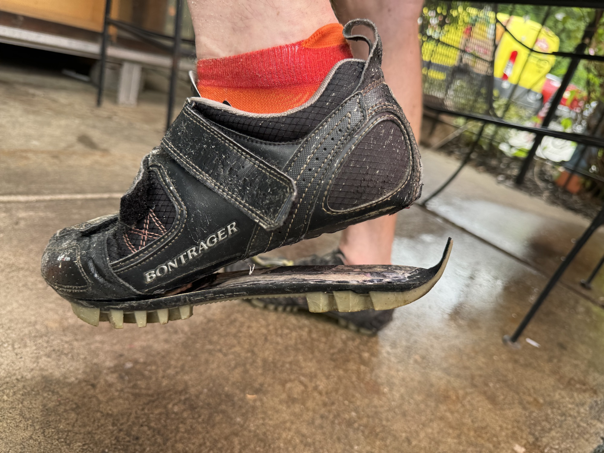
These two were up and at ’em very early everyday, sometimes ready before us and we’re early birds. Their advice to others wanting to try a multi-day, self supported bike tour is to plan, jump in and then be unafraid! Something unexpected will undoubtedly happen (as was the case when the soles of Dan’s cycling shoes fell off and another incident where his pedal cleat malfunctioned) but that’s the part of bike touring.
We become more resilient and even better problem solvers as we extend the boundaries of our comfort zone. Besides… this is America where almost anything is available and not farther than an Uber ride, a walk to a local store or an Amazon Prime order. As Christie says:
“After all, we’re making memories not just miles.”
Tom on the Trails
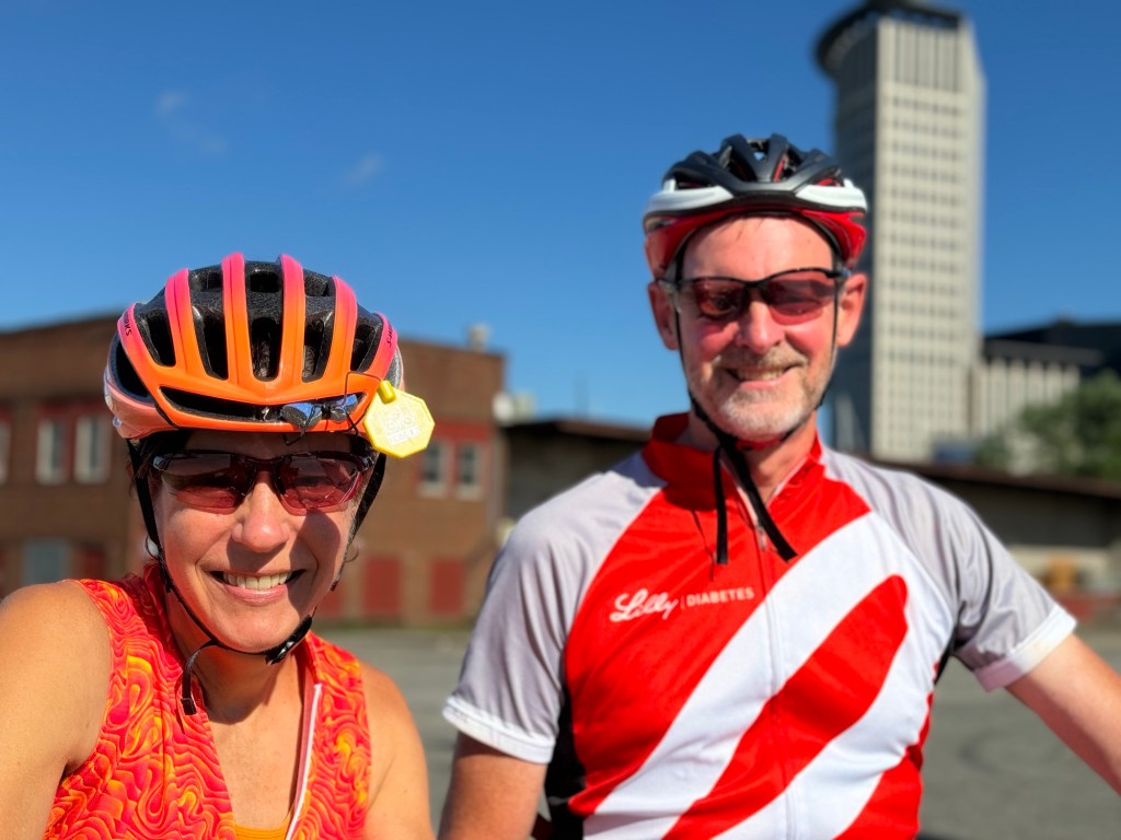
After checking into Trailside Lodging on the outskirts of Millersburg and feeling thirsty, Tom and I peddled into town and while locking bikes up, a man approached us and asked if we were riding the OTET. After a brief convo he asked if he could join us for bevvies and a chat. Turns out Tom Bilcze is the President of the Ohio to Erie Trail and was currently riding it northbound. #luckyus
Not only did we sense Tom’s love of cycling, he has a remarkable dedication to and understanding of the OTET. The two Tom’s and I agreed that cycling brings people together and provides a way to discover our communities and even our world, one pedal stroke at a time.
Although he’s a people person, he also likes to tour solo as he can meet people along his journey. He provided insights on OTET’s future growth and how the trail evolved. What a fascinating visit with Tom to get the behind-the-scenes workings of what it takes to maintain and expand the OTET. Unbeknownst to us, he also said there are quite a few organized OTET tours offered by Adventure Cycling and other companies and the number of trips are increasing every year.
Finally, Trail Tom shared that he posts to a “somewhat weekly” blog entitled “Tom on the Trails” where he shares more about cycling and the OTET. His pics are da bomb and if it doesn’t workout for him as a trail boss, he has a future as a palate tester on Diners, Drive-Ins and Dives because the man knows how to source tasty local trail fare. My only personal regret from our own southbound tour is that I didn’t get to Weaver’s Farm and Furniture to take a bite out of their Trail Bologna sammich. #nexttime
The “First Family” of the OTET
As we’ve always said, it’s the people we meet while on tour that is the true gift. We leapfrogged with a family of four from Brevard, NC who was also cycling southbound. Dad, Mom and two sons were riding tandems and camping along the way with a couple of indoor stays scheduled.
We were in awe of this young family not only for their ability to cycle the OTET but to do so and include their sons. We had multiple opportunities to interact with what we referred to as “our young family” and were especially charmed by their sons who were funny, articulate and polite.
Mom and Dad shared with us that they were able to complete a number of self-supported, multi-week tours before their sons were born and that it’s been a joy traveling with them on bikes, being outdoors, meeting other people and learning about places and connections to the world around them.
This week on the OTET was a continuation of their DC to Pittsburgh trek and their hope is to eventually link multiple trips and complete the Great American Rail Trail across the country.
And for this reason, I nominate this family to be elected as the “First Family” of the OTET, and maybe even the First Family of the yet to be completed Great American Rail Trail. Ride on, friends!
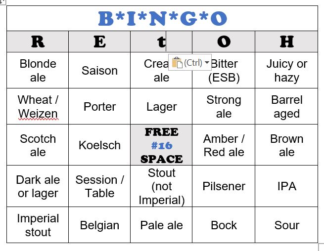
EtOH Bingo
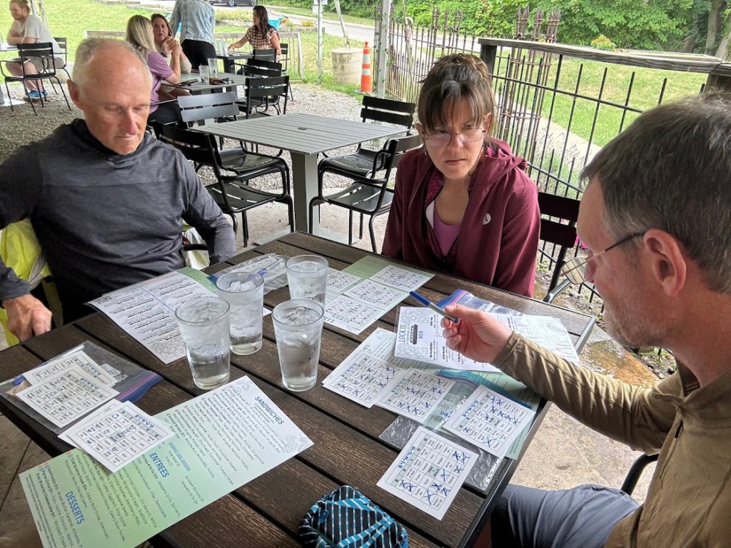
Last but not least… as requested by SO many, here’s the skinny on our Beer Bingo game. Since all four of us are craft beer lovers and believe local microbreweries are among the best places to meet locals and swap stories, we thought Beer Bingo might be an entertaining way to ensure we tasted a variety of craft beers and meet new friends.
Because we were not peddling from the Ohio River To Lake Erie Trail (OTET) northbound as many do, but instead southbound the initials would be EtOH or, Erie To OHio. Scientists that they are, Dan and Christie quickly recognized EtOH as the chemical compound for alcohol. Hence, the name of the game. The “R” in REtOH stands for “Ride”. Ride Erie to OHio which is exactly what we did.
It’s still up in the air about who actually thought about the Bingo game. I think Christie did. She thinks I did, but it doesn’t matter. We had ground rules at the beginning of the ride but made some up as we went along. I mean, why not?
Christie and Dan came up with 24 types of beer (note that there are 25 squares but the Free Space takes one block). Christie used Excel to randomize beer types on 16 different laminated cards, however all types of beer were represented on each card and we drew Bingo cards on the first day. Each of us had four cards and would keep these cards the remainder of the trip.
Each time we enjoyed a crafty (usually a small pour, I mean we aren’t lushes and we had cycling to do), we’d mark it off. At the end of the day, Bingos were declared and scored on a randomized name sheet. LOL we didn’t even figure out what the prizes would be. It was just fun to play.
During the last few days we decided that each one of us would keep a card and not erase it at the end of the day. This would be our “coverall” and scored at the end of the trip.
As we cycled south, Christie and I had fun fantasizing how this could be a retirement gig and fund future bike trips. For example, we could change up the bevvie offerings to create a wine-centric Bingo card, or an IPA-centric card. We could fashion a non-alcoholic card. And how fun would it be to collaborate with Trail Tom and create a card that included highlighted landmarks of the OTET (and Weaver’s Farm and Furniture definitely needs to be included.) How about EtOH swag including T-shirts, pins, socks and of course specially EtOH logo labeled markers and hand sani for marking and cleaning Bingo cards? And it could be replicated on other rail trails! All this of course was fodder for fun and nothing more, but can you imagine the extent of our convos and laughter?
Although our southbound ride is over we continue to be grateful for friendship, good health and the mission, volunteers and benefactors of the OTET. And whatever you call it, OTET or EtOH just call it an exceptionally nice ride.
To view more pics, videos and OTET info click on the image below:
We didn’t start out with a goal of riding bicycles in every state. As is the case for most of us, life experiences reveal opportunities and subsequently goals and the steps to accomplish them.
After we finished riding across the country on the Northern Tier route, we’d racked up 11 more states in addition to a few we already had in the bank. And COVID, although a limitation for many, provided time for us to spend time outdoors on bikes. Hence in February 2020, we made our state list and checked states off one by one in a variety of different ways.
Lucky for us (or maybe unlucky because we may not return) when we visited Alaska and Hawaii, we were able to get a couple rides in, even before riding a bike in every state was a thought.
In Anchorage to run a marathon and rode our first and ONLY tandem bike. Tom never coasts. He is always peddling.After running the Kauai Marathon we visited the Big Island. We arose at 3am to ride to an active volcano spewing lava.
After completing our 48th and 49th state on our very own Tour de N’Utah we started talking about Oregon and where we wanted to ride. We’d never experienced a fully supported bike tour together so our conversations included questions like:
What would the experience be like handing the reins over to people we’d never met to choose routes, mileage, departure times or make food choices?
What would it be like to finish a day of cycling and then meet other “strangers” for dinner and conversation every night? Whoa that’s a lot of talking.
What would it be like to ride road bikes again after essentially marrying our Salsa Cutthroats for life?
What would it be like finishing a ride with snacks and bevvies laid out and our clothing bags already safety stowed in our room instead of setting up a tent, using the “facilitrees” and cooking up a one pot meal over a camp stove?
Dinner is served along the Natchez Trace. June 2019
We’d seen Backroads vans and riders while on tour and commented how nice it must be to skip the tough parts with sketchy traffic patterns and road conditions. How nice it must be to cut off some of the elevation and most importantly, is it even a bike tour if someone else is schlepping clothing, gear and food in a van instead hauling it on our own bikes? Who could we trust to be responsible for navigation and finding/cooking meals? Would we be “cheating”? I mean we’d never done such a thing together. We rode the Tour d’Wyoming,MUP and TRIRI rides where some of that was taken care of but the Backroads tour seemed uber plushie and that just didn’t seem like us.
At the end of the day, we chose to return to Bend and Sisters and based on reviews, knew Backroads would be the best choice for us. As we talked about it, we were both comfortable with that decision and trusted that the people God brought to us that week would be people that would inspire us, teach us and entertain us. And we weren’t wrong.
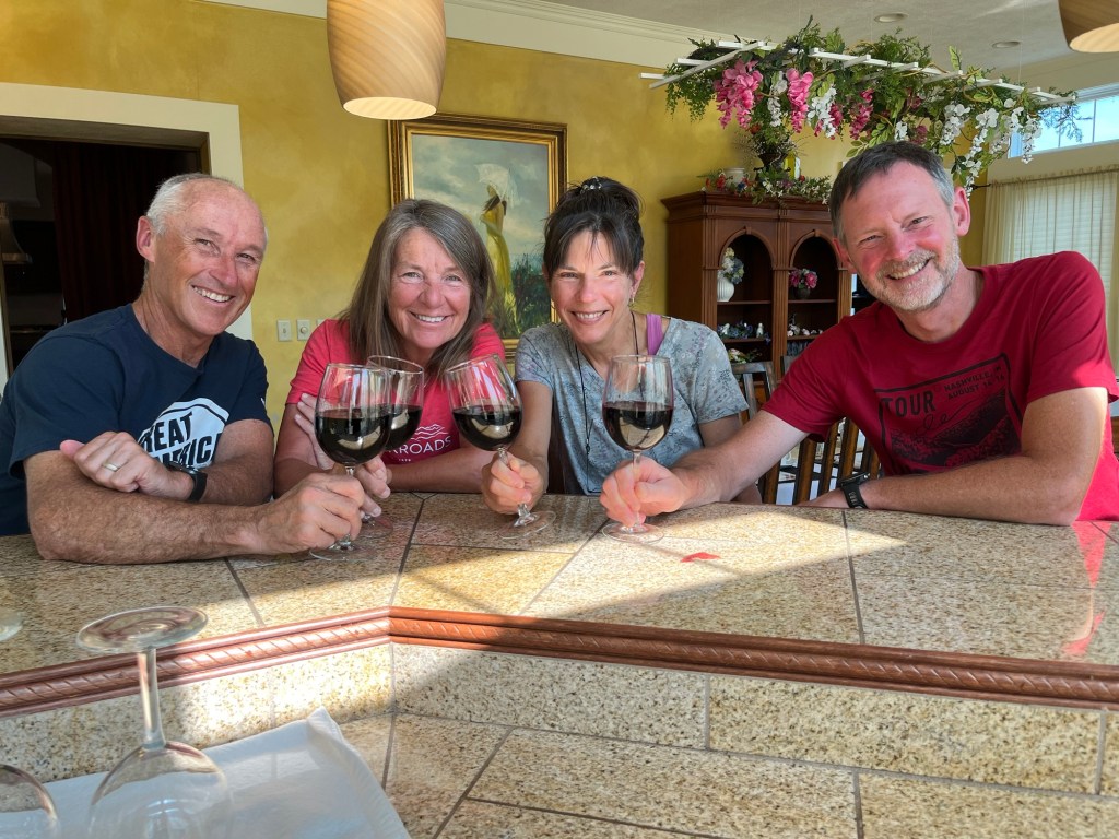
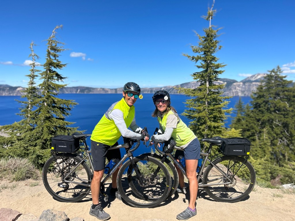
Our group of fourteen cyclists included us of course, three sisters, a couple with young children and a solo traveler, all from California. A couple from Iowa helped represent the Midwest, and two couples from Florida rounded out our group. The age range was mid-forties to seventy something. All were strangers on day one and parted as friends at the end.
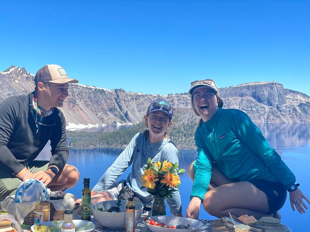
Backroads, or “Snack”Roads, as they are lovingly referred to, goes to great lengths to use locally sourced food to create carefully curated lunches that offer not only variety but taste. The tours at the Deschutes Brewery, Alpaca Country Estates and Rainshadow Organics were something that Tom and I would never stop and take time to visit if touring self supported. Most of the time we’re too tired.😂
At the end of the week, Tom and I agreed, we’d choose to end our Fifty State Chase again in exactly the same way. What a treat! Now that doesn’t mean we won’t do self supported bike tours in the future, but much to my surprise, I’m guessing another Backroads tour may be in our future, particularly an international destination.
Yes, the scenery is remarkable, the accommodations and food exemplary and the local side trips worth it, but our guides, Brandon, Lael and Leni make the magic happen. That’s all I have to say about that.
As far as costs, our six day bike tour in Central Oregon (plus the cost for airplane tickets, trip insurance and a hotel stay on both ends of the tour in Bend) cost about as much as our 65 day self supported bike tour in early 2023 when we cycled from San Diego to Key West. However, I wouldn’t trade either trip as both are as remarkable as they are unique.
Click on the image below to view more pics and vids: