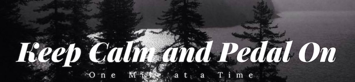
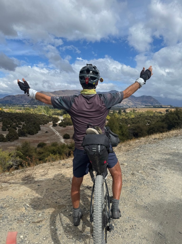
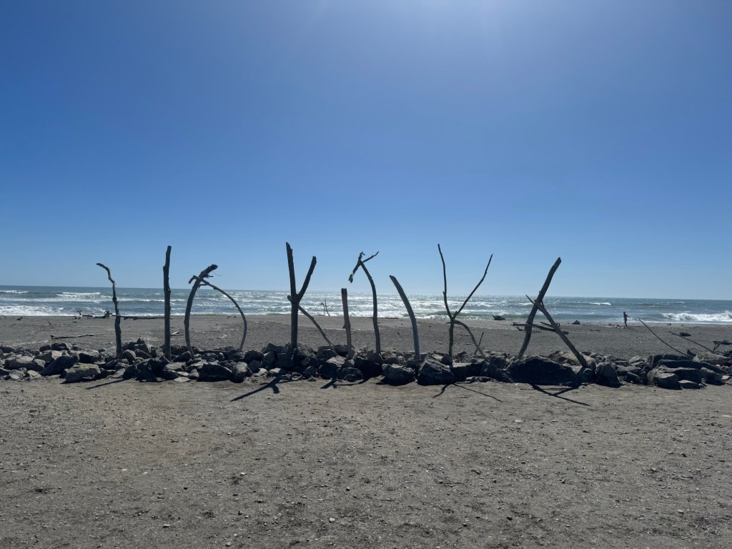
We weren’t planning on finishing today but a morning tailwind, sunshine and adrenaline pushed us to Bluff on the longest ride of the tour so far. And we wanted to do something big for our last day!
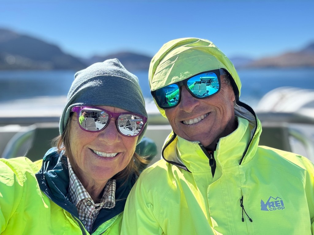
So here we are… in Bluff. The finish line of the Tour Aotearoa.
There will be more thoughts to share when we get home, but first Australia. And no bike riding, just hanging out.
Thank you everyone for your support, prayers and following our journey.
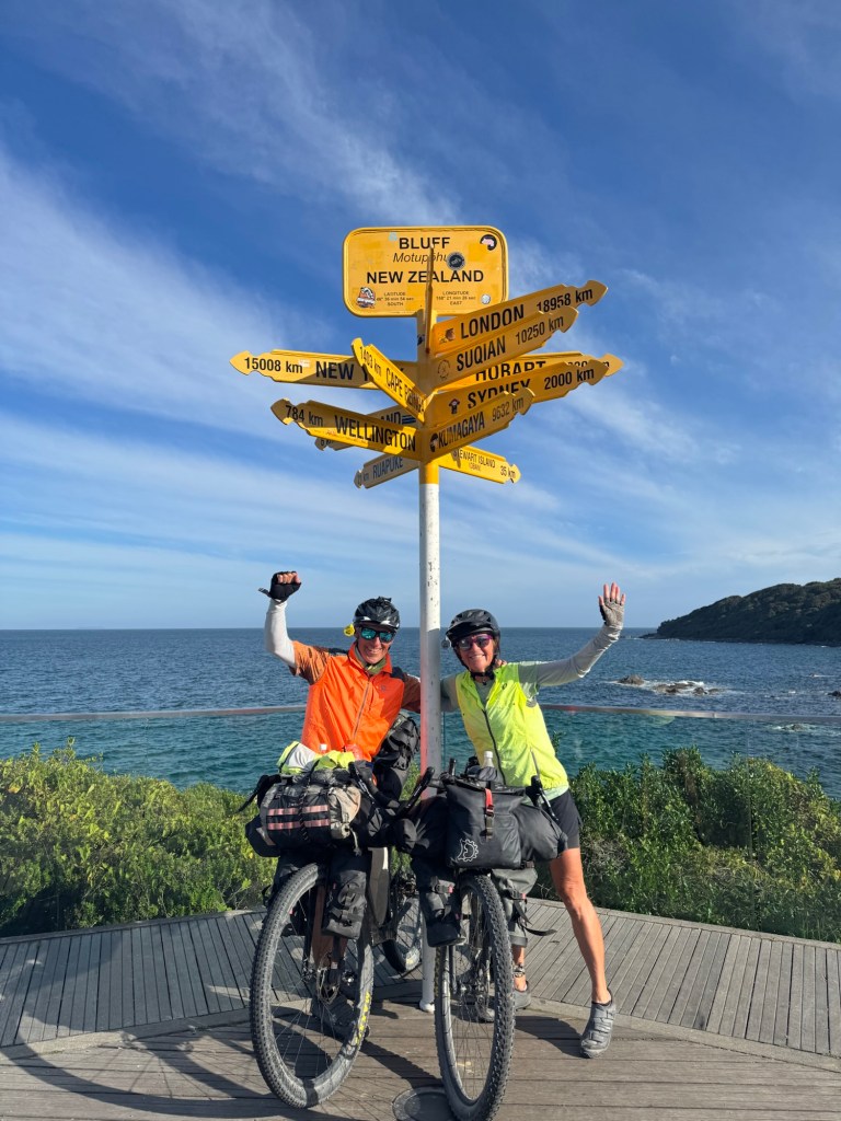
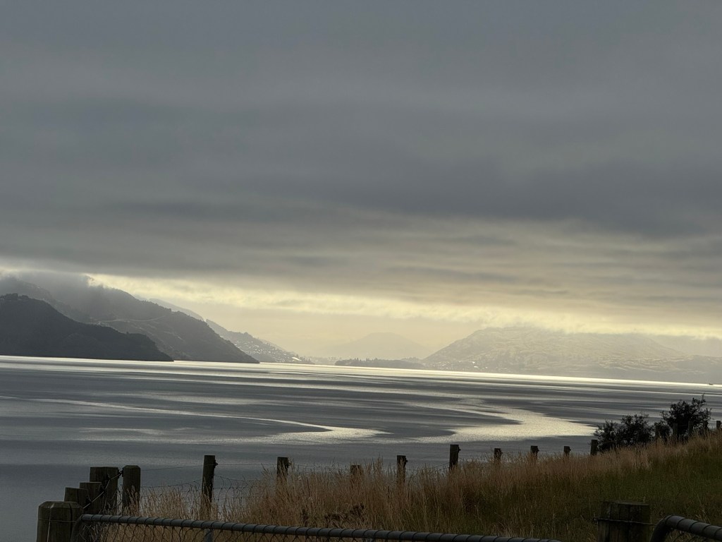
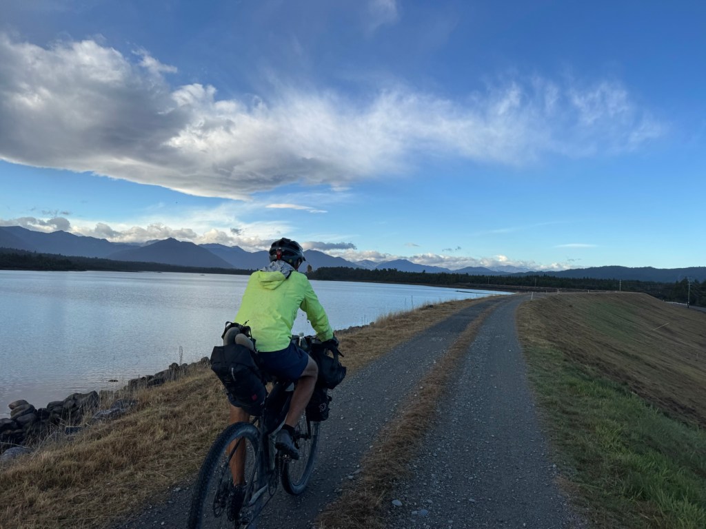
It was a spectacular day of all off road riding. We started the day with some breaky, with a view of the lake we crossed yesterday.
We saw the shimmering lights of Queenstown before we crawled in our tent and again when we awoke this morning (and I actually saw them three times during the night when I got up to visit the “facilitrees” during the night.) 🙄
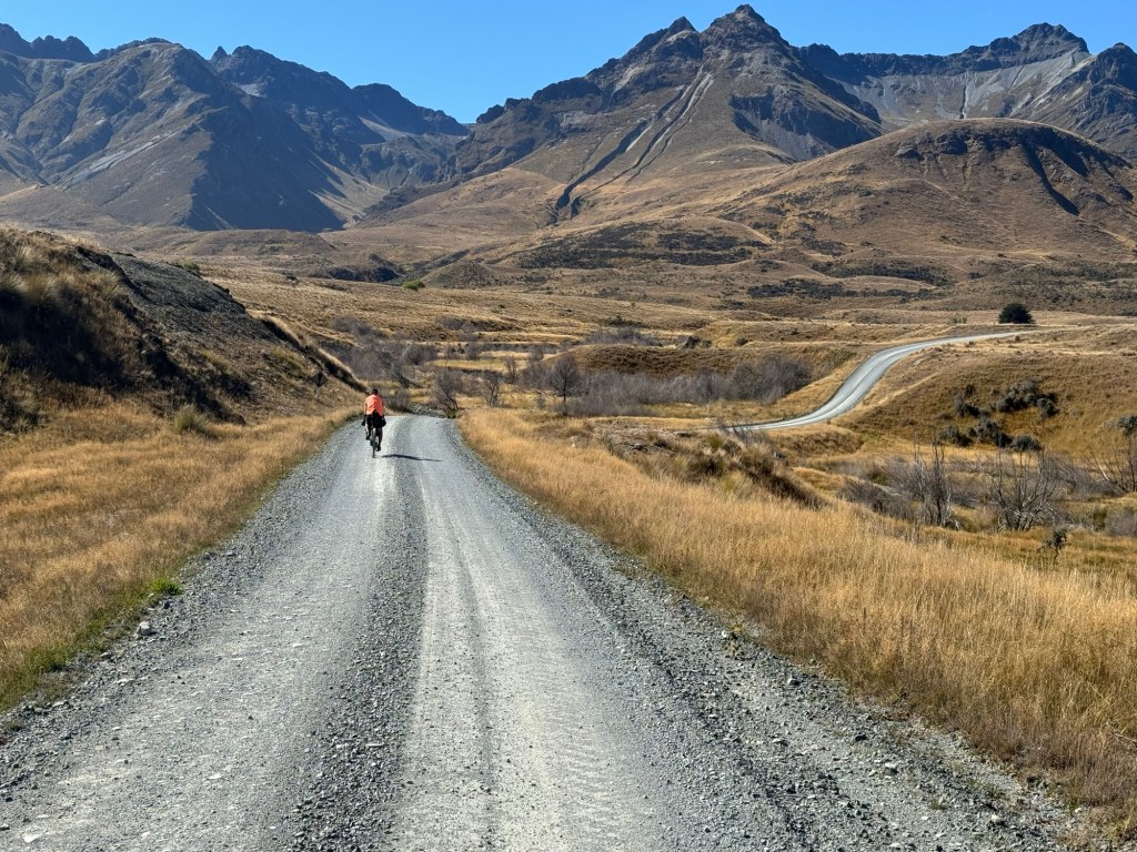
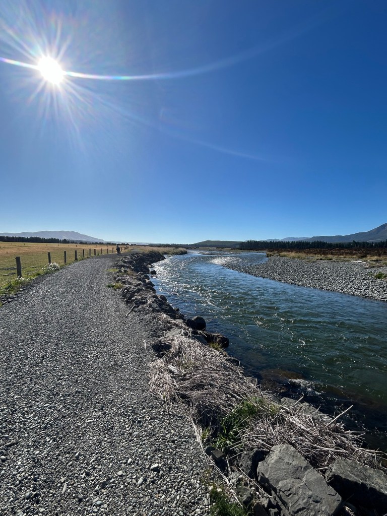
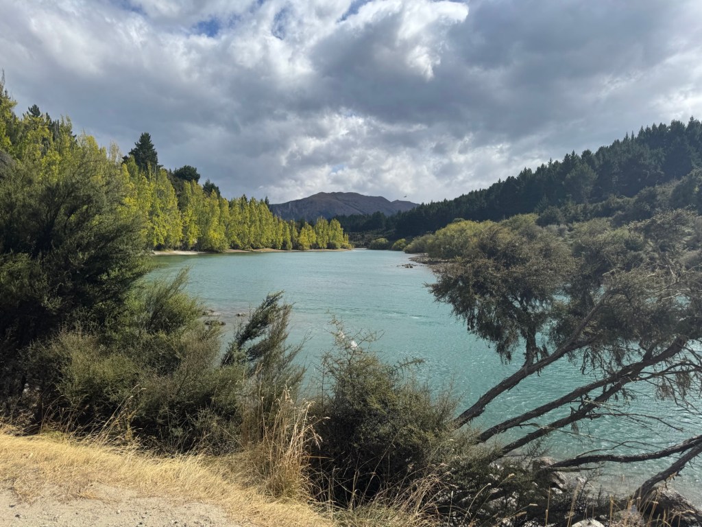
All. Day. Long. From the sheep stations in the high country to the open prairies in the middle of the day’s ride to the stream we followed 15 miles into Mossburn, all day we were awed by the southland’s beauty.
Just a couple pics here…
To view more, click on the image below to view today’s video.
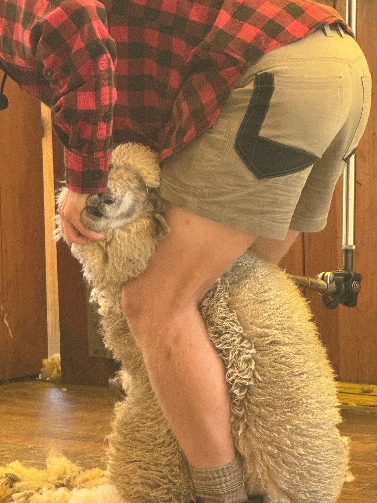
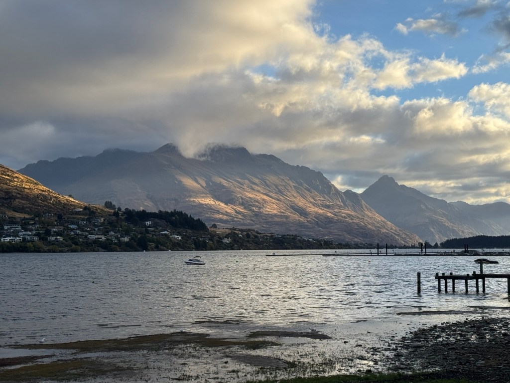
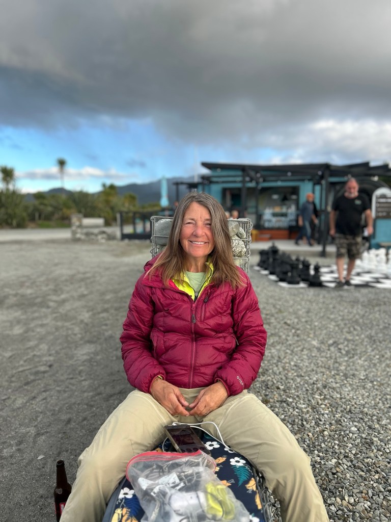
Yep that’s right! Just a five mile ride today for us today. We haven’t taken a day off since Wellington and decided to check the box “Farm Bar B Q” as an add on to our ferry ride across Lake Wakatipu to Walter Peak Station.
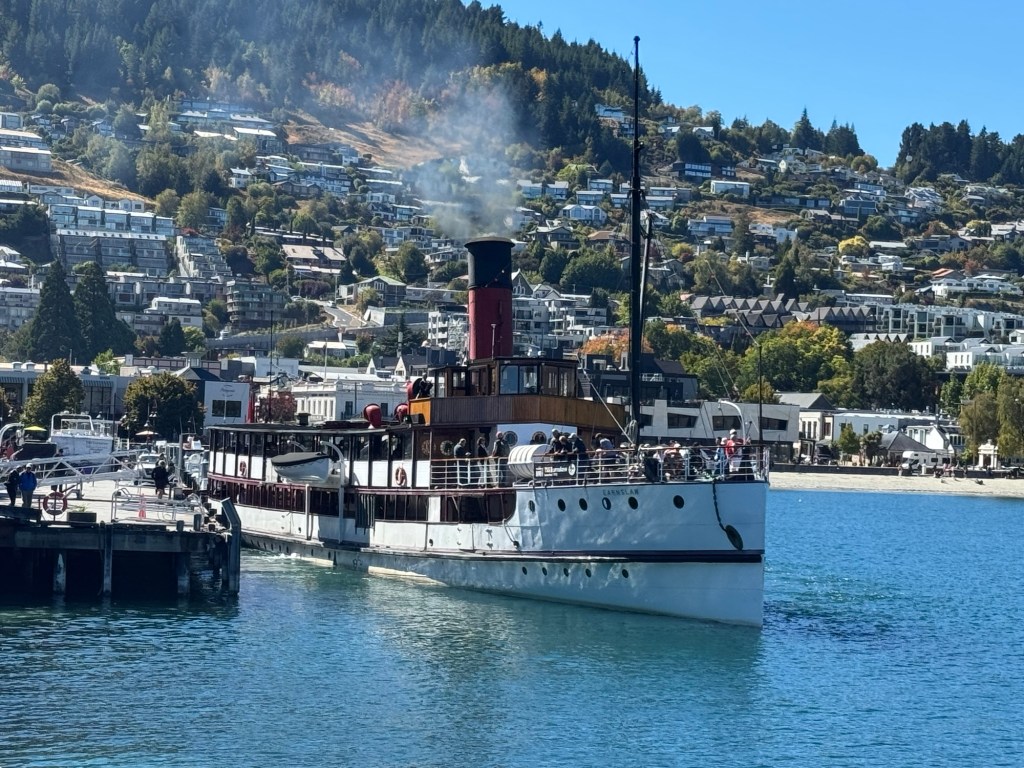
Before we left Queenstown however we had one last resupply at a Four Square and enjoyed a couple of flat whites while watching boats come in and out of the harbor. Pictured below is TSS Earnslaw, a coal fired steamer built in 1912 and still in commission.
Once aboard the Spirit of Queenstown, we took in all the sites of our fifth and final water crossing of the trip. Dang our first ferry out of Pouto Point seems like forever ago.
Our destination today, Walter Peak Station, in its heyday spanned over 170,000 acres, grazed 40,000 sheep and employed over 50 people.
Today, however the station is split in half between two parts: a high country working farm with 20,000 sheep spread over more than 61,000 acres and a second area that includes the original homestead and focused on tourism. And that’s where the we enjoyed the most delicious all-you-can-eat bar b q and learned more about sheep shearing.
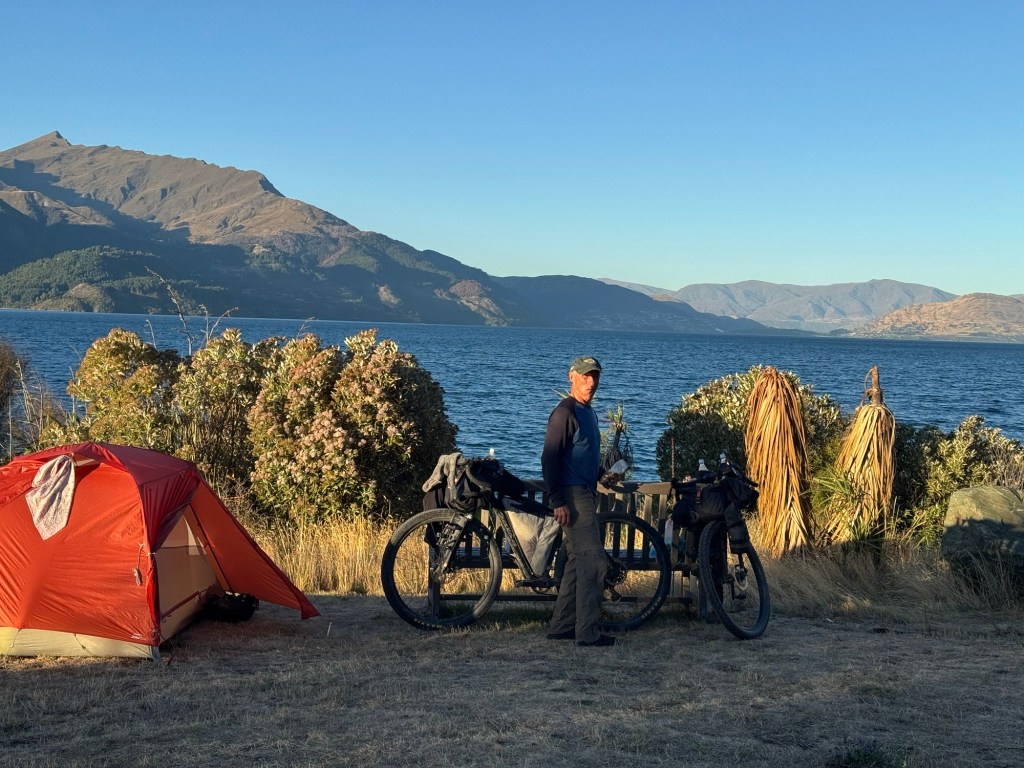
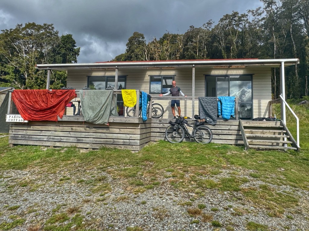
Just a half mile or so up a gravel road we were first to arrive to the Beach Point DOC where we snagged a prime lakefront site.
After we returned from our evening walk back down to the station we found almost a dozen cyclists camped nearby, all of them heading south to Bluff.
It was a good day to be a tourist but we’re ready to knock out the last three days. Let’s go!
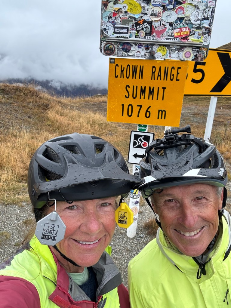
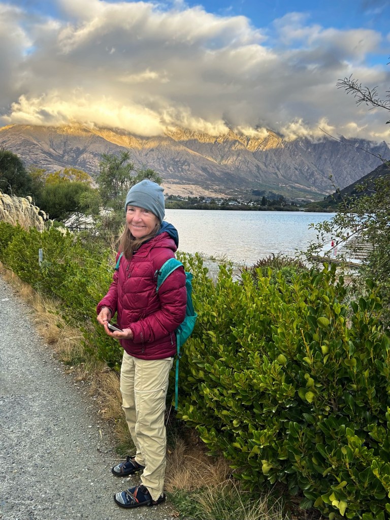
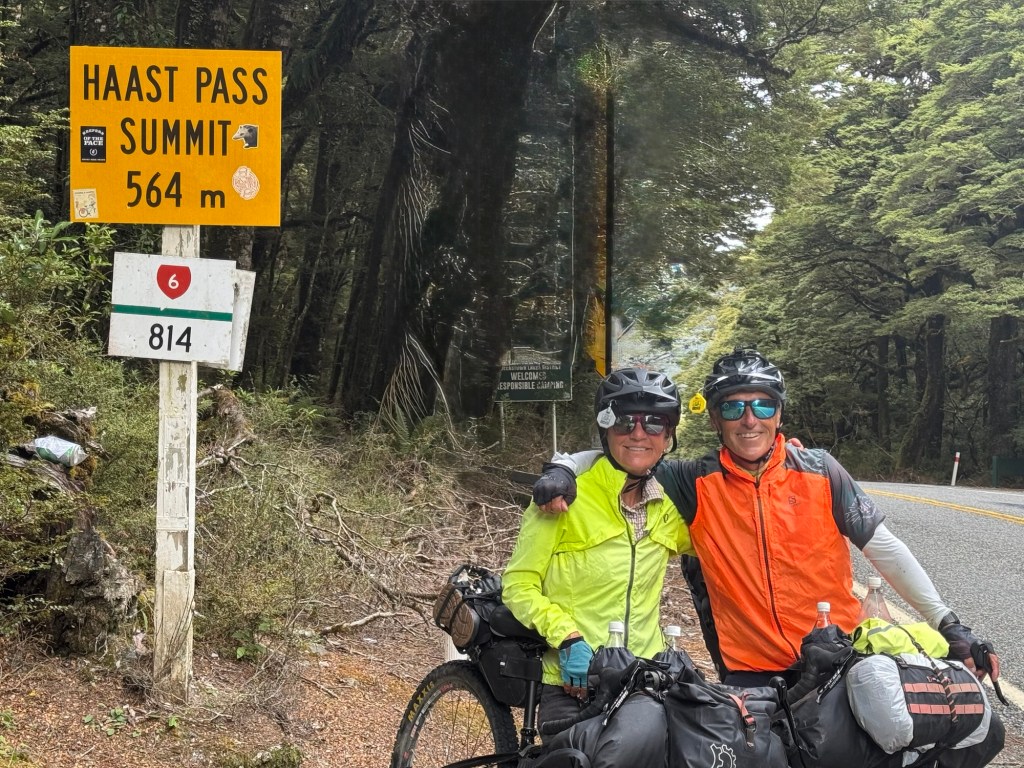
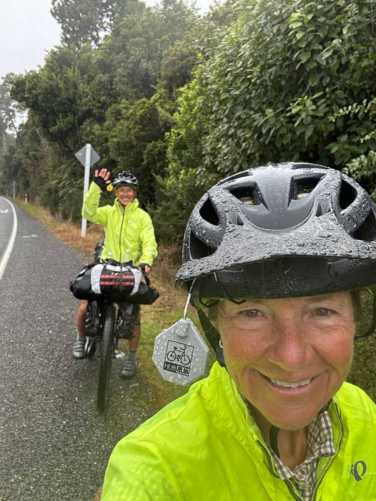
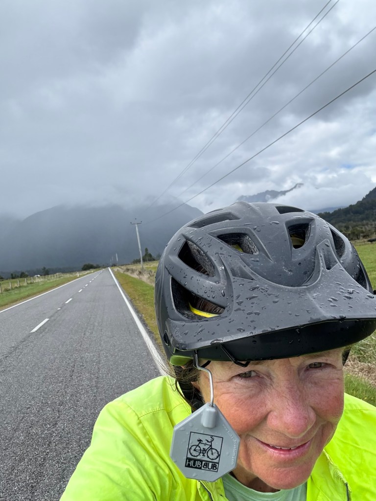
Today was our day to start peddling uphill, in the cold, in the rain and with a headwind. We didn’t take a single pic until we got to the top of Crown Range which is also the highest point of the Tour Aotearoa and the highest paved road in New Zealand.
At least when climbing we exerted enough energy to keep us warm. The ride down hill was sooooo cold. 🥶
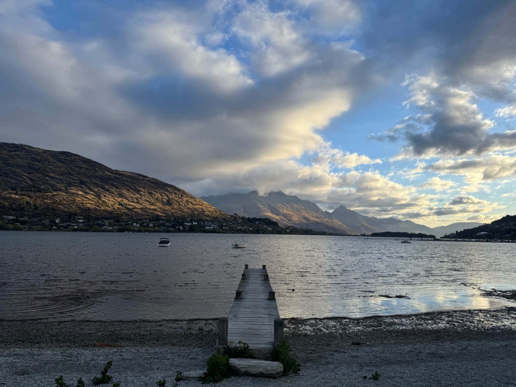
We opted to stay at a Holiday Park in Frankton which is a suburb of Queenstown (the busiest and most expensive tourist town in New Zealand).
What’s a Holiday Park? Only one of the most amazing ways to stay in New Zealand. Most offer camping and indoor stays (cabins or motel rooms), and community space such as kitchens, laundry facilities and lounge areas with televisions, ample power outlets to charge devices and wi-fi.
And they are so reasonably priced and CLEAN! The Driftaway where we are staying tonight is one of the most expensive but definitely best equipped. It was $45 American dollars for a campsite. And you cannot beat the view!
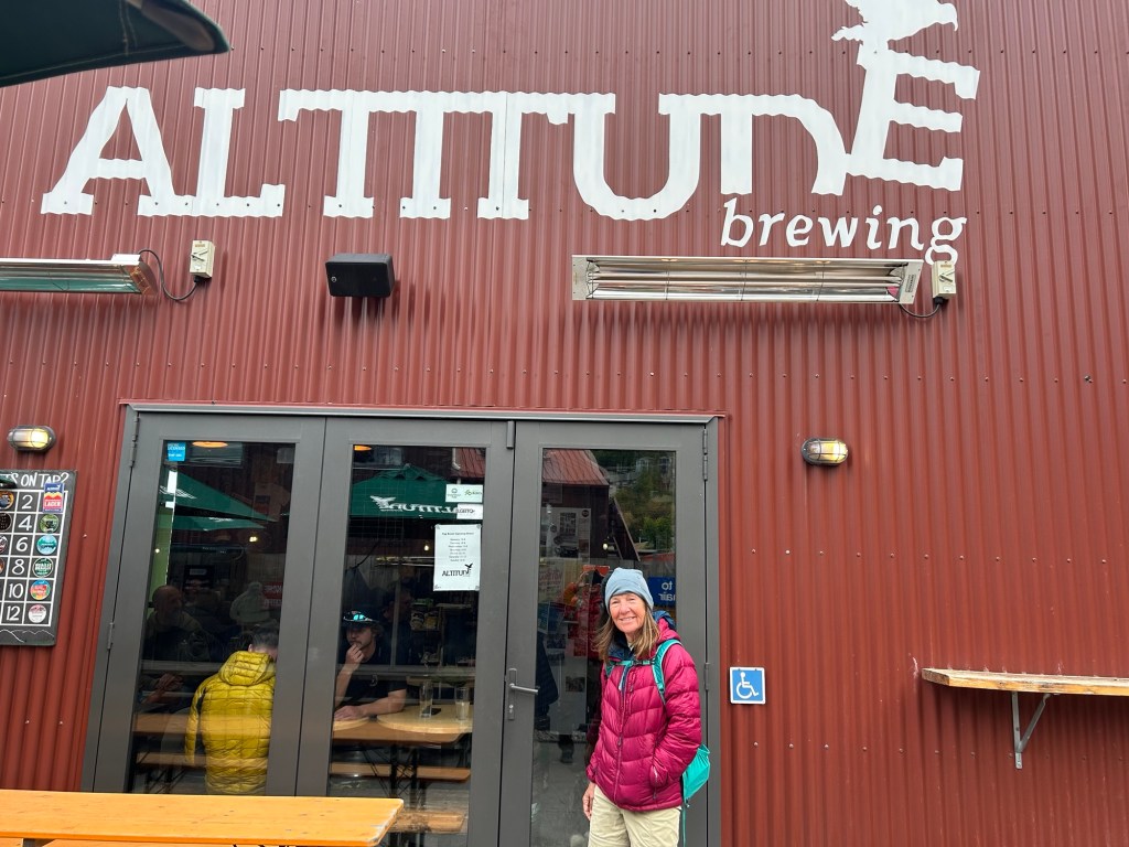
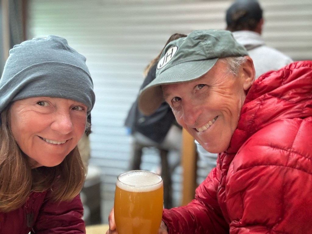
After arriving in Frankton, we walked over to Altitude for bevvies and food.
Wagyu smash burgers, loaded chippies and IPAs were a good day to rehash the day on the Crown Range climb.
The sun finally started to come out on our walk home and we both agreed… the mountain scapes here are among the most striking we have ever seen.
Short day tomorrow as we ferry across Lake Wakatipu to Walter Peak Station for a little Bar B Q and farm tour.
We have been planning indoor stays because of the weather forecasts for big rain and to be honest, the sand flies here are horrendous. They bite and they are everywhere.
Not mad about these indoor stays – every one of them have been 💯 with flushers, bed sheets, towels, potable water, wifi – well the amenities are endless. We do miss our tent though.
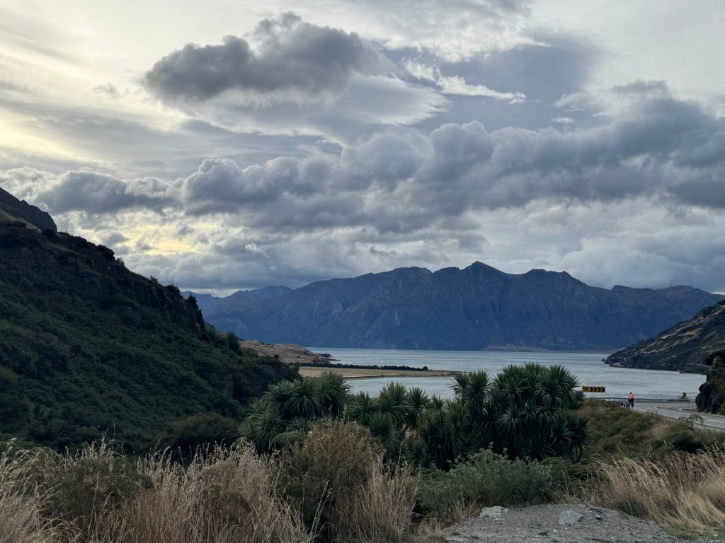
Today was hands down going to be awful. LOTs of rain forecasted but… also an unbelievable tail wind was forecasted. We planned on camping 46 miles down the road since indoor stays weren’t available.
Tail winds came and blew us right by Lakes Wanaka and Hawea but the rains never came. In fact it was difficult to control the bikes when we veered from the southerlies pushing our bikes and the sun came out!
Every day Tom says, “this might be my favorite day of riding” and he said it again today.
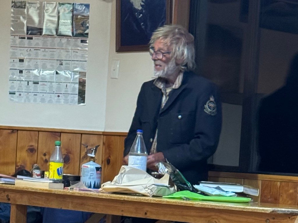
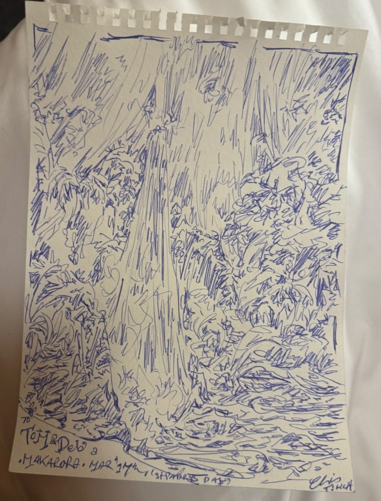
But before we began cycling, we went to the community kitchen to make coffee where we formerly met Chris posted up at a table drawing. The night before Tom saw him there heads down writing. He wasn’t a guest but he was staying there.
We had a lovely chat with him, did a currency exchange for him (somehow he ended up with American dollars and needed a few Kiwi dollars) and he sketched a waterfall for us. He left us with this quote: “When people help you, you give them the best you got.” Godspeed Chris, to wherever you’re headed.
With such favorable winds we were able to extend our ride past Wanaka and on to Cardrona where we had a lovely indoor stay at a historic inn. It’s definitely a lifetime top ten stay for us.
Today really might have been my favorite day of riding as well. The lakes, the trails, Wanaka, the whole shibang!
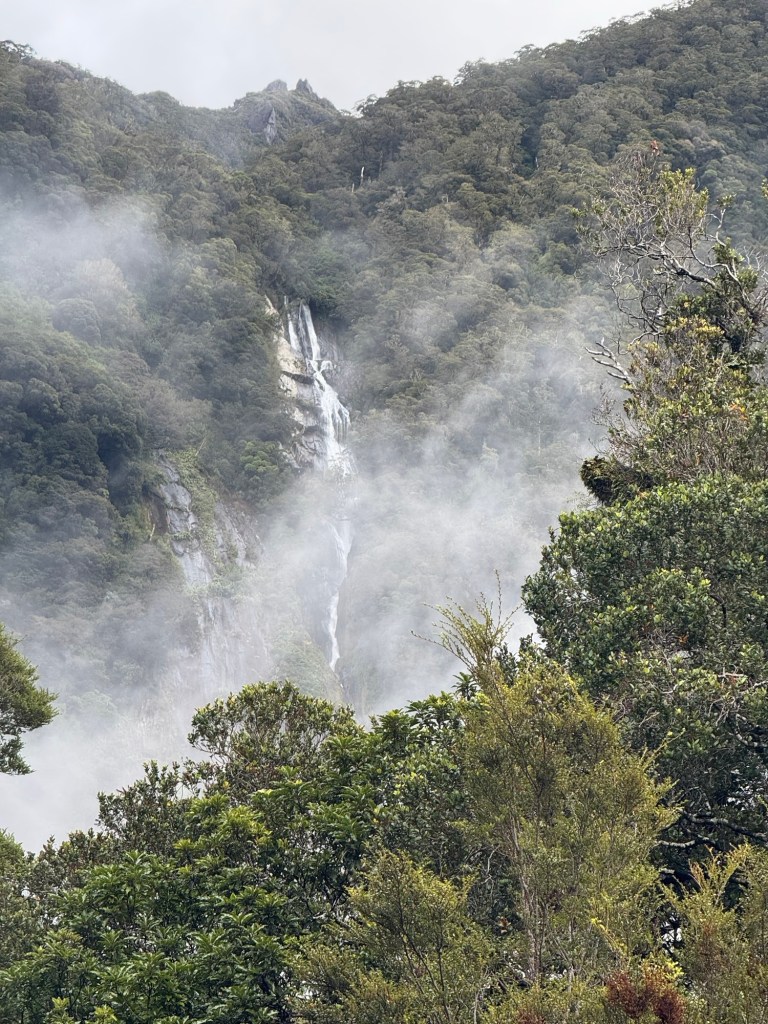
This route just keeps throwing us ringers everyday. Today we cycled through Mount Aspiring National Park and though the day began cloudy, it put a mystical feel on the ride.
We rode past so many waterfalls, some marked, most unmarked. That’s the beauty of bike travel… we could hear them before we could see them. While many in cars pass them because they aren’t marked, we saw so many.
Of course travelers in cars don’t need to hump their gear up and over the passes, but there is even joy in that (once it’s over).🤣
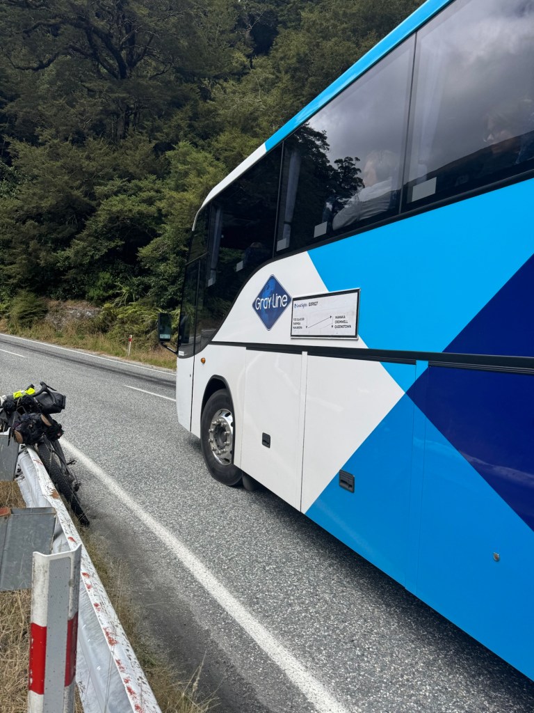
On the climb up Haast, I stopped to take a pic of a waterfall, mostly because it was well… powerful and noisy which meant big in terms of waterfalls, plus there was a guardrail on which to lean my bike.
It was an unmarked waterfall, but dang if as soon as I was ready to take the photo, a big ole tour bus pulled up and blocked my entire view. Really? You had to stop here. In front of me? 🤷🏼♀️
I looked up at the bus and who was waving like crazy at me from inside the bus? Our good buddy Durell from South Carolina whom we cycled with for five or so days! He and his bike were on a bus to Queenstown and here he was again. He keeps popping in and out of our lives. I call that a God wink.😉
Durell sent me the video he took looking out the bus window and the moment I recognized him is pretty special.
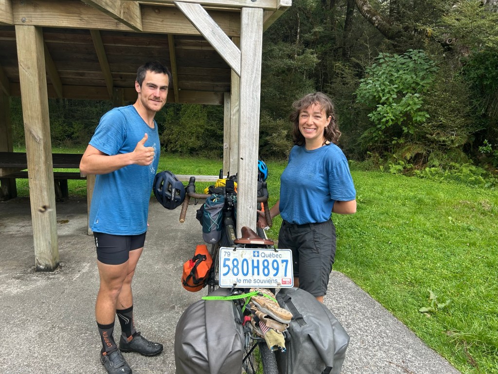
Just before we started climbing up to Haast Pass we stopped for a snack and brief rest. We saw a young couple obviously doing the same so of course we said “hello”.
Turns out Ulys and Virginia just posted in the TA Facebook group about riding the Great Divide Mountain Bike Route (south to north) on their way home to Quebec. They were asking about how alike and different the TA and GDMBR are. When I saw the post I thought “are they cray cray?”
And now here they were. No! This ambitious couple is going to do it! They are the sweetest pair and this is Virginia’s first bike tour. Just like our other Canadian friends Amelia and Sarah , their first bike tour too, and they are stomping on it!
Just going to put this out there – I’ve never met an unkind Canadian. They are all so nice. Am I right, eh? 🇨🇦
But now back to the National Park.
It. Was. Stellar.
Below are a few pics but today’s vid will give you a better idea of just how remarkable it was.
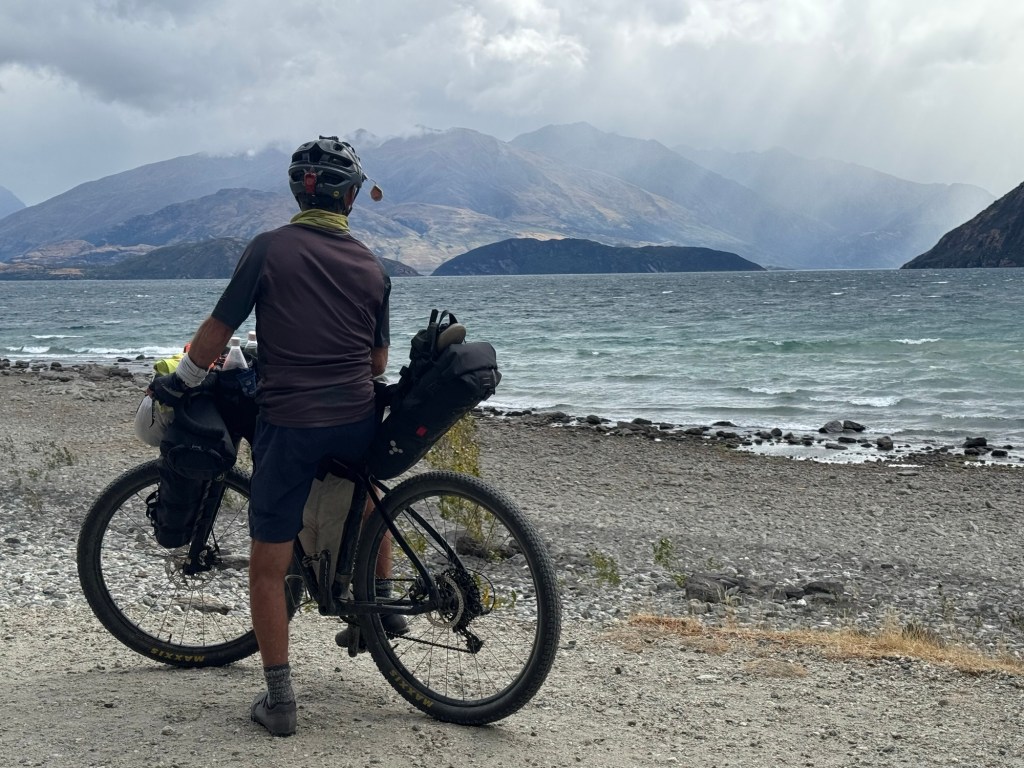
Just a short ride today – we knew we would be riding in the rain and fog and while we didn’t want to take a day off, our bodies appreciated less miles. We’ve got just three big climbs left – and one of them is Crown Point in a couple days, the highest point of the entire Tour Aotearoa.
Since it’s kind of a slow “news” day, I wanted to mention a little more about our route, how we know where to, more about the elevation, etc.
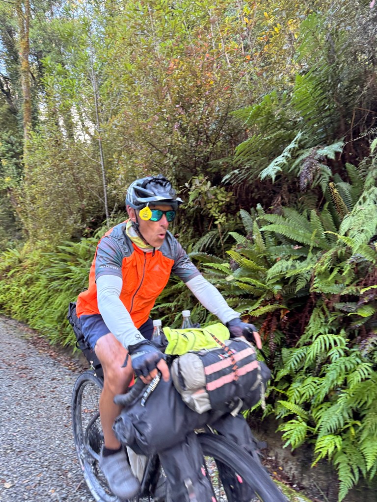
Tom is the primary navigator (I just follow and holler when RVs and trucks are approaching from behind). We both have helmet mirrors (photo above) that show us what is approaching from behind. We haven’t seen one person in New Zealand using them which is surprising given so many narrow, shoulderless roads.
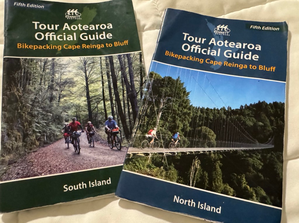
We use these books, written by the Kennet Brothers and there are GPX files that can be downloaded to our Garmin Navigation devices that are mounted in the cockpit of our bikes giving us turn-by-turn instructions.
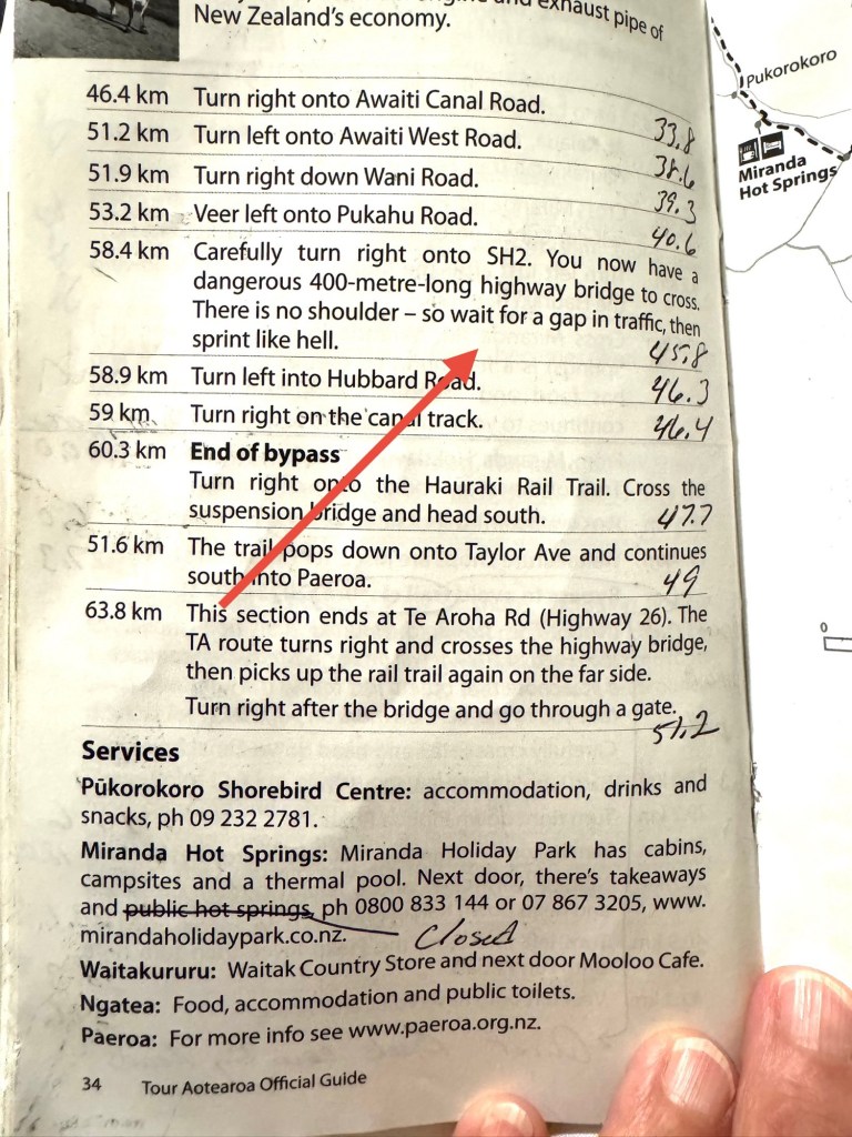
Makes it soooo easy… included in the booklets are text instructions, an elevation map and a road map with tips on where to stay, buy food, etc.
The books are not always up-to-date so we need to confirm with Google maps and there are traffic warnings in the text. Info on public toilets are included when one prefers using them over the “facilitrees.”🌳🙋🏼♀️
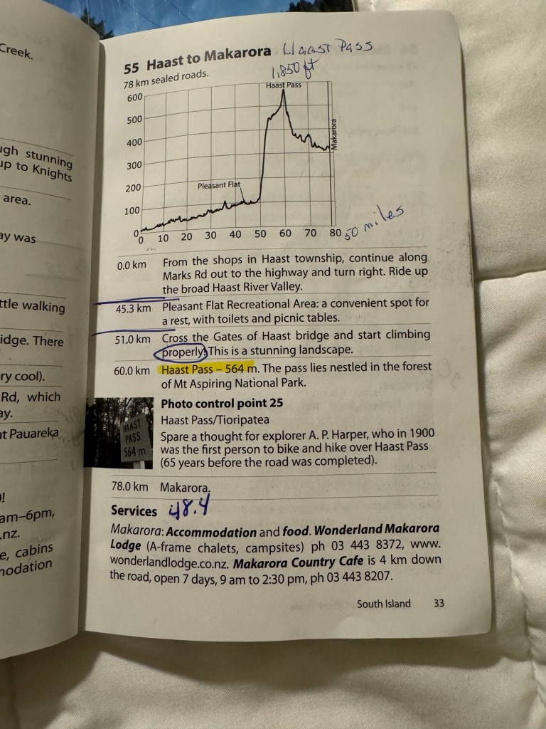
Today we turn away from the coast as our destination is Makarora and you can see we have Haast Pass on our to-do list today. 😂 Life is so simple when living on a bicycle.
We are getting comfortable using kilometers but still confirm distance with miles.
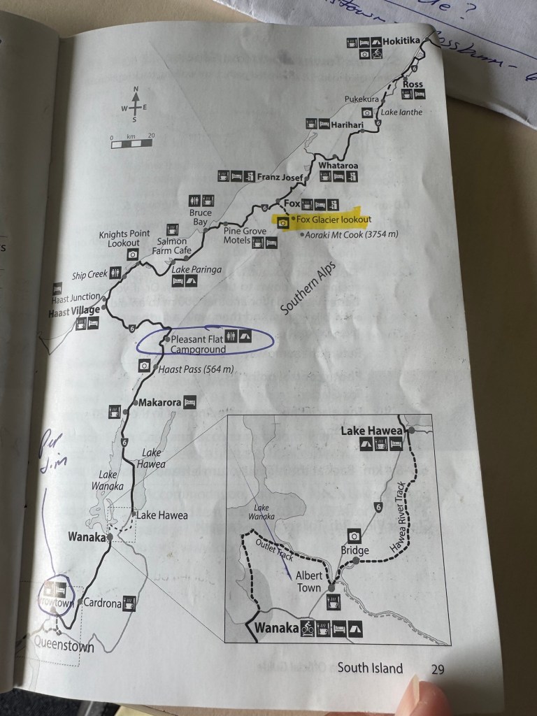
We’ve been using this map since Hokitika which seems like forever ago and we will be using it until Queenstown. Whew!
As far as we can tell, we have about a week of riding left so the horses are getting close to the barn so to speak. Mixed feelings about that but overall senses of gratitude and accomplishment will prevail.☺️
Oh finally in other news (and this is cool) Russ Cook, the first man to run the length of Africa (finished in April 2024) is now running the length of New Zealand – northbound on the Tour Aotearoa route!
We may “run into” him. He started at Bluff where we are finishing.
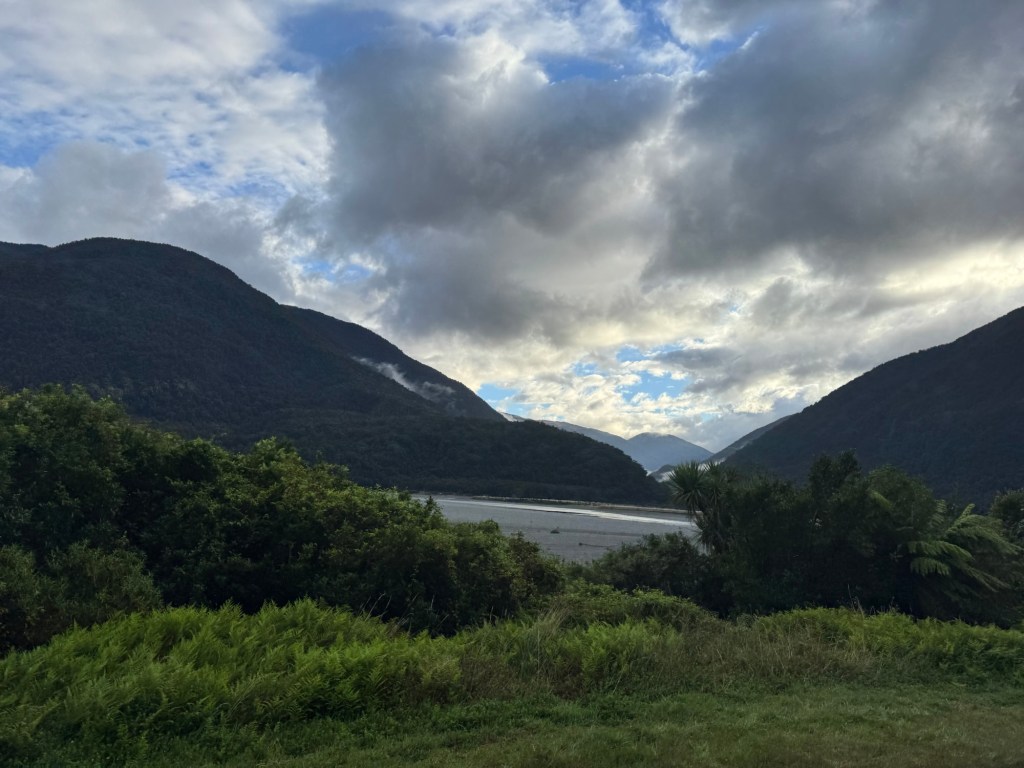
It was a gorgeous morning to wake up in the mountains.
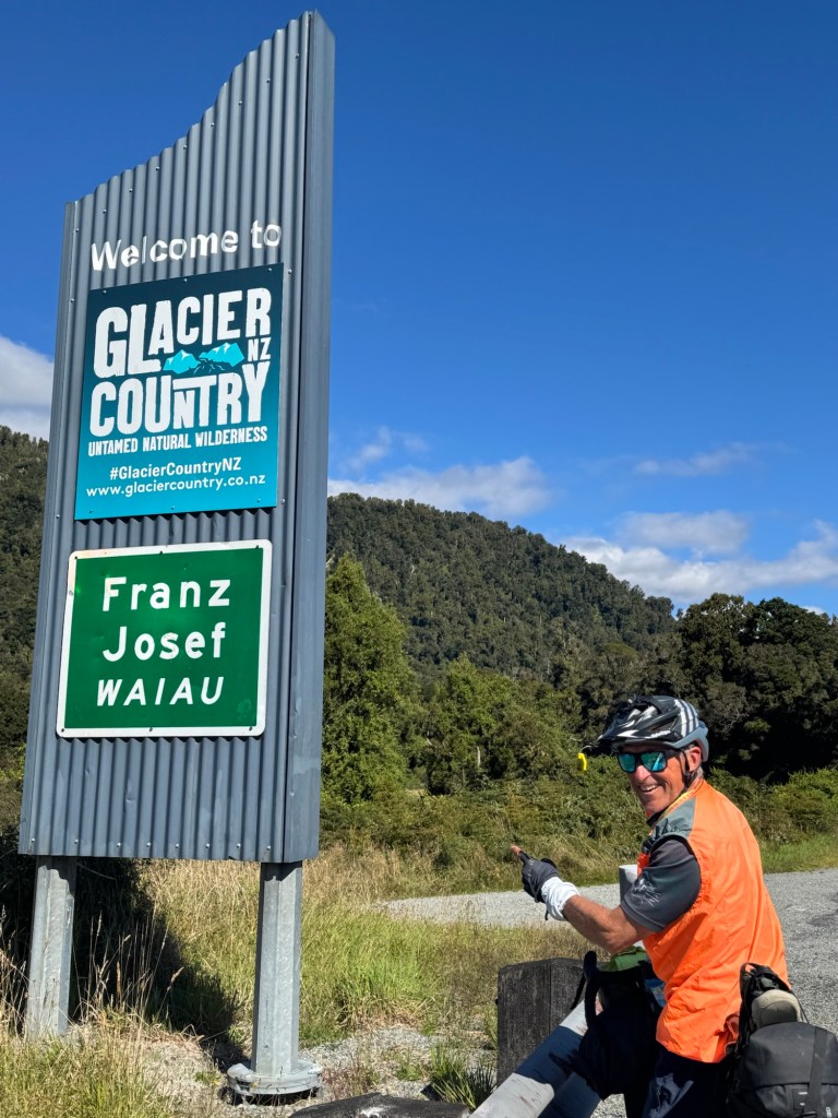
Needing a food resupply we stopped at a Four Square on the way out of Franz Josef. We also knew we had three climbs right out of the gate this morning so we were a bit conflicted on how much food to buy. More food = more weight on the bike to schlep up and over.
In the end, donuts won but we ate them before we ever left the parking lot. I mean… that way we wouldn’t have to carry them. Blueberries, apples, nuts, bagels, oatmeal, a banana and other supplies also jumped into the shopping basket.
We must have our climbing legs by now or maybe it was just early in the day but the three saddles were over before we knew it.
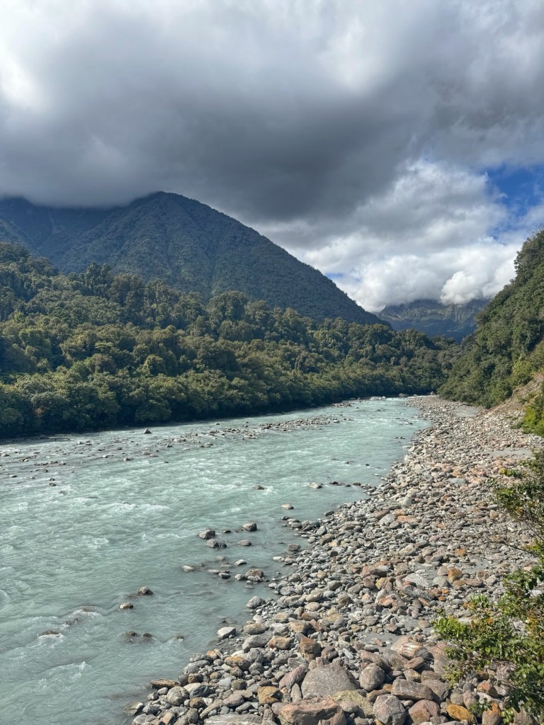
Then the rest of the day it was mostly downhill through Fox Glacier and valleys with glacial streams trickling through them.
Rain threatened most of the day but the only thing we had to do was put our rain jackets on and lucky us, it pretty much quit raining shortly after.
Just before stopping at the Salmon Farm to poke around we stopped for a break at Bruce Bay. At a place that is prime for so much commercial development it remains unchanged. You’ll only find one food truck (serving coffee, cold drinks and ice cream) and public restrooms across the street. That’s it. It is unspoiled and pure New Zealand.
When we were looking up the Salmon Farm, Tom found an Air B & B cottage affiliated with the farm. We splurged for a dry night indoors and dang are we ever glad we did.
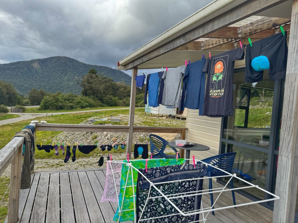
The host had homemade fudge (two varieties) and muffins waiting for us, fresh milk, museli for breakfast, coffee and an assortment of homemade jams. We were able to easily dry everything out from the night before.
Plus there was a washer and clothes line for laundry. Great find, Tom!
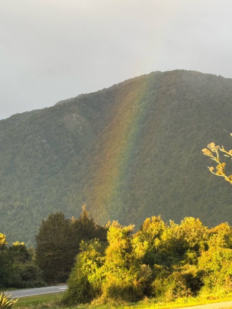
Just after pulling the clothes off the line we were lucky enough to see a rainbow that looked to land just next door.
We’ve begun to chart out the rest of our journey which includes one more ferry ride out of Queenstown, a couple healthy righteous climbs and even a few days of rain but we consider ourselves lucky to live these days on bicycles.
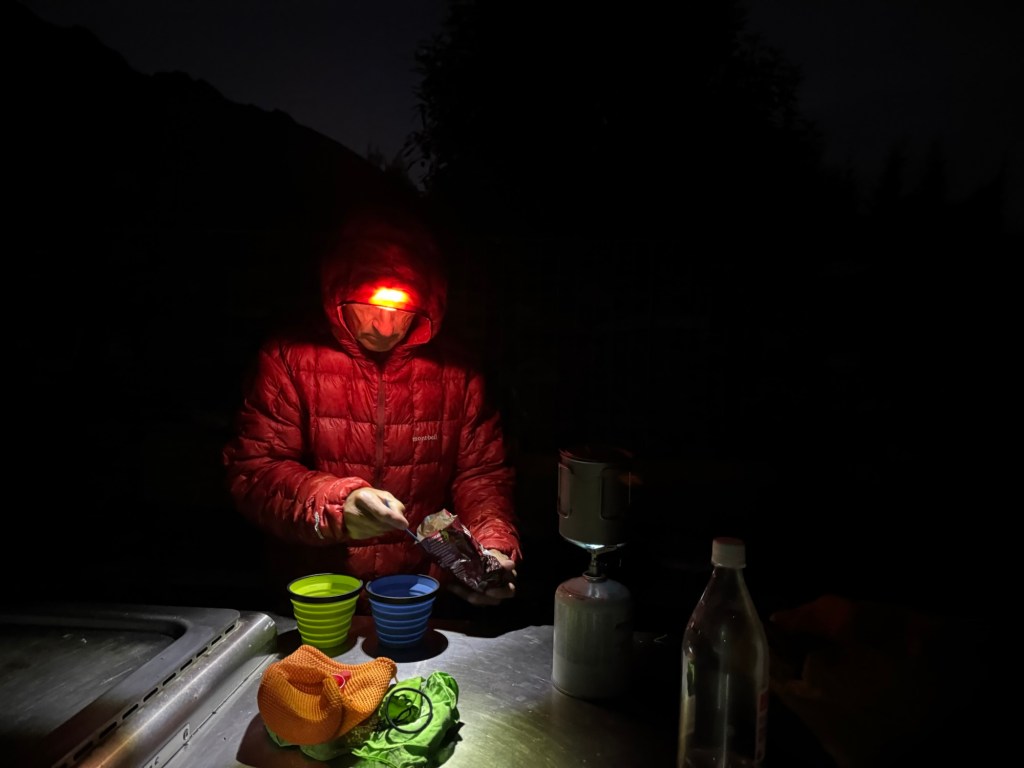
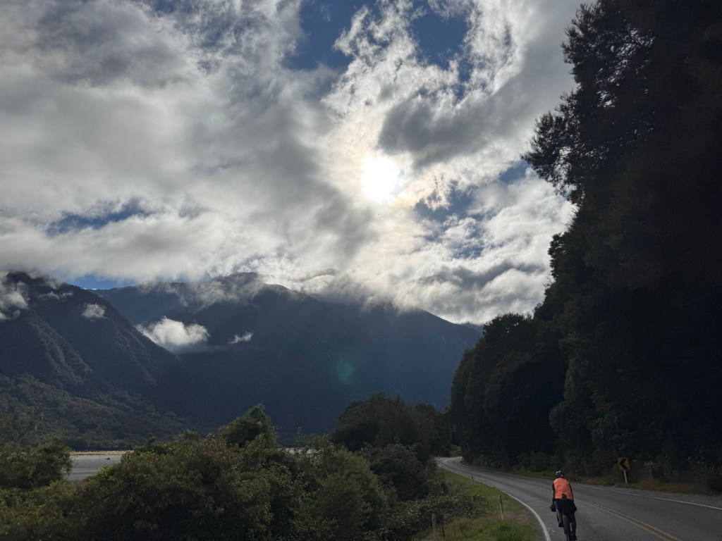
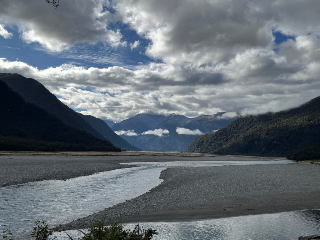
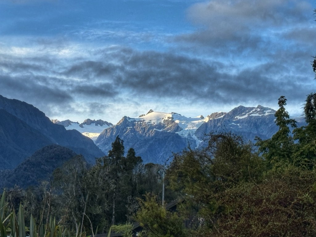
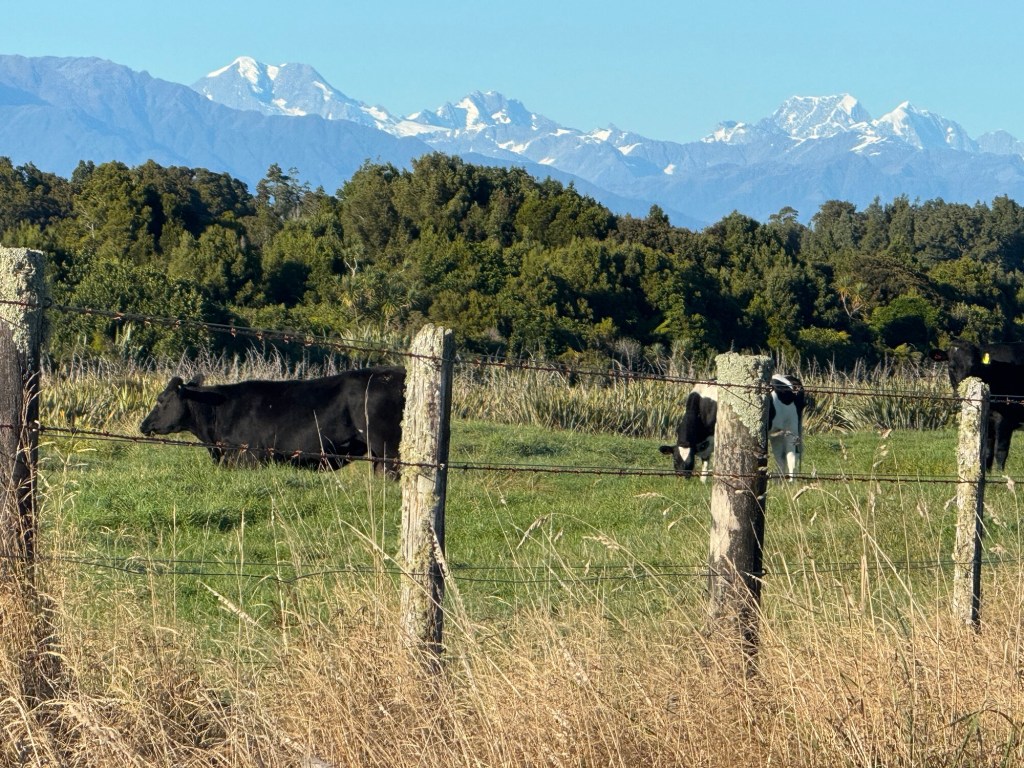
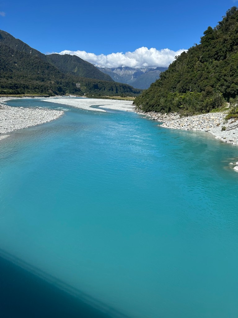
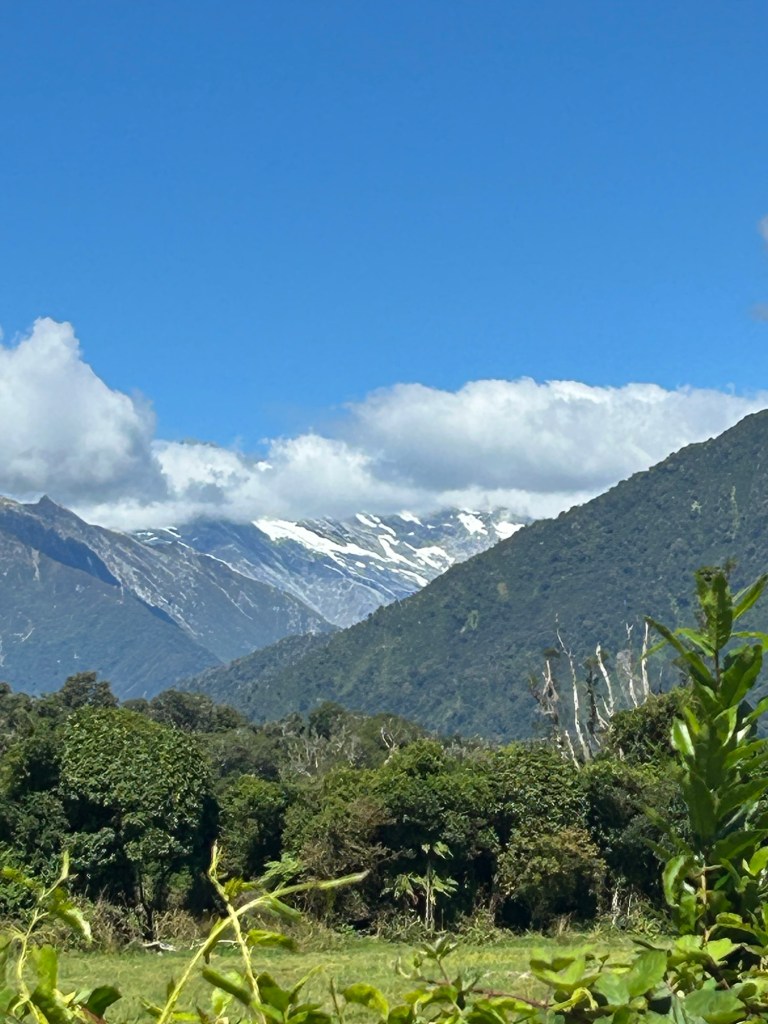
We are entering the Southern Alps area and got our first glimpse of snow covered mountains today.
With that came a day of road riding with blue bird skies, glacial rivers and mountain spam around nearly every corner.
The southwest region of the South Island in New Zealand is known for having the country’s most precipitation so we are preparing for some rainy rides and indoor stays at night.
While riding around on bikes all day, there is plenty of time for conversations with God, for praise, thanksgiving and petitions but there is also plenty of time to question. And Lord knows there’s lots to ponder these days.😂
I’ve been wondering why the town we are staying in is called “Franz Josef” and who decided that name. I think that’s one for Google later on when I have more time.
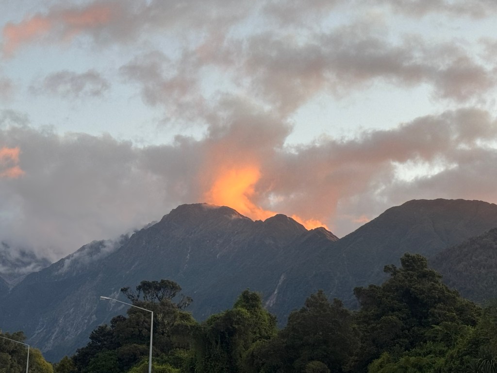
We walked into town for dinner… it’s probably the most touristy town we’ve visited and a little overwhelming but we were treated with the sunset view of what looked like lava spewing out of the mountaintop.
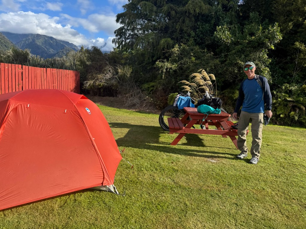
We are going to sleep so well in our tent tonight. Tired bodies and tasty food make for restful nights.
West Coast Wilderness Trail… done! And. It. Was. Amazing.
Today’s section was a potpourri of flowy single track, wide open vistas, stunning water scenes, gold mining tracks and goat trail look-alikes stitched together with friendly dirt and gravel roads. It’s been one of our fave days of riding.
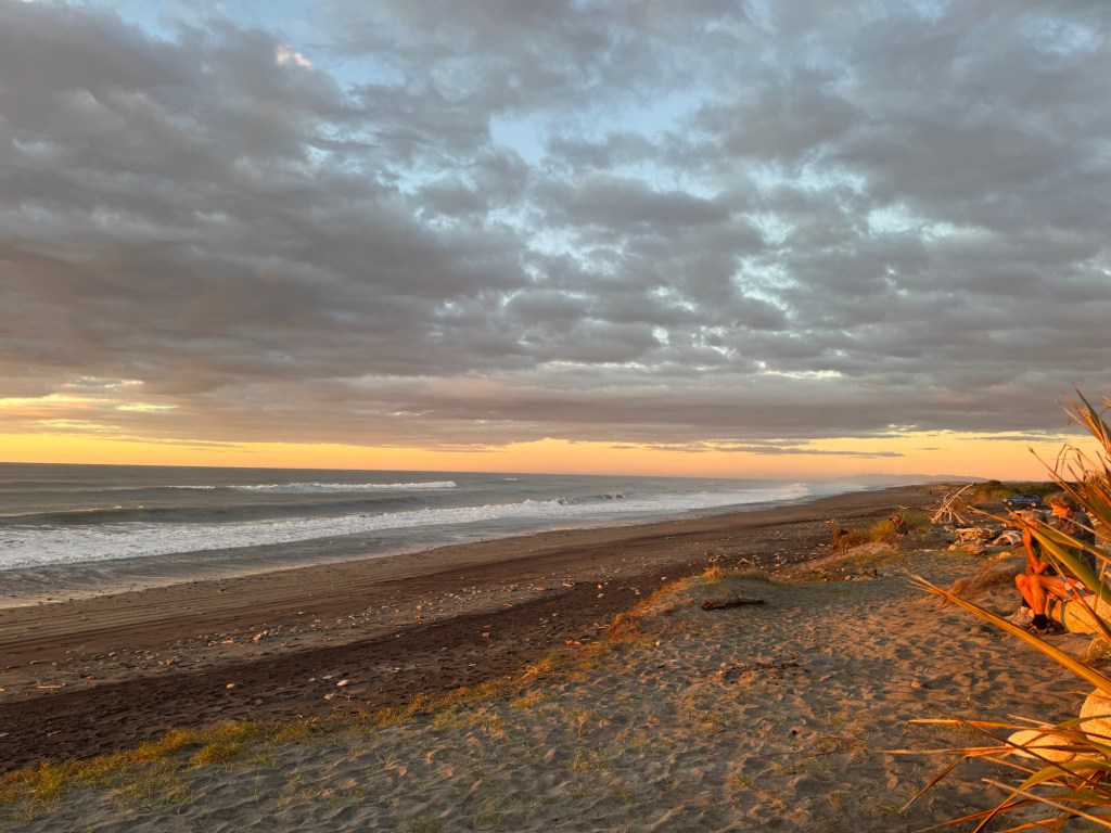
We put in a few extra miles of riding to finish the West Coast Wilderness Trail in Ross to get to a campground right on the Tasman Sea. 🌊 And it didn’t disappoint. We caught the last of today’s light watching the sun set over the sea.
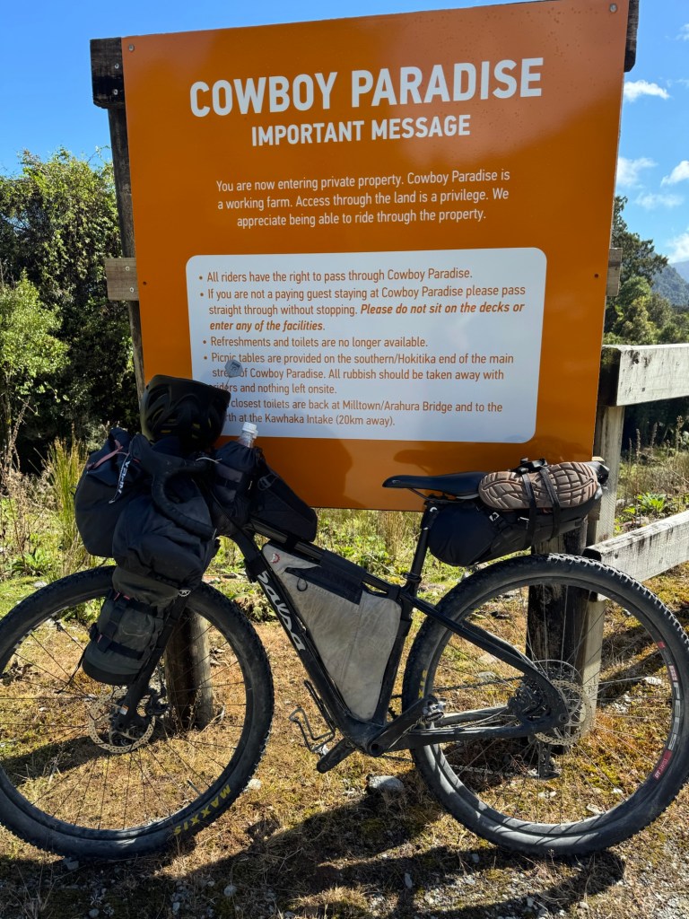
It was a “three map day” and we hit up Cowboy Paradise first, which has an interesting story. Apparently the owner had a cannabis growing operation in an underground bunker twice as large as the average kiwi house. He got busted and now the future of “paradise” is uncertain. Still a convenient place for us to stop for a self serve snack.
Then midafternoon we cycled through Hokitika and stopped in town for a flat white and an L&P.
We rolled into Ross after 5pm – the trails are fab but take some time to ride so it was a full day. It’s just too hard not to stop and take in the scenery and snap pics along the way.
Our campground had a wood fired pizza oven going with a little tiki bar named “Ever the Weekend” so we enjoyed pizza, wine and the setting sun. What a way to end a day of riding.